
Research article · 2026 · Full text
International Journal of Geography Geology and EnvironmentLand use and land cover change in Uttarakhand: study of the Himalayas
Volume 8(9) · Pages 112–115 · DOI: 10.22271/27067483.2026.v8.i9b.870 ↗
Research areasRemote Sensing and Land UseLand Use and Ecosystem ServicesConservation, Biodiversity, and Resource Management
Abstract
Author-writtenLand use and land cover (LULC) change is an important indicator of environmental changes taking place in mountainous regions. Uttarakhand, situated in the central Himalayan region, has a unique constitution of steep terrains, extensive forests, fragile watersheds, agricultural lands/slopes, settlements and an unfortunately high exposure towards natural hazards. This paper proceeds to explore the major patterns or drivers of intense environmental shifts/consequences. We shall look into management implications of LULC change in Uttarakhand, adopting a review-based approach, while drawing upon remote-sensing and GIS studies, official datasets of the National Remote Sensing Centre (NRSC) and Forest Survey of India (FSI), as well as scholarly research bodies. Evidence suggests that LULC shifts in Uttarakhand appear uneven, and the plains-foothill districts, particularly Dehradun, Haridwar and Udham Singh Nagar, have experienced substantial expansion of concrete infrastructure and industrial land. Many middle- and high-mountain areas have experienced agricultural abandonment, leading to the fragmentation of forests and changes in the patterns of vegetation. We shall further delve into such records and facts in this paper, to trace out anomalies that have risen out of development patterns, with an effort to understand how LULC change has implications for biodiversity, soil erosion, hydrological regulation, carbon sequestration, landslide susceptibility and agricultural sustainability.
Summary
Source-checkedPlain-language reading of the full paper, prepared with AI and checked against the text. Each point links to the authors' own words.
Why it matters
- Uttarakhand is a central Himalayan region characterized by steep terrain, extensive forests, and fragile watersheds, making it highly susceptible to natural hazards. View evidence ↗
- Understanding land use and land cover (LULC) changes in mountain environments is critical because their fragile geological conditions and steep slopes can lead to preventable disasters. View evidence ↗
- Forests are central to the state's ecology, covering 24,303.83 km², which is 45.44% of the assessed area according to the 2023 India State of Forest Report. View evidence ↗
The question
- The study aims to examine the spatial and temporal nature of LULC changes in Uttarakhand, identify their drivers, evaluate the resulting environmental and socioeconomic impacts, and discuss sustainable management strategies. View evidence ↗
What they did
- The research employs a qualitative methodology based on the review of academic papers, journals, government reports, statistics, and datasets. View evidence ↗
- The review draws upon remote-sensing and GIS studies, as well as official data from the Forest Survey of India (FSI) and the National Remote Sensing Centre (NRSC). View evidence ↗
What they found
- LULC changes are uneven across the state, with substantial expansion of industrial land and concrete infrastructure in plains-foothill districts such as Dehradun, Haridwar, and Udham Singh Nagar. View evidence ↗
- In middle- and high-mountain areas, agricultural abandonment has occurred, resulting in vegetation pattern changes and forest fragmentation. View evidence ↗
- In some uphill districts, the abandonment of agriculture has led to the regeneration of natural vegetation, shifting the boundaries between agricultural and forest or scrub lands. View evidence ↗
- Urban expansion in cities such as Dehradun, Haridwar, Haldwani, Rudrapur, and Rishikesh is encroaching upon agricultural and vacated lands. View evidence ↗
- Environmental degradation is linked to LULC changes; specifically, removing vegetation and disturbing slopes increases soil loss and surface runoff, while uncultivated terraces lead to land degradation. View evidence ↗
- Human-driven LULC changes, including road construction and urban expansion, increase vulnerability to floods and landslides by modifying drainage and reducing water infiltration. View evidence ↗
- The conversion, fragmentation, and degradation of forests in the region have reduced the potential for carbon sequestration. View evidence ↗
- The plains and foothills experience higher rates of industrialization and urbanization compared to other regions due to better accessibility and favorable topography. View evidence ↗
What it means
- The authors conclude that sustainable development in Uttarakhand requires regulated implementation focusing on forest protection, watershed management, and community-led governance. View evidence ↗
- The authors note that the complex Himalayan topography complicates LULC monitoring due to terrain shadows, seasonal variations, and the difficulty of distinguishing abandoned farmland from natural vegetation. View evidence ↗
Visual summary
1 visualsIllustrations explain the paper; they do not show study data.
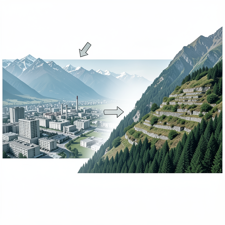
Spatial Divergence of LULC in Uttarakhand
AI-generated conceptual illustration (Himalayan mountain landscape of Uttarakhand). It explains the idea and does not show study data.
View source evidence ↗Introduction
The Earth's surface goes through several transformations because of natural processes and human activities. Land use and land cover change tends to indicate or represents these transformations. Land cover basically refers to the physical characteristics of earth's surface, which includes forests, grasslands, agricultural fields, water bodies, glaciers, barren land and human settlements. Land use, on the other hand, focuses on the reasons why land gets used by human societies in the first place. Changes in both domains are triggered by several factors, which include population growth, urbanization, infrastructure development, agriculture, industrialization, resource extraction, tourism and human migration. Mountain environments tend to be fragile and sensitive. So, knowing the ins-and-outs of these changes become necessary because limited level land, steep slopes, fragile geological conditions and strong ecological gradients lead to calamities and disasters that may otherwise get prevented. Uttarakhand provides an important setting for examining these processes, both natural and anthropocentric. This mountainous Indian state consists of a tremendous elevated range, having incredible climate conditions, fertile vegetation, biodiversity and many interesting geomorphological conditions. Its landscape extends from the subtropical plains and foothills to temperate forests, alpine meadows, glaciers and permanently snow-covered high mountains. Forests occupy a central position in the ecological functioning of the state, while agriculture, livestock, tourism, pilgrimage, forestry, hydropower and urban activities constitute major components of the human economy. The India State of Forest Report 2023 records 24,303.83 km² of forest cover in Uttarakhand, representing 45.44% of the assessed area. Many self-sufficient forms of governance at the local/village level can also be observed, many of which are running very effectively, free from mainstream political influence. It helps create an economic network that is community-led, wherein nature is used and conserved simultaneously as well. The land system of Uttarakhand remains dynamic, having gone through shifts/changes from time-to-time. Factors like rural outmigration, changes in agricultural practices, declining farm labour and expansion of roads/settlements have led to immense changes in the traditional agricultural landscape. Gentrification, growing urban centres and tourism destinations have transformed valleys, foothills and even river corridors, into concrete settlements and caused permanent changes in the nature of those mountainous terrains. Examining these transformations was made possible by remote sensing over large for decades. The National Remote Sensing Centre has undertaken annual national LULC assessment since 2005, while its 1:50,000scale LULC datasets provide more detailed assessments for selected periods. Recent research also demonstrates an increasing use of machine-learning classification and cloudbased platforms like Google Earth Engine, for the purposes of monitoring LULC dynamics in the state. The significance of LULC change in Uttarakhand extends beyond the visible transformation of landscapes. Shifts in the vegetation and soil coverings greatly impact groundwater recharge, rate of erosion, sediment transfer, slope stability, local climate, biodiversity and carbon reserve. Urbanistic expansions lead to the increase of impermeable surfaces, leading to changes in drainage systems, while forest conversion may also reduce the connectivity of habitats. Meanwhile, agricultural abandonment may improve vegetation in certain areas, however, weakening the long-standing management of the territory, making the existing cultivated terraces vulnerable. It is important to dive into these areas with greater detail, so as to better understand sustainable development and the vulnerable nature of growing human settlements.
Objectives and Methodology
The objective of this paper is therefore to examine the spatial and temporal character of LULC change in Uttarakhand, identify its major drivers, evaluate its environmental and socioeconomic consequences, and discuss approaches for sustainable land management in the Himalayan context. The study uses a qualitative method, using academic papers, journals, data-sets, government reports/statistics and so on. The emphasis is put on facts and recorded data, so as to arrive at real findings and substantive conclusions.
Land Use and Land Cover Change: Major Patterns
Land use and land cover change in Uttarakhand tends to vary based on the altitude, accessibility, human population and on-going economic activities. Transitions involve the changes happening with forests, agricultural land and builtup areas. These changes are particularly pronounced in the plains, foothills, river valleys, basically places with growing urban centres. On the other hand, remote mountain areas situated in higher altitudes show stronger evidence of agricultural abandonment and changing vegetation patterns, due to cultural shifts and economic viability. Forests still remain as the dominant natural land-cover component of these mountainous regions of Uttarakhand. According to the India State of Forest Report 2023, the state has 24,303.83 km² of forest cover, accounting for 45.44% of the assessed area. However, changes in forest density and fragmentation indicate that total forest area alone doesn't fully represent the actual forest condition. For instance, forest landscapes are affected by the expansion of human settlements, leading to unwanted outcomes of forest fires, exploitation of natural resources and so on. Scientists have interestingly noted that in certain districts uphill, agricultural abandonment has actually encouraged natural vegetation regeneration, altogether producing changes in the boundary between agricultural and forest or scrub landscapes. The middle Himalayan region has particularly recorded significant changes in the pattern and outlook of agricultural land. While rural outmigration remains as a key factor, it branches out to others like declining agricultural labour, fragmented holdings, limited irrigation facilities, wildlife damage and, importantly, low economic returns. Abandoned fields may gradually develop shrub and tree vegetation, but the process can also result in deterioration of terraces and traditional water-management systems. On the other side, undermined by urban, industrial and infrastructural growth, farmlands in the foothills and plains come under significant pressure. One of the most conspicuous forms of land-use change in Uttarakhand is the land built upon. Cities like Dehradun, Haridwar, Haldwani, Rudrapur, Rishikesh and others continue to expand into the agricultural face or other vacated lands. The landscapes of plains and foothills have recently been identified as frequent areas of urbanization. Construction of infrastructure along the roads and in the valleys has resulted in scattered settlements. Urban expansion leads to a reduction of free and agricultural land, but increases the amount of non-permeable surfaces, along with changes to natural drainage conditions. Infrastructural constructions like road construction and cuts basically change the face of the landscape, leading to the disturbance of vegetation and drainage, increased erosion processes in the mountains and heightened risk of landslides. The accumulation of effects appears to be significant when a lot of infrastructure projects are in one watershed. Another major factor in the alteration of localized land use and land-cover patterns is the growing importance of tourism and religious travel. The presence of hotels, lodges, shops, parking areas and transport facilities have changed many well-known tourist and pilgrimage sites. Although tourism contributes to job creation and local economic growth, the inappropriate development puts pressure on land use, water resources, forests and waste disposal systems. The implication of the phenomenon is felt particularly strongly in limited river valleys and in settlements located in sensitive mountain areas. To sum up, Uttarakhand's land use and land cover undergoes two polar processes: Intensification in certain areas. Shrinkage in distant agricultural areas.
In plain and hilly areas, urban, trade and economic activities are rapidly growing, whereas in the central mountains agricultural areas are getting deserted while recovery vegetation is taking shape, altering former patterns/conditions. Forests still occupy a large area in the region but have observably changed their structure due to unceasing human interventions.
Drivers and Environmental Outcomes
As already mentioned, land use and land cover transformations in Uttarakhand are the result of a combination of demographic, economic, infrastructural and environmental drivers. Urbanization may be the most significant factor, but there's also population growth, administration and commerce, demand for better roadconnectivity, rising residential needs, allocation of institutional and commercial lands, which has all collectively led to agricultural and open lands being transformed into urban areas and cities. The best examples are Dehradun, Haridwar and Haldwani. Rural outmigration has in-fact created a paradoxical situation for many regions in Uttarakhand. Out-migration of the working-age population has lowered the availability of labour for agriculture; hence, there have been reports about abandonment of terraced fields. Changes in livelihood choices, limited returns from agriculture, very small areas of land, insufficient irrigation and wildlife-related crop damages have accelerated the process. The development of highway systems, road networks, hydropower plants and other tourist infrastructures results in land conversion and enhanced accessibility of previously inaccessible territories. The increase in accessibility tends to encourage residential and commercial constructions near transport corridors. Nevertheless, in the mountains, the changes in land cover can cause major alterations in slope characteristics, drainage patterns and vegetation. Besides, tourism is causing an increased strain on land in a number of places in Uttarakhand. The growing infrastructure of hotels, roads, parking, and other commercial places has influenced various destinations and pilgrimage routes in a substantial way. Such development can bring economic advantages to local communities, but an uncontrolled development can cause the intensification of land conversion processes. Besides, changes in climate and environment can also affect the land use and land cover. Changes in land use and land cover in Uttarakhand have serious impacts on the environment owing to the topography of the Himalayas. It is considered ecologically sensitive. Transformation of forests, crops and vegetation directly impacts biodiversity, including the connectivity of habitats. For example, while it is possible that the forested area remains constant, roads, settlements and other infrastructure development can still split forested habitats and impede the natural flow of wildlife migration. Also, agriculture and vegetation management won't fail to affect soil erosion and land degradation. In this regard, vegetation removal and disturbance of slopes can cause surface runoff and soil loss, while poorly built terraces can lead to land degradation, especially if crops are no longer cultivated on those terraces/slopes. LULC change should necessarily be noted as the factor behind the vulnerability to landslides and floods, because anthropocentric developments like road construction, slope modification and drainage reconstruction can trigger landslides, while expansion of urbanized areas leads to reduced infiltration and increased runoff. Land cover variations considerably affect hydrological functions. Forests, farms, wetlands and any land covered with vegetation play a major role in the processes of infiltration, runoff and formation of moisture in soil, as well as groundwater. Any changes in these landscapes will change the hydrological behavior of basins and watersheds, with further implications for communities living in both high and lowland areas. The other very important change is carbon stock and climate regulation variations over the years. Forest degradation, fragmentation and forest conversion has led to a reduction in carbon sequestration potential. Urbanization may also lead to microclimatic shifts due to changing vegetation and permeable land covers. It may as well also lead to an increase in temperature of the land surface, a result of the inevitable global warming phenomenon. It's therefore safe to say that all environmental impacts of land use and land cover change are way more diverse than simply changes taking place in separate land plots. They should rather be assessed based on the impacts laid down upon biodiversity, soil processes, waters, carbon storages and risks through the connected mountain ranges.
Spatial Patterns, Hazards and Socioeconomic Implications
There are large spatial variations in land use and land cover changes in Uttarakhand state; there are wide differences in the patterns in the plains-states, foothills, mid-hills, and high Himalayas. The plains and foothills region have witnessed more urbanization, industrialization, agricultural development, and infrastructural expansion due to their relatively favorable topography and accessibility. This has resulted in significant conversion of agricultural and open lands into built-up areas in districts like Dehradun, Haridwar, and Udham Singh Nagar. The mid-hills have a contrasting pattern; agriculture abandonment, forest dynamics, roads development, and tourism along with settlement patterns changing occur simultaneously here. Also, the high Himalayan region is dominated by natural vegetation, alpine landscape, glaciers, and sparsely populated land, although some transformation is occurring due to precipitation, tourism, hydropower, and transport infrastructure changes. Thus, the spatial variation in land use and land cover indicates that state-level LULC statistics mask significant changes occurring within the individual districts, valleys, and watersheds. Remote sensing and GIS provide necessary tools for identification and monitoring the changes. The National Remote Sensing Centre has developed multitemporal LULC datasets for India, including annual assessments and more detailed 1:50,000-scale mapping results. Recent studies increasingly combine satellite imagery with GIS, machine-learning classification, vegetation indices, landscape metrics and time-series analysis to arrive at substantial findings. These methods ease the process of identifying these gradual ecological transformations, as well as their spatial hotspots. However, the complex topography of the Himalayas creates difficulties like terrain shadows, seasonal variations, mixed land-cover classes and difficulties in distinguishing abandoned agricultural land from natural vegetation ones. In this sense, field verification and local knowledge becomes crucial for improving classification accuracy. LULC change is linked to natural hazards too. Dynamic geological processes and sensitivity to seismic activities tends to create natural vulnerabilities, making the state and its residents susceptible to landslides, floods, erosion, etc. The alterations made by men to the land can exacerbate these same vulnerabilities. Cutting roads, working on slopes that are not very stable, removing vegetation, installing poor drainage systems and villages spreading significantly disrupts natural slopes and hydrological processes. The maximum amount of a fall happens in regions with many impervious surfaces as this factor causes surface runoff and results in flash-floods capable of wiping out entire settlements. So, the relation between the two phenomena can be explained cumulatively, in the sense that damages from different natural disasters arise because land use choices lead to more exposure, altogether reducing the land's potential to absorb disturbances coming from natural disasters. The results of LULC changes go beyond natural phenomena. The woods and agricultural zones are essential sources of food, fuel and other resources for the local population. Changes in land use can therefore cause intense decreases in traditional farming systems and an increase in the human dependence upon markets. At the same time, urbanization and tourism creates new areas for gaining income too. The emphasis of land use/land cover (LULC) research has recently shifted towards comprehending the interdependent processes involved in LULC research, instead of simply looking at individual land cover classes. Studies have transitioned from basic mapping to comprehensive analysis of urban sprawl, forest health, agriculture changes, climate variations, carbon sequestration, dangers and social changes. The advent of machine learning and advanced satellite images have also facilitated changes in land cover to be detected more precisely. Predictive models are increasingly used too, which help to predict what may happen in the future. Such progress is significant for the case of Uttarakhand as the changes in one region may impact other areas via connected watersheds, roads, ecosystems and settlement systems. In this sense, it is always better to know that the LULC analyses methods should combine geospatial analysis, field studies, and social-economic information in order to understand not only where land use is changing, but also the reasons for this change and the effects of such changes, thus gaining a holistic picture.
Conclusion
Changes in land use and cover in Uttarakhand showcases the innate balance between environmental and socioeconomic considerations, of nature and the people inhabiting it. As a consequence of gentrification, urbanization, infrastructural rise and agricultural change, the region has experienced many changes or transformations, pertaining to landscape, with the coming of more development projects in the lowland area, foothills, as well as recorded agricultural degradation in mountainous terrains. New-age technologies like remote sensing and GIS have provided effective and precise ways to monitor these changes, while machine learning and AI has also assisted in outlining the specifications of land use change along with its impacts. Ultimately, the impacts are observed in its biodiversity, soils, water resources, carbon sequestration, slope stability and susceptibility towards disasters. In conclusion, it can very well be said that sustainable development should be implemented in a well-regulated manner, with close consideration to, or keen emphasis on, environmental requirements through watershed management, forest protection measures, adequate infrastructural means and community-led governance systems.
References
8 in the original paper- Chatterjee D, et al. A comprehensive review of land use and land cover studies in Uttarakhand, India. Discover Environ. 2026;4:260.
- Forest Survey of India. India State of Forest Report 2023. Vol. 1. Ministry of Environment, Forest and Climate Change, Government of India; 2024.
- Forest Survey of India. India State of Forest Report 2023. Vol. 2. Ministry of Environment, Forest and Climate Change, Government of India; 2025.
- Jaiswal R, et al. Changes in land use/cover using geospatial techniques: a case study of Ramnagar Town Area, District Nainital, Uttarakhand, India. Egypt J Remote Sens Space Sci. 2024;16(1):111-117.
- Pargaien R, et al. Monitoring land use/cover change using remote sensing and GIS techniques: a case study of Hawalbagh Block, District Almora, Uttarakhand, India. Egypt J Remote Sens Space Sci. 2025;18(1):7784.
- Geospatial analysis of land use and land cover change and environmental impacts in Uttarakhand, India: a review. Environ Sustain Indic. 2026;30:101173.
- Decadal assessment and future prediction of land use land cover changes in the Upper Yamuna Basin using CA-ANN modeling. Discover Geosci. 2026.
- Coupled analysis of hydroclimatic variability, land use land cover change, and socio-economic adaptation in Uttarakhand using integrated remote sensing and GIS techniques. Sustain Geosci People Planet Prosper. 2026;2:100018.