
Research article · 2026 · Full text
International Journal of Agriculture and NutritionSoil Erosion: Agriculture’s silent crisis
Volume 8(4) · Pages 52–59 · DOI: 10.33545/26646064.2026.v8.i4a.590 ↗
Research areasSoil erosion and sediment transportSoil Management and Crop YieldSoil Science and Environmental Management
Abstract
Author-writtenThe world is facing population explosion and there is urgent need to increase farm productivity and total food production on sustainable basis without compromising on natural resources and environment. Due to intensive cropping, imbalanced use of fertilizers, unsustainable agricultural practices and cultivation of high yielding crop varieties leads to degradation of soil. Soil erosion is main contributor to soil degradation. All landforms are impacted by the naturally occurring process of soil erosion. Soil erosion in agriculture is the wearing down of a field's topsoil by wind, water, and other natural physical forces, or by forces related to farming operations like tillage. Three separate processes are involved in erosion, whether it is caused by water, wind, or tillage: soil detachment, movement, and deposition. One type of soil deterioration is soil erosion, which is the movement of the top layer of soil. The dynamic action of erosive agents—such as water, glaciers, snow, wind, plants, animals, and people causes this natural process. Soil erosion poses a serious threat to agriculture because it strips away the fertile topsoil needed for crop growth, leading to reduced yields, higher costs, and long-term land degradation. Farmers must adopt conservation practices like contour plowing, cover crops, and agroforestry to sustain productivity.
Summary
Source-checkedPlain-language reading of the full paper, prepared with AI and checked against the text. Each point links to the authors' own words.
Why it matters
- Global population growth creates an urgent need to increase food production sustainably without damaging the environment. View evidence ↗
- Soil erosion is a critical threat to farming because it removes the fertile topsoil, which results in lower crop yields and higher costs. View evidence ↗
- Wind and water erosion are the primary drivers of land degradation, contributing to about 84% of the world's damaged land. View evidence ↗
The question
- The paper examines how natural forces and farming operations, such as tillage, contribute to the wearing down of agricultural topsoil. View evidence ↗
What they did
- Global rainfall erosivity is monitored using the GloREDa database, which collects data from 3,625 stations across 63 nations. View evidence ↗
What they found
- Approximately 75 billion tons of soil are lost annually, a rate 13 to 40 times faster than natural erosion. View evidence ↗
- More than 40% of the world's agricultural land is affected by serious degradation. View evidence ↗
- Wind erosion is primarily driven by saltation (50-70%), followed by suspension (30-40%) and surface creep (5-25%). View evidence ↗
- Under climate change, every 1% change in total precipitation is expected to result in a 1.7% change in soil erosion. View evidence ↗
- Rainfall erosivity is projected to increase by 17% in the United States and 18% in Europe. View evidence ↗
- The Yellow River contributes over 1.6 billion tons of silt to the ocean annually. View evidence ↗
What it means
- To maintain productivity, farmers should implement conservation measures such as agroforestry, cover crops, and contour plowing. View evidence ↗
- Predicting soil erosion is difficult because it requires integrating multiple complex scientific disciplines, including hydrology, geology, and climatology. View evidence ↗
Visual summary
1 visualsIllustrations explain the paper; they do not show study data.
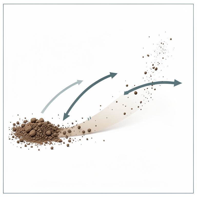
Mechanisms of Wind Erosion
AI-generated conceptual illustration (dry agricultural soil particles). It explains the idea and does not show study data.
View source evidence ↗Introduction
Agricultural activities have an important role in the primary sector of Indian economy, favorable climate characteristics have guaranteed the developing of numerous agricultural products, along the whole national land. The world is facing population explosion and there is urgent need to increase farm productivity and total food production on sustainable basis without compromising on natural resources and environment. Due to intensive cropping, imbalanced use of fertilizers, unsustainable agricultural practices and cultivation of high yielding crop varieties leads to degradation of soil. Soil erosion is main contributor to soil degradation. All landforms are impacted by the naturally occurring process of soil erosion. Soil erosion in agriculture is the wearing down of a field's topsoil by wind, water, and other natural physical forces, or by forces related to farming operations like tillage. Erosion, whether it is by water, wind or tillage, involves three distinct actions-soil detachment, movement and deposition. Soil erosion is the displacement of the upper layer of soil, one form of soil degradation. This natural process is caused by the dynamic activity of erosive agents, that is, water, glaciers, snow, wind, plants, animals, and humans (Apollo et al. 2018) [1] . Soil erosion can be a gradual process that goes mostly unnoticed or it can happen at a startling rate that results in a significant loss of topsoil. Reduced agricultural production potential, poorer surface water quality, and degraded drainage networks can all be signs of soil loss from farms. The rate at which erosion is happening worldwide has accelerated by ten to forty times due to human activity. Both "on-site" and "off-site" issues result from excessive (or rapid) erosion. Due to the loss of the nutrient-rich higher soil layers, on-site effects include declines in agricultural output and ecological collapse on natural landscapes. Desertification is sometimes the ultimate outcome. Sedimentation of streams, eutrophication of water bodies, and damage to homes and roadways caused by silt are examples of off-site consequences. The two main sources of land degradation are wind and water erosion, which together account for approximately 84% of the world's damaged land. As a result, excessive erosion is one of the worst environmental issues in the world (Blanco & Lal, 2010 and Toy et al, 2002) [4,52] . Urban sprawl, roadways, anthropogenic climate change, intensive agriculture, and deforestation are some of the most important human activities that contribute to erosion (Julien, Pierre Y. 2010) [27] . Nonetheless, a variety of restoration and preventative techniques can reduce or stop the erosion of susceptible soils. High in organic matter, fertility, and soil life, topsoil is transported either "off-site" where it fills up drainage channels or "on-site" where it accumulates over time. In addition to lowering farmland productivity, soil erosion pollutes nearby wetlands, lakes, and watercourses. Soil erosion can be a gradual process that goes mostly unnoticed or it can happen at a startling rate that results in significant topsoil loss. Soil compaction, low organic matter, loss of soil structure, poor internal drainage, salinisation and soil acidity problems are other serious soil degradation conditions that can accelerate the soil erosion process.
Soil Erosion:
Detachment and transportation of top soil materials from one place to another by lowing water, blowing wind, gravity, human activities, etc.
Types of Soil Erosion • Normal Erosion or Natural or Geological Erosion:
Gradual removal of surface soil by natural processes. This erosion is very slow and the rate of removal of soil is always less than the rate of soil is formed. This is a useful and helps in formation of soil and development of landscapes, etc. Natural soil erosion happens slowly and is caused by normal or natural conditions without human intervention. • Accelerated Erosion: Mainly caused by human activities such as deforestation, mining, over-grazing, faulty cultivation, etc. The rate of erosion is much faster than the rate of formation of soil, therefore, it called accelerated erosion. This erosion is very harmful. Normally the accelerated erosion is called soil erosion.
The accelerated soil erosion is due to active interference of man and animals in disturbing the equilibrium in between the rate of soil formation and rate of soil loss and occurs at a faster rate.
Types of Accelerated Erosion Accelerated erosion is of two types-water erosion and wind erosion:
Erosion caused by water is called water erosion and if caused by wind is called wind erosion.
Types of Water Erosion
• Splash or Raindrop erosion: Caused by the impact of falling rain drops. The continuous impact of the raindrops compacts and seals the surface which causes runoff. Its intensity depends upon size of raindrop and intensity of rainfall. • Sheet Erosion: Removal of a fairly uniform layer of soil from the land surface by action of rainfall and runoff water. Sheet erosion continuously makes the soil shallower and extremely harmful. It is usually so slow that the farmer is not aware of its existence. Field appears to be the same as before, but yields of crops begin to decline slowly. • Rill Erosion: Removal of soil by running water from small, shallow channels which develop due to concentration of surface flow along the slope. Rills generally develop on bare and unprotected land. It is an intermediary stage between sheet and gully erosion and clearly visible. Shallow channels can be smoothened by normal tillage operations. [52] and Zachar, Dusan (1982) [62] , splash erosion is typically regarded as the earliest and least severe stage of the soil erosion process, followed by sheet erosion, rill erosion, and gully erosion, which is the most severe of the four. Splash erosion occurs when a raindrop strikes the ground, creating a tiny crater that ejects soil particles [7] (Cheraghi et al. 2016) [8] . On flat ground, these soil particles can travel up to 0.6 meters (two feet) vertically and 1.5 meters (five feet) horizontally.
Surface runoff happens when the soil is saturated or when the rate of rainfall exceeds the pace at which water can seep into the soil. The runoff will carry loose soil particles, or sediment, down the hill if it has enough flow energy. The movement of loose soil particles by overland flow is known as sheet erosion (FAO, 1964) [14] .
Rivers and Streams
When water flows continuously over a linear feature, valley or stream erosion takes place. Both downward and headward erosion are occurring, deepening the valley and extending it into the slope, resulting in steep banks and head cuts. The valleys feature a characteristic V cross-section, the stream gradient is very steep, and the erosive activity is primarily vertical in the early stages of stream erosion. The erosive activity changes to lateral erosion when a certain base level is achieved, widening the valley floor and forming a narrow floodplain. As the stream meanders across the valley floor, the gradient of the stream becomes almost flat, and lateral sediment deposition becomes significant. The majority of erosion in all stages of stream erosion happens during floods, when there is more and fastermoving water available to carry a greater load of sediment.
Water is not the only thing that erodes in these processes; suspended abrasive particles, stones, and boulders can also act erosively as they move across a surface, a process called traction (Ritter, 2006) [44] . The deterioration of a stream or river's banks is known as bank erosion. This is different from what is known as scour alterations on the watercourse bed. By embedding metal rods into the bank and noting the location of the bank surface along the rods at various intervals, erosion and changes in the shape of river banks can be quantified (Nancy, 2004) [34] .
The melting and weakening of permafrost caused by flowing water is known as thermal erosion. It can happen near the coast as well as beside rivers. Since certain sections of the banks are made of non-cohesive materials cemented by permafrost, thermal erosion is the cause of the rapid river channel migration seen in the Siberian Lena River (Costard et al, 2013) [10] . The weakened banks fail during significant downturns, which contributes significantly to this degradation. The Arctic coast is also impacted by thermal erosion, as permafrost bluffs along the shoreline are undercut and fall due to a combination of near-shore temperatures and wave activity. Between 1955 and 2002, the average annual erosion rate along a 100-kilometer (62mile) stretch of the Beaufort Sea shoreline was 5.6 meters (18 feet) (Jones et al, 2018) [26] .
Floods
Large amounts of quickly flowing water create kolks, or vortices, at very high flows. Kolks induce severe local erosion, removing bedrock and producing geographical features known as "rock-cut basins," which resemble potholes.
Wind Erosion
Particularly in dry and semi-arid areas, wind erosion is a significant geomorphological influence. Additionally, it is a significant cause of crop damage, evaporation, desertification, hazardous airborne dust, and land degradation especially after being greatly raised above natural rates by human activities including deforestation, urbanization, and agriculture (Zhang & Huang, 2009) [63] .
There are two main types of wind erosion: Abrasion, which occurs when surfaces are worn down by airborne particles carried by the wind, and deflation, which occurs when the wind picks up and transports away loose particles.
There are three types of deflation: (1) surface creep, in which heavier, larger particles roll or slide along the ground;
(2) saltation, in which particles are lifted a short distance into the air and bounce and saltate across the soil's surface; and (3) suspension, in which the wind lifts very small, light particles into the air and frequently carries them for long distances. The majority of wind erosion (50-70%) is caused by saltation, which is followed by suspension (30-40%) and surface creep (5-25%) (Blanco and Lal, 2010; Balba, 1995) [2, 4] . Because silt particles are more easily separated and carried away, silty soils are typically the most vulnerable to wind erosion.
In desert regions and during dry spells, wind erosion is far more severe. In the Great Plains, for instance, soil loss from wind erosion is thought to be up to 6100 times higher during dry years than during wet ones (Wiggs, 2011) [61] .
Mass Movement
On a sloped surface, mass movement is the downward and outward movement of rock and sediments, mostly caused by gravity (Van Beek, 2008; Gray & Sotir, 1996) [17,56] . In mountainous regions, mass movement is frequently the initial step in the breakdown and transportation of weathered materials, and thus plays a significant role in the erosional process (Nicholas, 2009) [36] . It transports material from higher elevations to lower elevations, where it can be picked up and transported to even lower elevations by other eroding forces like streams and glaciers. On all slopes, massmovement processes are constantly taking place. Some of these processes function extremely slowly, while others happen very abruptly and frequently have disastrous outcomes.
In general, any noticeable movement of rock or material downslope is called a landslide. Nonetheless, landslides can be categorized in a far more thorough manner that takes into account the mechanisms causing the movement as well as the speed at which it takes place. A scree slope is one of the obvious topographical signs of a very slow kind of such activity.
Factors Affecting Soil Erosion Climate
The primary climatic element controlling soil erosion by water is the quantity and intensity of precipitation. When substantial rainfall falls during periods or in areas where vegetation does not adequately shield the soil's surface, the link is very strong. This could occur in semi-arid areas where vegetation is naturally scarce or at times when agricultural activities leave the land bare. Strong winds are necessary for wind erosion, especially during dry spells when there is less vegetation and dry soil, which makes the soil more erodible. Through their impacts on vegetation and soil qualities, other climatic parameters like average temperature and temperature range may also have an impact on erosion.
In general, places with more precipitation (especially highintensity rainfall), more wind, or more storms are likely to have more erosion given similar vegetation and ecosystems. Rainfall intensity is the main factor influencing erosivity in some parts of the world (such as the midwestern USA), with higher intensity rainfall typically leading to more waterinduced soil erosion. Another crucial element is the size and speed of the raindrops. Because larger, faster-moving raindrops have more kinetic energy than smaller, slowermoving ones, their impact will move soil particles farther (Blanco and Lal, 2010) [4] .
In other parts of the world, such as Western Europe, relatively low intensities of precipitation fall into previously saturated soil, causing runoff and erosion. In these circumstances, the amount of rainfall-rather than its intensity determines the degree of water-induced soil erosion.
Soil Structure and Composition
The soil's composition, moisture content, and compaction all play a significant role in how erosive rainfall is. Because clay helps hold soil particles together, sediments with more clay are typically less prone to erosion than those with sand or silt (Mirsal, 2008) [32] . Because organic elements agglomerate soil colloids and form a stronger, more stable soil structure, soil with high amounts of organic materials is frequently more resistant to erosion. [31] Because it restricts the quantity of water that can be absorbed by the soil (and thus kept from pouring on the surface as erosive runoff), the amount of water in the soil prior to precipitation also plays a significant impact. For a given amount of rainfall, wet, saturated soils will not be able to absorb as much rainwater, resulting in higher amounts of surface runoff and consequently higher erosivity (Torri, 1996) [51] . The permeability of the soil to water and, consequently, the volume of water that escapes as runoff are both impacted by soil compaction. Surface runoff will be higher in more compacted soils than in less compacted ones (Blanco and Lal, 2010) [4] .
Vegetative Cover
Between the soil and the atmosphere, vegetation serves as an interface. It reduces runoff by making the soil more permeable to rainwater. In addition to beneficial microclimate changes, it protects the soil from winds, which reduces wind erosion. By binding the soil together and intertwining with other roots, the plant roots create a more solid mass that is less prone to erosion from wind and water. Surface erosion accelerates when vegetation is removed (Styczen & Morgan, 1995) [50] .
Topography
The land's topography controls the surface runoff's flow velocity, which in turn controls the runoff's erosivity. Compared to shorter, less steep slopes, longer, steeper slopes especially those lacking sufficient vegetative cover are more vulnerable to extremely high rates of erosion during periods of intense precipitation. Additionally, mudslides, landslides, and other types of gravity erosion processes are more common on steeper terrain (Whisenant, 2008) [59] .
Human Activities That Increase Soil Erosion Agricultural Practices
The single biggest cause of the rise in erosion rates worldwide is sustainable agriculture methods. One of the main causes is the cultivation of agricultural lands, which breaks up the soil into finer particles. Modern agricultural machinery that enables deep plowing, which significantly increases the amount of soil available for transport by water erosion, has made the problem worse. Other practices include monocropping, farming on steep slopes, the use of chemical fertilizers and pesticides (which destroy soilbinding organisms), row cropping, and surface irrigation (Blanco & Lal, 2010; Lobb, 2009) [4,29] . The size-selective character of soil erosion episodes may lead to a complicated overall scenario regarding the definition of nutrient losses from soils. For example, the finer eroded fraction had a higher loss of total phosphorus than the entire soil (Poirier et al., 2012) [40] .
The reason for extrapolating this data to forecast behavior in receiving aquatic systems is that, in contrast to coarser-sized fractions, this more readily transported material might support a lower solution P concentration (Scalenghe et al., 2007) [47] . Because tillage dehydrates the soil and breaks it up into smaller particles that the wind can pick up, it also increases the rates of wind erosion. This is made worse by the fact that most trees are typically removed from agricultural areas, giving winds large, open expanses to travel over at faster speeds (Whitford, 2002) [60] . Heavy grazing increases soil compaction and decreases plant cover, both of which accelerate erosion (Imerson, 2012) [18] .
Deforestation
A layer of humus and leaf litter covers the forest floor in an undisturbed forest, protecting the mineral soil. Over the earth, these two layers provide a protective mat that lessens the impact of raindrops. Rainwater can slowly seep into the soil beneath them rather than pouring over the top as runoff because they are porous and extremely permeable to rainfall. Soil particles are kept from being washed away by the roots of plants and trees (Sands, 2005) [46] . Raindrops that impact the foliage and stems before they reach the ground are slowed down by the vegetative cover, which lowers their kinetic energy. However, surface erosion is prevented more by the forest floor than by the canopy. Raindrops attain their terminal velocity in roughly 8 meters (26 ft). Raindrops can frequently regain terminal velocity even after hitting the canopy since forest canopies are typically taller than this. Nevertheless, the intact forest floor may still absorb the effects of the rainfall thanks to its layers of organic matter and leaf litter (Goudie, 2000; Stuart & Edwards, 2006) [49] . By eliminating the humus and litter layers from the soil's surface, the vegetative cover that holds the soil together, and the high soil compaction caused by logging machinery, deforestation increases the rates of erosion by exposing mineral soil. Infiltration rates increase and erosion decreases to the extent that the forest floor is preserved after trees are cut down by fire or logging. If heavy rains occurs after a severe fire, it might cause significant further erosion (Goudie, 2000) [16,16] . In 2006, slash and burn management of tropical forests was one of the main causes of erosive soil loss worldwide. Entire swaths of a nation have been rendered unproductive in several parts of the world. For instance, the high central plateau of Madagascar, which makes up around 10% of the nation's land area, is almost entirely devoid of vegetation, with gully erosive furrows that are usually more than 50 meters (160 feet) deep and one kilometer (0.6 miles) broad.
In various parts of the world, shifting agriculture is a farming strategy that occasionally uses the slash and burn technique. As a result, the soil deteriorates and loses its fertility.
Roads and Urbanization
Urbanization has two main effects on erosion processes:first, it removes vegetation from the land, changes drainage patterns, and compacts the soil during construction; second, it covers the land with an impermeable layer of concrete or asphalt, which increases surface wind speeds and surface runoff (Nir, 1983) [37] . Fuel, oil, and other pollutants contaminate a large portion of the material carried in runoff from urban areas, particularly roadways (Randhir, 2007) [43] . In addition to eroding and deteriorating the land it runs over, this enhanced runoff significantly disrupts nearby watersheds by changing the amount and rate of water that passes through them and filling them with chemically contaminated detritus. The rate of bank erosion also significantly increases due to the increased water flow through nearby streams (James, 1995) [21] .
Climate Change
A more active hydrological cycle, including more intense rainfall events, is predicted to result from the rising air temperatures seen over the past few decades (IPCC, 1995) [19] . Coastal erosion rates have also significantly increased due to the rise in sea levels brought on by climate change (Bicknell et al., 2009) [3] . Research on soil erosion indicates that higher rates of soil erosion will result from higher rainfall volumes and intensities. Therefore, unless corrective action is taken, erosion will grow if rainfall volumes and intensities rise as predicted in many regions of the world. For a number of reasons, it is anticipated that soil erosion rates will alter in response to climate change. The most obvious is the shift in rainfall's erosive potency. Additional causes include: a) variations in plant canopy brought on by changes in plant biomass production linked to moisture regime; b) variations in litter cover on the ground brought on by variations in plant biomass production rates and plant residue decomposition rates driven by temperature and moisture-dependent soil microbial activity; and c) variations in soil moisture brought on by variations in precipitation regimes and evapo-transpiration rates, which alter infiltration and runoff ratios; d) changes in soil erodibility brought on by a drop in soil organic matter contents, which results in a soil structure more prone to erosion and increased runoff as a result of increased soil surface crusting and sealing; e) a change in winter precipitation from nonerosive snow to erosive rainfall as a result of rising winter temperatures; f) permafrost melting, which causes previously non-erodible soil to become erodible; and g) changes in land use required to adapt to changing climatic regimes. According to research by Pruski and Nearing, it is realistic to anticipate a 1.7% change in soil erosion for every 1% change in total precipitation under climate change, even if other factors like land use are not taken into account (Pruski & Nearing, 2002) [42] . According to recent research, rainfall erosivity is expected to increase by 17% in the US (Nearing et al., 2004) [35] and by 18% in Europe (Panagos et al., 2017) [38,39] .
Global Environmental Effects
Erosion is one of the biggest environmental issues facing the world today because of the severity of its ecological effects and the scale on which it occurs (Toy et al., 2002) [52] .
Land Degradation
These days, wind and water erosion account for 84% of degraded acreage, making them the two main sources of land degradation (Blanco & Lal, 2010) [4] . An estimated 75 billion tons of soil are lost from the land year, which is 13-40 times faster than the rate of erosion that occurs naturally (Zuaro & Pleguezuelo, 2009). Serious degradation affects over 40% of the world's agricultural land (Sample, 2007) [45] . Drought, deforestation, and climate change cause an area of fertile soil the size of Ukraine to disappear annually, according to the UN (Smith & Adwards, 2008) [48] .
According to UNU's Institute for Natural Resources in Africa in Ghana, if current trends in soil degradation continue, Africa may only be able to feed 25% of its population by 2025. Using high temporal resolution (less than 30 minutes) and high quality rainfall records, recent modeling advancements have assessed rainfall erosivity on a global scale. The Global Rainfall Erosivity Database (GloREDa), which comprises rainfall erosivity for 3,625 stations and spans 63 nations, is the outcome of a massive global data collection effort. A worldwide erosivity map at 30 arc-seconds sed using advanced geostatistical techniques was created using the first-ever worldwide Rainfall Erosivity Database (Panagos et al., 2017) [38,39] . Nearly 36 billion tons of soil are lost annually as a result of water, and deforestation and other changes in land use exacerbate the issue, according to a recent study (Borrelli et al., 2017) [6] published in Nature Communications. The study uses high-resolution geographically distributed modeling to examine the dynamics of soil erosion worldwide. The loss of soil fertility brought on by erosion is made worse by the fact that, instead of allowing the land to regenerate, chemical fertilizers are frequently applied, which contributes to more soil and water pollution (Potter et al., 2004) [41] .
Sedimentation of Aquatic Ecosystems
Due to the consequences of excess sediments entering the world's waterways, soil erosion particularly from agricultural activity is thought to be the primary cause of diffuse water pollution worldwide. In addition to acting as pollutants in and of themselves, the sediments also serve as carriers of other pollutants, such as heavy metals or attached pesticide molecules (Da Cunha, 1991) [11] . Increased silt loads can have disastrous effects on aquatic ecosystems. Because silt fills in the spaces between pebbles on the stream bed, it can suffocate fish spawning grounds. Additionally, as silt gets into their gills, it decreases their food supply and causes serious respiratory problems. The biodiversity of aquatic plant and algal life is reduced, and invertebrates are also unable to survive and reproduce. The ecological disruption brought on by the mass die off frequently lasts for a very long time, even if the sedimentation event itself may be somewhat brief (Merrington, 2002) [31] . The middle and upper reaches of the Yangtze and Yellow rivers in the People's Republic of China are home to one of the most severe and persistent water erosion issues in the world. Every year, more than 1.6 billion tons of silt enter the ocean from the Yellow River. In the northwest's Loess Plateau, water erosion is the main source of the sediment.
Airborne Dust Pollution
In the form of airborne particulates, or "dust," soil particles collected during soil erosion by wind are a significant contributor to air pollution. When these airborne soil particles land or are inhaled or consumed, they provide risks to the environment and public health since they are frequently tainted with hazardous substances like pesticides or petroleum fuels (Maiewski, 2002) [30] . Red sunsets are more common because dust from erosion suppresses rainfall and turns the blue sky into white. Since the 1970s, dust events have been connected to a reduction in coral reef health in Florida and the Caribbean (US Geological Survey, 2006) [54] . Similar dust plumes start in the Gobi desert and travel great distances downwind, or eastward, into North America when they combine with pollutants (James et al., 2002) [20] .
Monitoring and Measuring
People can better understand the causes of soil erosion, forecast erosion under various scenarios, and plan the use of preventative and restorative erosion solutions by monitoring and modeling erosion processes. However, effective modeling is difficult due to the complexity of erosion processes and the several scientific disciplines that must be taken into account in order to comprehend and predict them (e.g., climatology, hydrology, geology, soil science, agriculture, chemistry, physics, etc.) (Evans, 2012) [12] . Additionally, because erosion models are non-linear, it is challenging or impossible to scale them up to make predictions about broad regions from data gathered by sampling smaller plots (Brazier et al., 2011) [7] .
The most commonly used model for predicting soil loss from water erosion is the Universal Soil Loss Equation (USLE). This was developed in the 1960s and 1970s. It estimates the average annual soil loss A on a plot-sized area as (Ward & Trimble, 2004) [58] : A = RKLSCP Where R is the rainfall erosivity factor, [81, 82] K is the soil erodibility factor, L and S are topographic factors representing length and slope, C is the cover and management factor and P is the support practices factor. The USLE has frequently been used to estimate soil erosion over considerably larger areas, such as watersheds or even entire continents, despite its plot-scale spatial focus. For instance, soil erosion throughout all of Europe has recently been measured using RUSLE. One significant issue is that any USLE-based evaluation of erosion ignores erosion from gullies since the USLE is unable to replicate gully erosion. However, on farmed and grazed land, gully erosion can account for a significant amount (1080%) of overall erosion (Boardman & Poesen, 2006) [5] . Many different models of soil erosion have been created in the fifty years since the USLE was first introduced (Jetten & Favis, 2006) [24] . However, all erosion models may produce poor results when validated, that is, when model predictions are contrasted with actual measurements of erosion, due to the complexity of soil erosion and its component processes (Favis, 1998) [13] . As a result, new models of soil erosion are constantly being created. Some of these, like the G2 model, are still based on USLE (Karydos & Panagos, 2017) [28,38,39] . The use of USLE elements has been mostly or completely abandoned in other soil erosion models, such as the Rangeland Hydrology and Erosion Model and the Water Erosion Prediction Project model.
Soil Conservation Practices for Erosion Control
Control of water erosion requires the best agronomic, soil management and engineering practices that protect the soil and reduce runoff.
1. Agronomic Practices: These practices help to minimize impact of raindrops and the runoff.
• Crop Rotation: Compared to farmed land, fallow soil has more erosion. Compared to close-growing crops like wheat, berseem, etc., erosion is far higher in widely spread crops like cotton and maize. Soil erosion is significantly reduced by grasses and forage crops.
Because forages are a non-row crop, their fibrous root system helps prevent erosion by anchoring the plants to the top layer of the soil and covering the entire field. It has also been demonstrated that conventional planting techniques like crop rotation and mixed cropping, as opposed to monocropping, greatly lower erosion rates. • Contour Cultivation: This method involves plowing, planting crops, etc. in rows across the slope rather than up and down on mild slopes. Every horizontal row that is planted along the slope functions as a tiny dam. • Tillage: To create a seed bed tilth suitable for various crops, the field is ploughed and the soil is disturbed and smoothed using traditional methods. When the soil is left fallow after being plowed, it becomes vulnerable to erosion. Conservation tillage: little or zero tillage disturbs the soil as little as possible. By improving soil structure, infiltration, and pore-size distribution, these low-intensity tillage techniques promote soil consolidation. • Mulching: Any substance applied to the soil's surface is referred to as mulch. It works well to increase water infiltration and decrease runoff. Because they lessen the effect of rains breaking up the soil particles, crop leftovers help to mitigate erosion. • Strip Cropping: It is a practice of growing alternate strip of erosion controlling and erosion promoting crops such as grasses-maize-grasses-potato. It is a means of reducing the length of slope. When the strips are laid out on the contours on slopes, the system is called contour strip cropping.
• Agro-Forestry: This type of intercropping involves planting crops in between rows of trees or shrubs.
Because the trees and shrubs retain soil particles and stop soil erosion, the soil is not left fallow once the crop is harvested. • Engineering techniques: These techniques are employed to regulate the flow of water across the surface of the land. Whether the goal is to improve surface water storage capacity, decrease runoff water velocity, or securely dispose of excess water will determine the practice. Terracing, bunding, dams, and other techniques are among them. • Terracing: Built along the contour of sloping terrain, a terrace is an embankment or ridge of soil with a nearly level top and a steep or vertical downhill face. It is a technique that reduces the land's length and slope. It requires levelling operations, which are expensive and need technical expertise. Terraces that are perpendicular to the slope form on hills. Ditches are often installed behind the terrace to allow for proper drainage in regions with heavy rainfall. People all across the world have been using terracing, an incredibly successful method of controlling erosion, for thousands of years. • Bunding: To provide greater time for infiltration and lower runoff, bunds are built along field boundaries without regard to contours. In order to establish contour bunds on hills, earthen embarkations are built across the slope in accordance with the contours. • Dams: The purpose of dams is to control gullies. These are engineering constructions designed to slow down water runoff.
Wind Erosion Control
Reducing soil erodibility and breaking wind velocity at the soil-atmosphere interface are the fundamental principles of controlling wind erosion. This can be accomplished by: • Vegetation Cover: Using vegetation or vegetative wastes to protect the soil's surface. It is possible to undertake stubble mulch farming and grass planting. • Soil Moisture Conservation: Using techniques like contour plowing, strip cropping, deep plowing, etc. when it rains. • Increase Surface Roughness: To slow down wind and catch some of the soil particles in motion, roughen the land's surface. Creating clods at the surface is one way to accomplish this. Additionally, stubble mulch has shown great efficacy. • Breaking Wind Velocity: Strip cropping and alternate strips of cropped and fallowed land is effective in reducing wind velocity, if done perpendicular to prevailing wind direction. Barriers such as wind breaks and shelter belts are effective in reducing wind velocities and for trapping drifting soil. A wind break is defined as any type of barrier for protection from winds, more commonly made as mechanical or vegetative barriers for farm, gardens, etc. Windbreaks (also called shelterbelts) are rows of trees and shrubs that are planted along the edges of agricultural fields, to shield the fields against winds (Forman, 1995) [15] .
In addition to significantly reducing wind erosion, windbreaks provide many other benefits such as improved microclimates for crops (which are sheltered from the dehydrating and otherwise damaging effects of wind), habitat for beneficial bird species, (Johnson et al., 2011) [25] carbon sequestration, (Udawatta & Shibu, 2011) [55] and aesthetic improvements to the agricultural landscape (Blanco & Lal, 2010) [4] . A shelter belt is a longer barrier than a wind break and consists of a combination of shrubs and trees intended for the conservation of soil and moisture and for the protection of field crops.
References
62 in the original paper- Apollo M, Andreychouk V, Bhattarai SS. Short-Term Impacts of Livestock Grazing on Vegetation and Track Formation in a High Mountain Environment: A Case Study from the Himalayan Miyar Valley (India). Sustainability. 2018;10(4):951.
- Balba Monem A. Desertification: Wind erosion. Management of Problem Soils in Arid Ecosystems. CRC Press; 1995. p. 214.
- Bicknell J, editor. Adapting Cities to Climate Change: Understanding and Addressing the Development Challenges. Earthscan; 2009. p. 114.
- Blanco H, Lal R. Soil and water conservation. Principles of Soil Conservation and Management. Springer; 2010. p. 2.
- Boardman J, Poesen J. Soil erosion in Europe: major processes, causes and consequences. Soil Erosion in Europe. Wiley; 2006. p. 479-487.
- Borrelli P, Robinson DA, Fleischer LR, et al. An assessment of the global impact of 21st century land use change on soil erosion. Nature Communications. 2017;8(1):12-08.
- Brazier RE. Scaling soil erosion models in space and time. In: Morgan RP, Nearing M, editors. Handbook of Erosion Modelling. John Wiley & Sons; 2011. p. 100.
- Cheraghi M, Jomaa S, Sander GC, Barry DA. Hysteretic sediment fluxes in rainfall-driven soil erosion: Particle size effects. Water Resour Res. 2016;52.
- Cornelis WS. Hydroclimatology of wind erosion in arid and semi-arid environments. In: D'Odorico P, Porporato A, editors. Dryland Ecohydrology. Springer; 2006. p. 141.
- Costard F, Dupeyrat L, Gautier E, Carey-Gailhardis E. Fluvial thermal erosion investigations along a rapidly eroding river bank: application to the Lena River (central Siberia). Earth Surface Processes and Landforms. 2003;28(12):1349-1359.
- Da Cunha LV. Sustainable development of water resources. In: Bau J, editor. Integrated Approaches to Water Pollution Problems: Proceedings of the International Symposium (SISIPPA). Taylor & Francis; 1991. p. 12-13, 1923.
- Evans R. Assessment and monitoring of accelerated water erosion of cultivated land-when will reality be acknowledged?. Soil Use and Management. 2012;29(1):105-118.
- Favis-Mortlock D. Validation of field-scale soil erosion models using common datasets. Modelling Soil Erosion by Water. Springer-Verlag NATO-ARS Series; 1998. p. 1-55, 89-128.
- Food and Agriculture Organization. Types of erosion damage. Soil Erosion by Water: Some Measures for Its Control on Cultivated Lands. United Nations; 1965. p. 23-25.
- Forman RTT. Windbreaks, hedgerows, and woodland corridors. Land Mosaics: The Ecology of Landscapes and Regions. Cambridge University Press; 1995.
- Goudie A. The human impact on the soil. The Human Impact on the Natural Environment. MIT Press; 2000. p. 188.
- Gray DH, Sotir RB. Surficial erosion and mass movement. Biotechnical and Soil Bioengineering Slope Stabilization: A Practical Guide for Erosion Control. John Wiley & Sons; 1996. p. 20.
- Imeson A. Human impact on degradation processes. Desertification, Land Degradation and Sustainability. John Wiley & Sons; 2012. p. 165.
- Intergovernmental Panel on Climate Change (IPCC). Second Assessment Synthesis of Scientific-Technical Information relevant to interpreting Article 2 of the UN Framework Convention on Climate Change. 1995. p. 5.
- James KB, Bishop RD, Jeffrey ST. Robotic Observations of Dust Storm Enhancement of Carbon Biomass in the North Pacific. Science. 2002;298:81721.
- James W. Channel and habitat change downstream of urbanization. In: Herricks EE, Jenkins JR, editors. Storm water Runoff and Receiving Systems: Impact, Monitoring, and Assessment. CRC Press; 1995. p. 105.
- Jefferson IF, Smalley IJ. Saltating sand erodes metastable loess ground: events in the impact zone. 1999.
- Jetten V, Favis-Mortlock D. Modelling soil erosion in Europe. Soil Erosion in Europe. Wiley; 2006. p. 695716.
- Johnson RJ. Global perspectives on birds in agricultural landscapes. In: Campbell W, Bruce Ortiz, Silvia Lopez, editors. Integrating Agriculture, Conservation and Ecotourism: Examples from the Field. Springer; 2011. p. 76.
- Jones BM, Hinkel KM, Arp CD, Eisner WR. Modern Erosion Rates and Loss of Coastal Features and Sites, Beaufort Sea Coastline, Alaska. Arctic. 2008;61(4):361-372.
- Julien PY. Erosion and Sedimentation. Cambridge University; 2010. p. 1.
- Karydas CG, Panagos P. The G2 erosion model: An algorithm for month-time step assessments. Environmental Research. 2010;161:256-267.
- Lobb DA. Soil movement by tillage and other agricultural activities. In: Jorgenson SE, editor. Applications in Ecological Engineering. Academic Press; 2009.
- Majewski MS, Capel PD. Pesticides in the Atmosphere: Distribution, Trends, and Governing Factors. CRC Press; 1996. p. 121.
- Merrington G. Soil erosion. Agricultural Pollution: Environmental Problems and Practical Solutions. Taylor & Francis; 2002. p. 77-78.
- Mirsal IA. Soil degradation. Soil Pollution: Origin, Monitoring & Remediation. Springer; 2008. p. 100.
- Nair PKR. An Introduction to Agroforestry. Springer; 1993. p. 333-338.
- Nancy GD. Erosion and Scour. Stream hydrology: an introduction for ecologists. 2004. p. 06-01.
- Nearing MA, Pruski FF, O'Neal MR. Expected climate change impacts on soil erosion rates: A review. Journal of Soil and Water Conservation. 2004;59(1):43-50.
- Nichols G. Sedimentology and Stratigraphy. John Wiley & Sons; 2009. p. 93.
- Nîr D. Man, a Geomorphological Agent: An Introduction to Anthropic Geomorphology. Springer; 1983. p. 121-122.
- Panagos P, Ballabio C, Meusburger K, et al. Towards estimates of future rainfall erosivity in Europe based on REDES and World Clim datasets. Journal of Hydrology. 2017;548:251-262.
- Panagos P, Borrelli P, Meusburger K, et al. Global rainfall erosivity assessment based on high-temporal resolution rainfall records. Scientific Reports. 2017;7(1).
- Poirier SC, Whalen JK, Michaud AR. Bioavailable phosphorus in fine-sized sediments transported from agricultural fields. Soil Science Society of America Journal. 2012;76(1):258-267.
- Potter KW. Impacts of agriculture on aquatic ecosystems in the humid United States. In: De Fries RS, editor. Ecosystems and Land Use Change. American Geophysical Union; 2004. p. 34.
- Pruski FF, Nearing MA. Runoff and soil loss responses to changes in precipitation: a computer simulation study. Journal of Soil and Water Conservation. 2002;57(1):7-16.
- Randhir TO. Watershed Management: Issues and Approaches. IWA Publishing; 2007. p. 56.
- Ritter ME. Geologic Work of Streams. The Physical Environment: an Introduction to Physical Geography. University of Wisconsin; 2006.
- Sample I. Global food crisis looms as climate change and population growth strip fertile land. The Guardian. 2007.
- Sands R. The environmental value of forests. Forestry in a Global Context. CABI; 2005. p. 74-75.
- Scalenghe R, Edwards AC, Barberis E. Phosphorus loss in over fertilized soils: The selective P partitioning and redistribution between particle size separates. European Journal of Agronomy. 2007;27(11):72-80.
- Smith K, Edwards R. 2008: The year of global food crisis. The Herald (Scotland). 2008.
- Stuart GW, Edwards PJ. Concepts about forests and water. Northern Journal of Applied Forestry. 2006;23(1).
- Styczen ME, Morgan RPC. Engineering properties of vegetation. In: Morgan RPC, Rickson RJ, editors. Slope Stabilization and Erosion Control: A Bioengineering Approach. Taylor & Francis; 1995.
- Torri D. Slope, aspect and surface storage. In: Agassi M, editor. Soil Erosion, Conservation, and Rehabilitation. CRC Press; 1996. p. 95.
- Toy TJ, Foster GR, Renard KG. Soil erosion: processes, prediction, measurement, and control. John Wiley & Sons; 2002.
- Toy TJ. Soil Erosion: Processes, Prediction, Measurement, and Control. John Wiley & Sons; 2002. p. 60-61.
- US Geological Survey. Coral Mortality and African Dust. 2006.
- Udawatta RP, Shibu J. Carbon sequestration potential of agroforestry practices in temperate North America. In: Kumar BM, Nair PKR, editors. Carbon Sequestration Potential of Agroforestry Systems: Opportunities and Challenges. Springer; 2011. p. 35-36.
- Van Beek R. Hillside processes: mass wasting, slope stability, and erosion. In: Norris JE, editor. Slope Stability and Erosion Control: Ecotechnological Solutions. Springer; 2008.
- Ward AD, Trimble SW. Soil conservation and sediment budgets. Environmental Hydrology. CRC Press; 2004. p. 259.
- Whisenant SG. Terrestrial systems. In: Perrow MR, Davy AJ, editors. Handbook of Ecological Restoration: Principles of Restoration. Cambridge University Press; 2008. p. 89.
- Whitford WG. Wind and water processes. Ecology of Desert Systems. Academic Press; 2002. p. 65.
- Wiggs GFS. Geomorphological hazards in drylands. In: Thomas DSG, editor. Arid Zone Geomorphology: Process, Form and Change in Drylands. John Wiley & Sons; 2011. p. 588.
- Classification of soil erosion. Soil Erosion. Elsevier; 1982. p. 10:48.
- Zheng X, Huang N. Mechanics of Wind-Blown Sand Movements. Springer; 2009. p. 7-8.
- Zuazo VHD, Pleguezuelo CRR. Soil-erosion and runoff prevention by plant covers: a review. In: Lichtfouse E, editor. Sustainable agriculture. Springer; 2009. p. 785.