
Research article · 2025 · Full text
International Journal of Geography Geology and EnvironmentSpatial Disparities in Cropping Intensity and Agricultural Productivity: A Study of South Dinajpur District, West Bengal
Volume 7(7) · Pages 61–66 · DOI: 10.22271/27067483.2025.v7.i7a.506 ↗
Research areasAgricultural Economics and PracticesAgriculture, Land Use, Rural DevelopmentSocial and Economic Development in India
Abstract
Author-writtenCropping intensity has become a central indicator in contemporary agricultural geography because it captures how far a limited land base is being used across multiple seasons. Yet high cropping intensity does not automatically imply uniformly high agricultural productivity. In districts marked by uneven irrigation, variable soil fertility, fragmented holdings, and differential market access, intensification often produces a spatially uneven agrarian landscape. South Dinajpur district in West Bengal offers an important case for examining this contradiction. Official district data identify a high cropping intensity of 176 percent, a net sown area of 188.6 thousand hectares, and a gross cropped area of 331.9 thousand hectares, indicating substantial land-use intensification. At the same time, the district remains only partially irrigated, with large areas still effectively dependent on rainfall or localized irrigation access. Recent work from West Bengal and the wider Eastern Indo-Gangetic Plain suggests that irrigation, diversification, soil quality, roads, markets, and storage are decisive in shaping agrarian transition, while district and sub-district disparities are often obscured by aggregate statistics. This article addresses the gap by developing a district-focused review of spatial disparities in cropping intensity and agricultural productivity in South Dinajpur. It synthesizes official district records, recent peer-reviewed literature on cropping intensity, agricultural sustainability, and crop diversification, and new work on soil fertility in the Barind tract of Dakshin Dinajpur. The article argues that South Dinajpur should not be interpreted simply as a high-intensity agricultural district; rather, it should be understood as an internally differentiated agrarian space in which productivity outcomes depend on the uneven geography of irrigation, soil fertility, cropping structure, and infrastructural support. The article contributes a conceptual framework for future block-level and GIS-based empirical research and offers a spatially grounded interpretation of why intensification and productivity may diverge within the same district.
Summary
Source-checkedPlain-language reading of the full paper, prepared with AI and checked against the text. Each point links to the authors' own words.
Why it matters
- Cropping intensity is a key measure in agricultural geography as it shows how effectively limited land is used across different seasons. View evidence ↗
- Agricultural intensification is used in India to maintain food production as the amount of land available per person decreases. View evidence ↗
- It is a common but misleading assumption that high cropping intensity automatically equals high agricultural productivity. View evidence ↗
The question
- The study investigates how a district can have a high overall cropping intensity while still experiencing significant spatial differences in productivity. View evidence ↗
- The research examines why using district-wide averages is often insufficient for understanding actual agricultural performance. View evidence ↗
What they did
- The study is designed as a district-focused analytical review rather than an empirical paper because no original block-level data were available. View evidence ↗
- The analysis synthesizes three source types: official government documents, peer-reviewed studies on agricultural efficiency and intensity, and specific soil-fertility research from the Barind tract. View evidence ↗
- The review follows a four-step framework: establishing an aggregate profile, identifying productivity drivers, interpreting the system as spatially uneven, and creating an explanatory model. View evidence ↗
What they found
- South Dinajpur has a high cropping intensity of 176%, with a net sown area of 188.6 thousand hectares and a gross cropped area of 331.9 thousand hectares. View evidence ↗
- Despite high intensity, irrigation is incomplete, with a net irrigated area of 82.54 thousand hectares compared to a rainfed area of 93.08 thousand hectares. View evidence ↗
- Agricultural intensification in the district is rice-led, with rice occupying 240.295 thousand hectares, far exceeding the areas used for wheat, jute, mustard, and potato. View evidence ↗
- The district lacks canal irrigation and relies on localized systems such as bore wells, shallow tube wells, lift irrigation, and tanks. View evidence ↗
- Soil fertility in the Barind tract is uneven, with 45.41% of the sampled area classified as low fertility and 54.49% as moderate fertility. View evidence ↗
- The district-wide cropping intensity of 176% is useful for external comparisons but fails to show the internal distribution of that intensity. View evidence ↗
What it means
- The authors conclude that South Dinajpur is a spatially uneven system where productivity depends on the interaction of irrigation, soil fertility, crop structure, and infrastructure. View evidence ↗
- The authors recommend that agricultural planning move away from aggregate measures like cropping intensity toward spatially differentiated strategies. View evidence ↗
- The study is a review and does not provide empirical measurements of block-level disparities. View evidence ↗
Visual summary
1 visualsIllustrations explain the paper; they do not show study data.
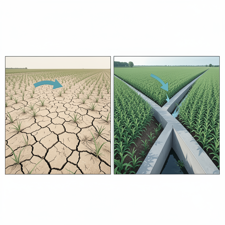
Drivers of Spatial Productivity Disparity
AI-generated conceptual illustration (Agricultural landscapes of South Dinajpur, West Bengal). It explains the idea and does not show study data.
View source evidence ↗Introduction
The contemporary debate on Indian agriculture is increasingly shaped by a structural constraint: land cannot expand indefinitely, so improvements in output must come from more efficient and more intensive use of existing cultivated area. This is why cropping intensity has become such a widely used measure in agrarian analysis. It captures the ratio between gross cropped area and net sown area and thus serves as a shorthand for the degree to which land is cultivated more than once during the agricultural year. Recent work from West Bengal explicitly describes cropping intensity as an important measure of agricultural productivity and land-use intensity, while India's agricultural statistics show that national cropping intensity reached 155.9 percent in 2022-23. In other words, intensification has become a central mechanism through which Indian agriculture seeks to sustain food production under conditions of shrinking per capita land availability. Yet a problem remains. Cropping intensity is often treated as if it were interchangeable with agricultural productivity. That assumption is misleading. A district may record high cropping intensity and still exhibit low or unstable productivity in some areas because the ability to crop land repeatedly depends on much more than land availability alone. Irrigation reliability, soil fertility, crop choice, input use, infrastructural connectivity, storage, and local ecological constraints all mediate whether repeated cultivation translates into higher yields and more secure incomes. Recent geography and agrarian studies show precisely this complexity. In West Bengal, agrarian transition has been linked not only to irrigation but also to fertilizer use, road connectivity, storage facilities, market access, and climatic variability. Studies from other Indian regions further show that irrigation intensity is important but not sufficient on its own, because agricultural efficiency increasingly depends on a wider bundle of technological and institutional factors. South Dinajpur district is a particularly revealing case through which to examine this issue. The district's official agricultural profile records a geographical area of 221.9 thousand hectares, a cultivable area of 204.85 thousand hectares, a net sown area of 188.6 thousand hectares, an area sown more than once of 143.3 thousand hectares, and a gross cropped area of 331.9 thousand hectares, producing a reported cropping intensity of 176 percent. The same district profile reports net irrigated area at 82.54 thousand hectares, gross irrigated area at 135.23 thousand hectares, and rainfed area at 93.08 thousand hectares. These figures are significant because they suggest a district that is highly intensified overall, but not uniformly secured by irrigation. The district is therefore better understood as a spatially uneven agrarian landscape rather than a homogeneous highperformance agricultural space. The crop structure of South Dinajpur reinforces that reading. Official data identify rice as overwhelmingly dominant, with a total cropped area of 240.295 thousand hectares in 2008-09, while wheat, jute, mustard, and potato occupied much smaller areas at 23.950, 18.72, 18.658, and 16.660 thousand hectares respectively. This pattern points to a district that is both intensive and selective: intensive because multiple cropping is clearly widespread, but selective because intensification remains heavily organized around a rice-led system rather than a uniformly diversified agrarian economy. Such cropping structures matter geographically because different crops demand different water regimes, input packages, labor schedules, and market infrastructures. Thus, even before one measures block-wise output, the district profile already suggests that internal disparities in productivity are likely. This article starts from that tension. It asks how a district with high aggregate cropping intensity can still contain meaningful spatial disparities in agricultural productivity. It also asks why district averages are often inadequate for interpreting agrarian performance. Recent work on the Eastern Indo-Gangetic Plain is especially important here, because it shows that sub-national averages can conceal very different patterns at district, sub-district, and community scales. In the same way, recent research on cropping pattern transition in West Bengal demonstrates that agrarian change is shaped by a combination of irrigation, infrastructure, markets, and climate rather than by a single variable. For South Dinajpur, this means that the key analytical problem is not whether agriculture is intensive in general, but how and where intensification is converted into productivity. The article therefore advances three propositions. First, the district's high cropping intensity should be interpreted as a district-level average that may conceal important internal disparities. Second, agricultural productivity in South Dinajpur is likely to vary spatially because irrigation, soil fertility, and crop diversification are unevenly distributed. Third, future research on the district needs to move beyond descriptive district totals and adopt a block-level and GISbased perspective capable of linking land use, irrigation access, soil conditions, and crop performance. These propositions provide the basis for the review that follows.
Literature Review 2.1 Theoretical framing: intensification, productivity, and spatial inequality
Agricultural geography has long been concerned with the difference between intensification and productivity. Intensification refers to the increasing use of land, labor, water, and inputs in order to raise output from a given land base. Productivity, by contrast, concerns output relative to a selected unit, most commonly land area, labor, or a bundle of inputs. In practical district-level analysis, cropping intensity often functions as a proxy for intensification rather than a direct measure of productivity. Recent work from West Bengal is especially clear on this point: cropping intensity indicates how intensively land is used, while actual agricultural performance depends on a broader ecology of irrigation quality, rainfall, seed technology, mechanization, labor, and diversification. This distinction is foundational for the present article because it explains why a district can appear highly intensified while still containing lowerperforming localities. A second theoretical concern is spatial inequality. Agrarian change is rarely even across administrative space. Recent research on the Eastern Indo-Gangetic Plain shows that subnational indicators can mask sharp divergences at finer scales, including district and community levels. That insight is particularly important for South Dinajpur because the district is small enough to be represented as a single agricultural unit in many datasets, but heterogeneous enough that such representation may be misleading. Once the unit of analysis becomes smaller, the apparent coherence of district averages weakens. Spatial disparity therefore is not an afterthought; it is the central analytical issue. A third concern is sustainability. Recent Indian work using a Pressure-State-Response model argues that cropping intensity, irrigation intensity, foodgrain productivity, crop diversification, institutional credit, and transport connectivity are all significant indicators of agricultural sustainability. This matters because it moves the debate beyond simple output growth. High cropping intensity may be economically attractive in the short term, but if it rests on fragile water access, nutrient depletion, or narrow crop specialization, it may generate uneven or unsustainable productivity outcomes. In that sense, the geography of cropping intensity has to be read alongside the geography of resource stress.
Major debates in the literature
One major debate concerns the extent to which irrigation drives productivity. State-level work in West Bengal identifies irrigation as a major driver of cropping transition, while a 2024 regional study from Karnataka shows that agricultural efficiency remains positively related to irrigation intensity, though the relationship is not sufficient on its own. Over time, fertilizers, improved seeds, and other technological factors also become important. The implication is that irrigation is best understood as a necessary enabling factor rather than a single master variable. For South Dinajpur, where official data record net irrigated area of 82.54 thousand hectares against net sown area of 188.6 thousand hectares, the literature strongly suggests that uneven irrigation access is likely to be one of the main sources of internal productivity variation. A second debate concerns crop diversification. West Bengal research finds that irrigation, fertilizer use, roads, markets, and storage shape transitions away from narrow foodgrain dependence, while Eastern Indo-Gangetic Plain research shows that crop diversification trends appear very different once one moves from sub-national to finer spatial scales. This debate matters because diversification is not simply a matter of switching crops; it is also a matter of risk management, income composition, soil health, and seasonal land use. Where diversification is possible, intensification may produce more stable productivity; where it is absent, repeated cultivation may reproduce vulnerability. South Dinajpur's rice-dominant structure suggests that diversification is present but limited, which may contribute to uneven agricultural outcomes across space. A third debate concerns measurement. New remote-sensing work from India demonstrates that the spatial and temporal analysis of cropping patterns and cropping intensity is essential for timely agricultural policy, especially under climate variability. That study also notes that spatial resolution may not matter greatly at larger scales, but can matter more for smaller study areas. This is directly relevant to South Dinajpur. A district-level average may be adequate for state comparison, but if the research question is about internal disparity, then finer-scale mapping becomes indispensable. The literature therefore supports a methodological shift from district-wide description to blockand village-sensitive spatial analysis.
South Dinajpur in the existing literature
The accessible literature on South Dinajpur remains uneven. Official district planning documents provide an important statistical profile of land use, irrigation, crop area, and fisheries, but they do not analytically examine spatial disparities in productivity. Recent soil research from the Barind tract of Dakshin Dinajpur, however, has become especially important. Malo and Saha's 2025 study shows that soil fertility in the rice-based Barind tract is spatially differentiated and that 45.41 percent of the sampled area falls into a low fertility class while 54.49 percent falls into a moderate fertility class. The study further argues that localized soil-fertility assessment and GIS-based nutrient management are necessary for sustainable rice productivity. This is highly relevant because it introduces a concrete soilbased explanation for why intensity and productivity may not coincide uniformly across the district. The soil-fertility literature also contributes an important process insight. In the same study, the authors note that high cropping intensity of two to three crops per year contributes to nitrogen depletion where nutrient replenishment is inadequate. That observation is critical for this article's argument. It suggests that intensification can produce diminishing productivity returns if the resource base is uneven or poorly managed. Thus, the geography of productivity in South Dinajpur cannot be reduced to cropping frequency; it must also include the geography of soil condition and nutrient stress.
Research gap
Taken together, the literature yields an important gap. There is strong evidence that cropping intensity is a useful indicator of land-use intensity, that agricultural productivity depends on irrigation, infrastructure, diversification, and resource quality, and that finer-scale spatial patterns often diverge from district or state aggregates. There is also emerging district-specific evidence that parts of Dakshin Dinajpur, especially the Barind tract, face meaningful soilfertility constraints. What remains missing, however, is an integrated, peer-reviewed, district-focused geographical article that directly interprets South Dinajpur's cropping intensity and agricultural productivity through the lens of spatial disparity. To the best of this review, the available literature has not yet combined district baseline statistics, agrarian-transition literature, soil-fertility mapping, and spatial-scale critique into a single analytical account of South Dinajpur. This article addresses that gap by constructing such an account.
Methodology
Because no original block-level dataset was supplied, this article is written as a review article rather than an empirical paper. The methodology therefore follows a district-focused analytical review design. Three kinds of sources were used. First, official government documents were used to establish the agrarian baseline of South Dinajpur, including land use, cropping intensity, irrigation, crop structure, and district resource conditions. Second, recent peer-reviewed studies on cropping intensity, agricultural efficiency, agricultural sustainability, crop diversification, and irrigation in India and West Bengal were used to frame the district within wider geographical debates. Third, recent district-relevant soil-fertility research from the Barind tract of Dakshin Dinajpur was used to connect broad agrarian indicators with localized biophysical constraints. The analytical framework used in the article is organized around four linked steps. The first step establishes the district's aggregate profile, focusing on cropping intensity, crop structure, and irrigation. The second step identifies the major drivers that the literature associates with productivity variation, namely irrigation, crop diversification, soil fertility, and infrastructural access. The third step interprets South Dinajpur as a spatially uneven agrarian system by bringing district facts into dialogue with recent geography literature on scale and spatial inequality. The fourth step formulates a district-specific explanatory framework that can guide future empirical and GIS-based work. This approach does not claim to measure block-level disparities directly. Instead, it identifies the most plausible structures through which such disparities are produced. The source selection principle was relevance rather than volume. Priority was given to recent peer-reviewed sources, especially from 2022 to 2025, because the article aims to situate South Dinajpur within current debates on agrarian transition, sustainability, and spatial agricultural analysis. Older official district statistics were still used where they remain the clearest district-level baseline available. This combination is methodologically justified because the argument depends both on current conceptual debates and on stable district characteristics such as land use, cropping structure, and irrigation dependence. No human subjects were involved, and no primary data were generated; therefore, formal research ethics approval was not required for this review design.
Results and Thematic Analysis
Results and Thematic Analysis
South Dinajpur as a high-intensity but uneven agrarian district
The first major result of the review is that South Dinajpur should be understood as a district of high aggregate agricultural intensity but probable internal unevenness. The official district profile is unambiguous about the intensity of land use: net sown area stands at 188.6 thousand hectares, area sown more than once at 143.3 thousand hectares, and gross cropped area at 331.9 thousand hectares, yielding a cropping intensity of 176 percent. That figure is substantially above the recent all-India level of 155.9 percent. On the surface, such a profile indicates strong landuse pressure and a high degree of multiple cropping. Yet the same profile reveals that net irrigated area is only 82.54 thousand hectares and rainfed area is 93.08 thousand hectares. The district therefore combines high intensity with incomplete irrigation coverage. This coexistence is the article's starting point because it implies that repeated cultivation is not equally secured across the cultivated landscape. This finding gains further significance when viewed through recent West Bengal literature. Pani, Mishra, and Dutta argue that high cropping intensity in West Bengal depends on the interaction of irrigation quality, rainfall, labor, seeds, farm size, and machinery, and that future expansion in agriculture increasingly depends on improved irrigation that allows multiple crops from the same land parcel. If that logic is applied to South Dinajpur, the district's high aggregate cropping intensity becomes analytically ambiguous. It signals intensification, but not necessarily secure productivity. The district profile, read alongside the literature, suggests that the benefits of intensification are likely distributed unevenly across areas with different irrigation access and resource quality.
Rice-led intensification and selective diversification
The second result is that South Dinajpur's intensification is rice-led rather than broadly diversified. Rice dominates the district's crop structure by a very large margin, occupying 240.295 thousand hectares in the official district plan, while wheat, jute, mustard, and potato each occupy much smaller areas. This configuration is important because it indicates that the district's overall cropping intensity is being generated within a relatively narrow cropping system. Such systems can be productive, but they are also more exposed to irrigation stress, soil nutrient depletion, and market or climate shocks when diversification remains limited. Statewide evidence from West Bengal supports this concern. Paria, Mishra, and Behera show that agrarian transition toward more varied crop patterns depends on irrigation, roads, storage, markets, fertilizer use, and climate. In other words, diversification is not simply a farmer preference; it is enabled by infrastructure and institutional conditions. This matters spatially because diversified pockets of agriculture are likely to perform differently from ricedominant ones. Where farmers have better irrigation access, stronger market links, and greater flexibility to shift toward oilseeds, vegetables, potato, or other high-value crops, agricultural productivity may rise differently than in localities locked into narrow seasonal cereal regimes. Thus, the district's crop structure suggests that South Dinajpur's productivity landscape is not only about how many times land is cropped, but also about what is grown, under what support conditions, and with what ecological consequences. The literature from the Eastern Indo-Gangetic Plain strengthens this interpretation by showing that district and sub-district diversification patterns can diverge sharply from larger-scale averages.
Irrigation as the central spatial filter
The third result is that irrigation is the district's main spatial filter, but not its only one. Official data indicate that the district lacks canal irrigation in the reported profile and depends primarily on bore wells or shallow tube wells, lift irrigation, tanks, and deep tube wells. Bore wells and shallow tube wells account for the largest share of irrigated area in the district profile, followed by lift irrigation and tanks. This structure is crucial because such irrigation systems are rarely distributed evenly in practice. They tend to reflect local hydrogeology, capital availability, infrastructure, and institutional capacity. Consequently, even where the district-level cropping intensity is high, the conditions that sustain that intensity are likely to vary from one part of the district to another. The wider literature confirms the importance of this pattern. The Karnataka study on agricultural efficiency and irrigation intensity shows a positive relationship between the two, even though other inputs also matter. West Bengal research similarly emphasizes that irrigation is one of the most important drivers of agrarian transition and multiple cropping. For South Dinajpur, the most reasonable interpretation is therefore spatial rather than purely aggregate: areas with stronger and more reliable access to groundwater-based or lift-based irrigation are likely to maintain more stable double-or triple-cropping systems, while areas with weaker or less reliable water access are more exposed to seasonal fluctuation and lower productivity. That is precisely the sort of disparity district averages tend to hide.
Soil fertility and the Barind tract question
The fourth result is that soil fertility adds a second major axis of spatial disparity. The recent Barind tract study from Dakshin Dinajpur shows that 45.41 percent of the sampled area falls into a low soil-fertility class and 54.49 percent into a moderate class. The authors further report significant nitrogen deficiency and explicitly note that high cropping intensity of two to three crops per year contributes to nutrient removal beyond replenishment. This is one of the most important findings for any attempt to understand South Dinajpur's productivity geography, because it demonstrates that the district's intensification rests on an ecologically uneven substrate. Where soils are more depleted or chemically constrained, high cropping frequency may not translate into proportionately high yields unless nutrient management is improved. This result changes how cropping intensity should be interpreted. In many district-level reports, a high croppingintensity figure is taken as evidence of progress. The Barind tract evidence suggests a more cautious reading. Intensification can indicate effective land use, but it can also indicate increased pressure on already stressed soils. Thus, spatial disparity in agricultural productivity within South Dinajpur may reflect not only who has irrigation, but also whose land can sustain repeated cultivation without deeper fertility loss. The fact that the Barind study recommends site-specific nutrient mapping and adaptive fertilizer management shows that productivity in the district is likely contingent on localized environmental conditions rather than uniform district-level inputs.
Why district averages are analytically insufficient
The fifth result is methodological but important: district averages are too coarse to explain intra-district productivity differences. The recent Eastern Indo-Gangetic Plain study by Nandi and colleagues demonstrates that sub-national indicators can obscure finer-scale variation and even create misleading impressions of moderate diversification where, in reality, some districts or communities are highly specialized and others are more diversified. The same problem applies to South Dinajpur. A single district-wide cropping-intensity value of 176 percent is useful for comparison with other districts or states, but it does not reveal which parts of the district are sustaining that intensity, under what crop combinations, with what irrigation support, and on what soil base. The official district profile offers essential baseline data, but not an explanation of internal variation. The remote-sensing literature reinforces this point. Pazhanivelan and colleagues argue that spatial and temporal analysis of cropping patterns and intensity is essential for policy-relevant agricultural planning, especially under climate uncertainty. They also note that spatial resolution becomes more important as the study area becomes smaller and more heterogeneous. This is directly relevant to South Dinajpur because the key question is not simply how much land is cropped more than once, but where this occurs and how it intersects with irrigation access, soil fertility, and crop structure. Future research on South Dinajpur therefore requires a much finer spatial lens than the district average alone can provide.
A district-specific explanatory model
Taken together, these themes support a district-specific explanatory model. In South Dinajpur, agricultural productivity should be understood as the outcome of four interacting spatial processes. First, the district's overall land scarcity and agrarian dependence encourage multiple cropping. Second, irrigation access determines whether multiple cropping is reliably feasible. Third, soil fertility conditions, especially in the Barind tract, mediate how productive repeated cultivation can actually be. Fourth, crop diversification and infrastructural access influence whether intensification translates into stable, high-value, or resilient productivity. The key analytical point is that these processes are not evenly distributed in space. Spatial disparity is therefore not incidental to the district's agriculture; it is structurally produced by the interaction of water, soil, crop choice, and infrastructure.
Discussion
The findings of this review allow a clearer interpretation of South Dinajpur's agrarian geography. First, the district's high cropping intensity should not be read as straightforward evidence of uniformly high agricultural productivity. The district profile confirms substantial intensification, but the combination of partial irrigation coverage, rice dominance, and emerging soil-fertility constraints suggests that productivity outcomes are likely differentiated. This interpretation is consistent with wider Indian and West Bengal literature, which shows that irrigation, diversification, markets, and resource quality jointly structure agrarian performance. In that sense, South Dinajpur fits a broader pattern: intensification is necessary in land-constrained regions, but it does not erase spatial inequality. Second, the article clarifies the conceptual difference between intensification and productivity. In policy discussion, high cropping intensity is often treated as a developmental achievement in itself. This review suggests a more differentiated reading. High cropping intensity in South Dinajpur is clearly significant, but it may represent very different realities in different parts of the district. In some places, it may reflect effective irrigation, secure crop sequencing, and strong yields. In others, it may represent pressure on fragile soils, heavy dependence on a narrow crop system, and a higher risk of diminishing returns. The Barind tract findings are especially important here because they show that repeated cultivation may coincide with nutrient depletion rather than stable productivity. Thus, the district's agrarian geography should be read through the combined lens of intensity and sustainability, not through cropping frequency alone. Third, the discussion highlights the importance of scale in agricultural geography. One of the strongest messages from current EIGP research is that aggregate indicators can conceal important smaller-scale divergences. That lesson applies directly to South Dinajpur. A district-wide intensity score or crop-area table is useful, but it cannot identify whether lower-productivity areas are associated with weaker irrigation access, poorer soils, lower diversification, or weaker connectivity. The scale problem is therefore not technical; it shapes the substantive conclusions one can draw. Without a block-wise and GIS-based perspective, the geography of disparity remains only partially visible. Fourth, this article suggests a practical bridge between geographical theory and agricultural policy. If productivity disparities are spatially produced, then policy responses also need to be spatially differentiated. Uniform district-wide recommendations are unlikely to be adequate. Areas constrained primarily by irrigation require different interventions from those constrained primarily by soil fertility or crop specialization. The recent soil-fertility work from Dakshin Dinajpur already points in this direction by recommending site-specific nutrient management. The broader West Bengal literature similarly emphasizes ecology-sensitive farming and irrigation institutions rather than one-dimensional productivity expansion. South Dinajpur thus becomes a strong example of why agricultural geography matters for policy: it reveals where the same district needs different strategies in different places. Finally, the article contributes to the literature by reframing South Dinajpur as an internally differentiated agrarian district rather than a single agricultural unit. That contribution is modest but important. Much of the districtspecific literature available for regions like South Dinajpur remains descriptive, statistical, or administrative. By linking district baseline data to contemporary debates on irrigation, diversification, scale, sustainability, and soil fertility, this article offers a more analytical framework for future work. It does not claim to have measured block-level disparities empirically. Rather, it shows why such disparities are likely, what structures produce them, and why future geography research in South Dinajpur should focus on them directly.
Conclusion
This article has argued that the most defensible way to write under the title "Spatial Disparities in Cropping Intensity and Agricultural Productivity: A Study of South Dinajpur District, West Bengal" without an original dataset is as a review article with a district-focused analytical framework. The review shows that South Dinajpur is a highly intensified agrarian district by aggregate measures, with a reported cropping intensity of 176 percent, a gross cropped area of 331.9 thousand hectares, and a rice-dominant crop structure. At the same time, the district is only partially irrigated, depends heavily on localized irrigation systems, and contains soil-fertility constraints in at least part of its agricultural landscape, especially the Barind tract. These conditions make it unlikely that cropping intensity translates uniformly into productivity across the district. The central contribution of the article is therefore interpretive. It shows that South Dinajpur should be understood not as a homogeneous high-intensity agricultural district, but as a spatially uneven agrarian system in which productivity is mediated by irrigation access, crop structure, soil fertility, and the wider enabling environment of markets, roads, storage, and institutions. The article also emphasizes that district-level averages are too coarse to capture this reality. Recent work from West Bengal and the Eastern Indo-Gangetic Plain strongly supports the view that aggregate statistics can obscure local divergence. For that reason, the geography of South Dinajpur's agriculture needs to be studied at finer spatial scales. From a disciplinary perspective, the article contributes to agricultural geography by clarifying the analytical difference between intensification and productivity in a district context. From a policy perspective, it suggests that district agricultural planning should move beyond headline measures such as cropping intensity and adopt more spatially differentiated strategies. High-intensity agriculture can coexist with low productivity or low sustainability in specific localities, and policy must be able to detect that. South Dinajpur offers precisely the kind of district where such an approach is necessary. Future research should therefore combine block-level statistics, remote sensing, soil-fertility mapping, irrigation-access analysis, and cropyield data to produce a genuinely spatial account of agricultural performance.
Future Research Directions
Future research should proceed in four directions. First, block-wise empirical analysis is needed to measure how cropping intensity varies within South Dinajpur and whether those differences align with variation in yields of rice, wheat, jute, potato, and mustard. Second, GIS-based mapping of irrigation sources should be integrated with crop data, because groundwater-based and lift-based irrigation are likely to produce sharply uneven cultivation opportunities across the district. Third, soil-fertility mapping should be extended beyond the currently studied Barind tract sites to build a district-wide nutrient and soil-quality surface that can be linked directly to cropping intensity and productivity. Fourth, future work should not rely on district averages alone but should analyze village or gram panchayat-level divergence where data permit. These steps would allow the present review framework to be tested empirically and would move South Dinajpur research from descriptive agrarian profiling to robust spatial explanation.
References
9 in the original paper- Das S, Sharma KK, Majumder S, Das D, Chowdhury IR. Spatio-temporal variation and relationship between agricultural efficiency and irrigation intensity in a semiarid region of India. Regional Sustainability. 2024;5(2):100144. doi:10.1016/j.regsus.2024.100144.
- Government of India, Ministry of Agriculture. Agriculture contingency plan for district: Dakshin Dinajpur, West Bengal. 2011.
- Government of India, Ministry of Agriculture & Farmers Welfare. Annual report 2024-25. 2024.
- Jatav SS, Naik K. Measuring the agricultural sustainability of India: An application of PressureState-Response (PSR) model. Regional Sustainability. 2023;4(3):218-34. doi:10.1016/j.regsus.2023.05.006.
- Malo SK, Saha S. Assessment of the soil fertility index (SFI) for sustainable nutrient management in rice-based cropping systems of Barind tract of West Bengal, India. Discover Soil. 2025;2:96. doi:10.1007/s44378-02500130-8.
- Nandi R, Ghosh A, Karmacharya S, Krupnik TJ. Spatiotemporal variation of crop diversification across Eastern Indo-Gangetic plains of South Asia. Farming System. 2025;3(2):100138. doi:10.1016/j.farsys.2025.100138.
- Pani A, Mishra P, Dutta MK. Ecological implication of changing irrigation sources and farming practices: Experiences from West Bengal, India. Discover Agriculture. 2024;2:134. doi:10.1007/s44279-02400142-y.
- Paria B, Mishra P, Behera B. Climate change and transition in cropping patterns: District level evidence from West Bengal, India. Environmental Challenges. 2022;7:100499. doi:10.1016/j.envc.2022.100499.
- Pazhanivelan S, Kumaraperumal R, Vishnu Priya M, Rengabashyam K, Shankar K, Nivas Raj M, Yadav MK. Multi-temporal analysis of cropping patterns and intensity using optical and SAR satellite data for sustaining agricultural production in Tamil Nadu, India. Sustainability. 2025;17(4):1613. doi:10.3390/su17041613.