
Research article · 2025 · Full text
International Journal of Geography Geology and EnvironmentPopulation dynamics and urban expansion: Implications for sustainable land use in developing regions
Volume 7(9) · Pages 65–67 · DOI: 10.22271/27067483.2025.v7.i9a.410 ↗
Research areasUrban and Rural Development Challenges
Abstract
Author-writtenPopulation growth and rapid urbanization are reshaping landscapes across developing regions, generating opportunities for economic development while intensifying pressures on land, water, and ecological resources. This paper examines the linkages between population dynamics, urban expansion, and sustainable land use by integrating demographic, spatial, and policy perspectives. Using secondary data sources such as census reports, satellite imagery, and urban land use statistics, we analyze how demographic transitions, rural‑to‑urban migration, and peri‑urban growth affect land allocation patterns. GIS‑based spatial analysis highlights the pace and direction of urban sprawl, while policy reviews reveal gaps in planning and governance. Findings indicate that unchecked urban expansion often leads to agricultural land loss, ecological fragmentation, and informal settlement proliferation. However, sustainable land use strategies—such as compact urban form, green belt protection, transit‑oriented development, and participatory land governance—can mitigate adverse impacts. The paper emphasizes the need for integrated population-land use planning in developing regions to balance economic aspirations with ecological and social sustainability.
Summary
Source-checkedPlain-language reading of the full paper, prepared with AI and checked against the text. Each point links to the authors' own words.
Why it matters
- Rapid population growth and urbanization in developing regions create economic opportunities but increase pressure on ecological resources, water, and land. View evidence ↗
- Poorly managed urban expansion can lead to the loss of fertile agricultural land, higher risks of disasters, and increased social inequality. View evidence ↗
The question
- The study aims to explore the interaction between urban expansion and population dynamics and how this interaction affects sustainable land use in developing regions. View evidence ↗
What they did
- The research utilized secondary data sources, including UN population databases, national censuses, World Bank socio-economic data, satellite imagery (MODIS and Landsat), and various planning frameworks. View evidence ↗
- The authors used GIS analysis for land use/land cover classification and multi-temporal change detection to quantify the conversion of forests and agricultural land into urban areas. View evidence ↗
- The methodology included correlating population growth rates with urban expansion rates and performing content analysis on planning frameworks to find governance gaps. View evidence ↗
What they found
- Population growth rates in developing regions remain higher than those in developed countries. View evidence ↗
- GIS analyses indicate that urban growth typically manifests as outward sprawl into peri-urban belts. View evidence ↗
- Agricultural land located near cities is the most vulnerable to urban expansion, which threatens food security. View evidence ↗
- Urban expansion leads to the encroachment of ecological systems, specifically forests and wetlands. View evidence ↗
- Social inequality is exacerbated by the growth of informal settlements in areas where infrastructure and planning are insufficient. View evidence ↗
- Urban expansion is not caused by population growth alone; it is also shaped by infrastructure investments, land governance, and economic policies. View evidence ↗
What it means
- The authors conclude that sustainable land systems can be achieved through integrated approaches that combine participatory governance, GIS monitoring, and demographic foresight. View evidence ↗
- To mitigate the negative impacts of urban growth, the authors recommend strategies including transit-oriented development, green belt protection, participatory governance, and compact urban forms. View evidence ↗
- The study's reliance on secondary data limited the granularity of the findings; the authors suggest that primary surveys would better explain household land use choices. View evidence ↗
- The authors note that while satellite imagery is useful for spatial trends, it does not provide detailed socio-economic dynamics. View evidence ↗
Visual summary
1 visualsIllustrations explain the paper; they do not show study data.
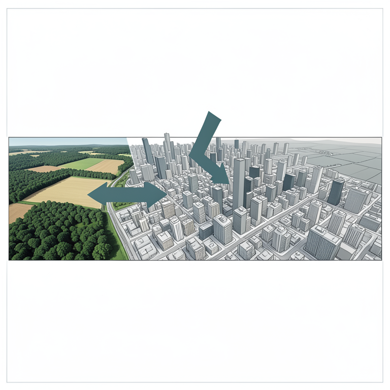
Drivers of Urban Expansion
AI-generated conceptual illustration (a developing city landscape with surrounding rural farmland and natural forests). It explains the idea and does not show study data.
View source evidence ↗Introduction
Population dynamics encompassing growth, density, migration, and demographic structure are fundamental drivers of land use change. In developing regions, rapid demographic transitions coincide with accelerated urbanization, producing new demands on housing, infrastructure, and livelihoods. Urban expansion, when poorly managed, can consume fertile agricultural land, increase disaster risks, and exacerbate social inequality. This research paper explores how population dynamics and urban expansion interact to shape sustainable land use outcomes in developing regions. Using secondary data and GIS-based spatial analysis, we identify patterns of growth, challenges, and opportunities for sustainable land use planning.
Objectives
1. Examine the demographic drivers of urban expansion in developing regions. 2. Assess the spatial patterns and consequences of urban sprawl using secondary data and GIS. 3. Analyze implications for sustainable land use in agriculture, ecology, and infrastructure. 4. Recommend strategies for integrating population and land use planning.
Literature Review
Research on urban expansion in developing regions highlights several recurring themes: Demographic Transition: Population growth rates, declining fertility, and rural-to-urban migration alter settlement systems (Cohen, 2004) [3] . Urban Sprawl: Expansion at low densities often encroaches on prime agricultural land (Angel et al., 2011) [2] . Peri-Urbanization: Hybrid zones between urban and rural areas exhibit mixed land uses and contested governance (Allen, 2003) [1] .
Land Use Change Detection: Remote sensing and GIS tools enable monitoring of land conversion dynamics (Seto et al., 2012) [4] . Sustainability Challenges: Urban expansion raises concerns of food security, biodiversity loss, and climate vulnerability (UN-Habitat, 2020) [5] .
The literature also emphasizes governance gaps: limited enforcement of land use plans, weak property rights, and fragmented institutional responsibilities. Sustainable models such as compact cities, transit-oriented development, and green infrastructure offer pathways for resilience.
Conceptual Framework
Conceptual Framework
Analytical Methods
GIS Analysis: Land use/land cover (LULC) classification from satellite imagery to map urban expansion. Change Detection: Multi-temporal analysis to quantify land converted from agriculture/forest to urban. Demographic Correlation: Linking population growth rates with urban expansion rates at city/regional levels. Policy Review: Content analysis of planning frameworks to identify gaps and opportunities.
Case Illustrations 6.1 South Asia (India)
Rapid urbanization driven by population pressure and rural-to-urban migration. Studies show large-scale conversion of agricultural land in peri-urban Delhi, Bengaluru, and Pune.
Sub-Saharan Africa
Cities such as Lagos and Nairobi demonstrate rapid, unplanned expansion with significant informal settlement growth, highlighting governance challenges.
Latin America
Urban expansion often associated with economic growth but also ecological degradation. São Paulo and Mexico City illustrate metropolitan sprawl into ecologically sensitive zones.
Results
Results
Population Dynamics
Developing regions continue to experience higher population growth rates than developed countries. Migration flows concentrate population in urban centers, straining infrastructure. Youth bulges create high housing and employment demands.
Urban Expansion Patterns
GIS analyses from various studies show outward sprawl into peri-urban belts. Agricultural land near cities is most vulnerable, with consequences for food security. Ecological systems such as wetlands and forests face encroachment.
Land Use Implications
Agricultural Loss: Decline in peri-urban farmland undermines local food supply. Environmental Degradation: Habitat fragmentation, heat island effects, and reduced ecosystem services. Social Inequality: Informal settlements grow where planning and infrastructure lag.
Discussion
Population dynamics and urban expansion intersect to create complex land use challenges in developing regions. Rapid growth magnifies governance weaknesses, with informal land markets, speculation, and inadequate enforcement leading to unsustainable land use. However, the relationship is not deterministic: proactive planning can mitigate negative impacts. Satellite imagery provides spatial trends but not detailed socio-economic dynamics. Future studies should integrate climate change scenarios, smart city technologies, and cross-regional comparisons.
Key
Key
Conclusion
Population dynamics and urban expansion exert profound influences on sustainable land use in developing regions. Without effective governance and planning, rapid growth risks irreversible loss of agricultural land, ecological services, and social equity. However, integrated approaches-linking demographic foresight, GIS-based monitoring, and participatory governance-offer pathways toward resilient and sustainable land systems.
References
5 in the original paper- Allen A. Environmental planning and management of the peri-urban interface: perspectives on an emerging field. Environ Urban. 2003;15(1):135-147.
- Angel S, Sheppard SC, Civco DL. The dynamics of global urban expansion. Washington (DC): World Bank; 2011. p. 186.
- Cohen B. Urban growth in developing countries: a review of current trends and a caution regarding existing forecasts. World Dev. 2004;32(1):23-51.
- Seto KC, Güneralp B, Hutyra LR. Global forecasts of urban expansion to 2030 and direct impacts on biodiversity and carbon pools. Proc Natl Acad Sci U S A. 2012;109(40):16083-16088.
- UN-Habitat. World cities report 2020: the value of sustainable urbanization. Nairobi: UN-Habitat; 2020. p. 196.