
Research article · 2024 · Full text
International Journal of Agriculture and NutritionAgro-climatic zonation and its impact on crop management practices in rainfed agriculture
Volume 6(2) · Pages 52–58 · DOI: 10.33545/26646064.2024.v6.i2a.246 ↗
Research areasCrop Yield and Soil FertilityRice Cultivation and Yield ImprovementAgronomic Practices and Intercropping Systems
Abstract
Author-writtenAgro-climatic zonation forms the basis for location-specific agricultural planning and is especially crucial in rainfed regions where crop performance is tightly linked to rainfall variability, temperature regimes, and soil characteristics. This paper investigates how agro-climatic classification systems influence crop management strategies in rainfed agriculture. Drawing from global and regional examples, it examines the zonation principles, their relevance to cropping patterns, input use efficiency, soil-water conservation, and resilience building in vulnerable agro-ecologies. The paper further discusses how integrating zonation with precision agriculture, crop modeling, and farmer knowledge can improve planning, productivity, and sustainability in rain-dependent systems.
Summary
Source-checkedPlain-language reading of the full paper, prepared with AI and checked against the text. Each point links to the authors' own words.
Why it matters
- Rainfed agriculture is a critical global resource, supporting more than 60% of the world's farming population. View evidence ↗
- Rainfed farming accounts for nearly 80% of cultivated land globally and provides approximately 58% of food staples. View evidence ↗
- There is a significant yield gap between rainfed and irrigated systems, with rainfed cereals often producing less than 1.5 tons per hectare compared to over 4 tons in irrigated areas. View evidence ↗
The question
- The paper aims to investigate how agro-climatic zonation can be used to improve crop management practices within rainfed agricultural systems. View evidence ↗
What they did
- The author analyzed the vulnerabilities of rainfed systems and evaluated the impact of zonation on farm and policy decisions using global case studies. View evidence ↗
- The study examined the integration of indigenous knowledge and technological tools into zonation frameworks. View evidence ↗
What they found
- In Ethiopia's Eastern Oromia region, using zonation to promote fast-maturing maize hybrids increased yields by 20-25% compared to traditional landraces. View evidence ↗
- In Niger, zonation-based micro-catchment techniques in areas with less than 400 mm rainfall restored over 200,000 hectares of land and increased millet yields by 30-40%. View evidence ↗
- In Malawi, aligning fertilizer recommendations with agro-ecological zones instead of national standards improved maize yield responses by 15-25%. View evidence ↗
- Zone-based targeting of lime applications on acidic soils in Ethiopia's highland regions increased wheat productivity by 45%. View evidence ↗
- In the Sahel region of West Africa, 40% of the annual yield variability in millet is attributed to dry spells lasting more than 10 days. View evidence ↗
What it means
- The author concludes that agro-climatic zonation is an essential framework for managing the challenges of rainfed agriculture. View evidence ↗
- The author recommends that zonation be integrated as a core instrument of policy rather than remaining just a technical tool. View evidence ↗
- The author notes that static zonation maps based on historical averages may become obsolete due to rapid environmental changes. View evidence ↗
Visual summary
1 visualsIllustrations explain the paper; they do not show study data.
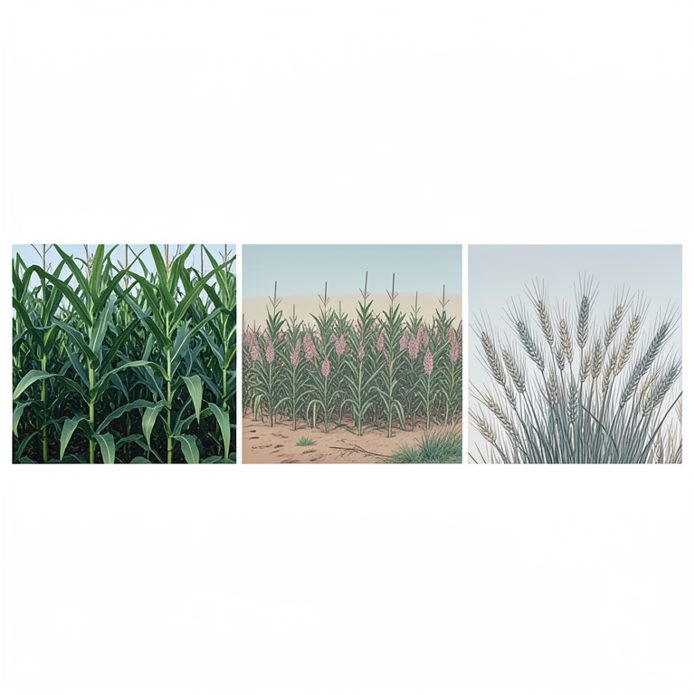
Concept of Agro-Climatic Zonation
AI-generated conceptual illustration (maize, sorghum, and barley plants in a diverse landscape). It explains the idea and does not show study data.
View source evidence ↗Introduction
Rainfed agriculture remains the principal source of food and livelihood for over 60% of the world's farming population (FAO, 2020). Unlike irrigated systems that benefit from controlled water availability, rainfed agriculture is entirely dependent on the timing, amount, and distribution of rainfall. This inherent reliance on climatic variability makes rainfed systems particularly vulnerable to droughts, floods, delayed monsoons, and other unpredictable weather phenomena. These vulnerabilities are projected to intensify under climate change scenarios, threatening food security and sustainable development goals in large parts of Africa, South Asia, and Latin America (IPCC, 2021) [12] . Globally, rainfed farming occupies nearly 80% of the world's cultivated area and produces about 58% of global food staples such as rice, wheat, maize, and pulses (Rockström et al., 2010) [18] . In Sub-Saharan Africa, nearly 95% of farmland is rainfed, while in South Asia, the figure stands at approximately 60%. Despite this dominance, productivity in rainfed systems remains significantly lower than in irrigated counterparts-often less than 1.5 tons per hectare for cereals compared to over 4 tons in irrigated areas (Wani et al., 2009) [25] . This yield disparity stems from several biophysical constraints, including soil degradation, water scarcity, poor infrastructure, and limited access to inputs and advisory services. One of the most critical strategies for addressing these challenges is the use of agro-climatic zonation-a scientific classification of geographical areas based on long-term patterns in temperature, rainfall, humidity, and soil characteristics. Agro-climatic zones (ACZs) form the ecological foundation upon which context-specific agricultural planning, policy-making, and technology deployment are structured. By defining zones with relatively homogenous climatic and soil conditions, planners can recommend the most suitable crops, varieties, planting schedules, input regimes, and risk mitigation strategies tailored to local realities. The relevance of zonation becomes even more pronounced in rainfed regions where variability in weather and terrain is high. For instance, the same maize variety may perform well in a semi-arid zone with 700 mm rainfall but fail in a nearby sub-humid zone due to differences in soil depth and thermal regime. Hence, generalized recommendations are often ineffective or even counterproductive. Agro-climatic zonation enables a shift from blanket approaches to precision agriculture-an essential transition in the age of climate uncertainty and resource stress.
Moreover, agro-climatic zonation is not a new concept. Early zonation models date back to the 1970s when the Food and Agriculture Organization (FAO) introduced Agro-Ecological Zones (AEZ) for land-use planning. These models have since evolved with the integration of remote sensing, geospatial analysis, and crop simulation technologies. Today, countries such as India, Kenya, Ethiopia, and Brazil use zonation frameworks to guide national agricultural research agendas, extension programming, and input subsidies. In India, for example, the National Agricultural Research System (NARS) has classified the country into 15 agro-climatic zones and 127 sub-zones, which form the basis for technology development under the All India Coordinated Research Projects (ICAR, 2020). However, despite these advancements, the full potential of zonation remains underutilized-especially in rainfed systems. Many regions still rely on static or outdated zonation maps that fail to capture the dynamic shifts in climate patterns or land use. Furthermore, the linkage between zonation data and field-level crop management decisions is often weak or fragmented. There is a need to modernize zonation frameworks by incorporating real-time climate monitoring, farmer knowledge, and scenario-based modeling. Such integration is critical for building resilient rainfed systems capable of withstanding climatic shocks while sustaining productivity and livelihoods. This paper aims to explore the multi-dimensional role of agro-climatic zonation in improving crop management practices in rainfed agriculture. It analyzes the physiological vulnerabilities of rainfed systems, evaluates how zonation shapes decisions at the farm and policy levels, and presents global case studies where zonation has led to transformative agricultural outcomes. The study also reflects on the importance of integrating technological tools and indigenous knowledge into zonation frameworks, and discusses policy imperatives for mainstreaming zonation into adaptive agricultural development.
Understanding Agro-Climatic Zonation
Agro-climatic zonation is a scientific classification method used to delineate geographic areas based on climatic parameters such as annual rainfall, temperature, length of growing period (LGP), and evapotranspiration. When these climatic factors are integrated with edaphic (soil-related) and physiographic characteristics, the resulting zones form the basis for crop planning, land evaluation, and agricultural resource management. In rainfed areas, where production is tightly bound to seasonal weather patterns, agro-climatic zonation serves as a critical tool for optimizing input use and minimizing risk. Historically, the concept of agro-climatic classification emerged from the need to link ecological conditions with agronomic recommendations. The Food and Agriculture Organization (FAO) was among the first to institutionalize agro-ecological zonation in the 1970s, defining zones based on moisture availability and growing periods. According to FAO (1984) [] , the length of the growing period is defined as the number of days in a year when temperature and moisture conditions allow crop growth. This metric is particularly relevant in rainfed regions, where a narrow and erratic window often determines crop success. India has made significant advancements in agro-climatic zoning. The Planning Commission's original classification divided the country into 15 agro-climatic zones based on rainfall, temperature, and soil type. This was later refined by the National Bureau of Soil Survey and Land Use Planning (NBSS&LUP) into 20 agro-ecological regions and 127 subregions, incorporating soil depth, terrain, and LGP. These zonations guide the deployment of centrally funded programs such as the Rashtriya Krishi Vikas Yojana (RKVY) and have informed cropping system research across the Indian Council of Agricultural Research (ICAR) network. In Sub-Saharan Africa, agro-climatic zonation has similarly guided strategic planning. Kenya's Ministry of Agriculture uses a framework of seven agro-ecological zones (AEZs), ranging from humid (Zone I) to very arid (Zone VII). Each zone is associated with a specific rainfall regime and crop portfolio. For instance, AEZ III (lower highlands) receives 950-1500 mm annual rainfall, suitable for maize, wheat, and beans, whereas AEZ VI (semi-arid) with <600 mm supports only drought-tolerant crops such as sorghum and cowpea. This classification is vital for advising farmers on seed varieties, planting times, and fertilizer use, especially under rainfed conditions where small deviations in weather can result in significant yield losses (Jaetzold & Schmidt, 2009) [13] . The zonation process also benefits from advancements in geospatial technology. Satellite imagery, GPS mapping, and GIS layers allow for more dynamic, high-resolution zoning than traditional surveys. For example, the Global Agro-Ecological Zones (GAEZ) model developed by FAO and IIASA integrates climatic and soil databases to generate zone-specific land productivity estimates under different input scenarios. This has been instrumental in projecting climate change impacts on rainfed crops in vulnerable regions. Despite its technical robustness, agro-climatic zonation is not a static tool. It must be periodically revised to reflect climate variability and land use change. As rainfall patterns shift due to global warming, zones may migrate or change in character, altering the suitability of crops and management practices. Longitudinal studies in East Africa have shown that shifts in rainfall onset and duration are already affecting the reliability of historical agro-ecological classifications, underscoring the need for adaptive, real-time updating mechanisms (Cooper et al., 2008) [6] .
Rainfed Agriculture and Its Vulnerabilities
Rainfed agriculture constitutes the backbone of rural livelihoods in many parts of the world, covering approximately 80% of global croplands and contributing to more than 60% of total food output (Rockström et al., 2010) [18] . Unlike irrigated systems that benefit from controlled water delivery, rainfed agriculture relies entirely on atmospheric precipitation. This reliance makes it inherently vulnerable to weather uncertainties, including erratic rainfall, prolonged dry spells, and early or delayed onset of the rainy season. These climatic irregularities directly impact sowing schedules, crop growth stages, and final yields. A critical feature of rainfed systems is their location. These are typically found in arid and semi-arid zones, or in undulating terrains where irrigation infrastructure is either technically unfeasible or economically unsustainable. In regions like Sub-Saharan Africa, South Asia, and parts of Latin America, rainfed farming not only dominates land use but also underpins food security and employment. Yet, productivity remains low-often less than 1.5 tons per hectare for staple cereals-due to biophysical constraints and management challenges (Wani et al., 2009) [25] . Soil degradation is a pervasive problem in rainfed areas. The absence of vegetative cover during dry periods, combined with intense rainfall during monsoon peaks, accelerates erosion. In India alone, nearly 120 million hectares of rainfed land suffer from varying degrees of soil erosion and nutrient depletion, reducing the effective rooting depth and limiting moisture retention capacity (Ministry of Agriculture & Farmers Welfare, 2022) [15] . These limitations exacerbate water stress even in years of average rainfall. The unpredictability of rainfall distribution poses one of the most pressing threats. Even when total seasonal rainfall is adequate, its uneven distribution can lead to crop failure. Dry spells during critical growth stages such as flowering or grain filling can cause irreversible yield loss. A study conducted in the Sahel region of West Africa demonstrated that 40% of annual yield variability in millet could be attributed to intra-seasonal dry spells lasting more than 10 days (Sultan et al., 2005) [21] . Such variability leaves farmers exposed to production shocks with limited mechanisms for recovery. Socioeconomic factors further intensify the vulnerability of rainfed farming. Farmers in these regions often operate with minimal access to credit, limited insurance coverage, and poorly developed extension services. Their ability to adopt improved varieties or soil and water conservation practices is constrained by both risk aversion and capital shortage. Moreover, in many rainfed regions, gender disparities in land ownership and input access further inhibit inclusive agricultural growth. Climate change compounds existing vulnerabilities. Rising temperatures shorten crop growing periods and increase evapotranspiration rates, exacerbating moisture deficits. In parts of southern Africa and the Deccan Plateau of India, the frequency of below-normal rainfall years has increased in the past two decades, with projections indicating a further 10-20% decline in growing season rainfall by 2050 (IPCC, 2021) [12] . These changes threaten to erode past gains in yield improvement and rural development unless proactive, zonation-based strategies are implemented. In light of these challenges, rainfed agriculture demands localized solutions that are adaptive to specific climatic, soil, and topographic realities. Agro-climatic zonation offers a practical pathway for building resilience by linking biophysical data with context-specific agronomic decisions. It enables targeted interventions such as drought-resilient crop promotion, optimized planting windows, and siteappropriate soil management-all of which are essential for stabilizing yields and improving livelihoods in water-scarce farming environments.
Impact of Zonation on Crop Management Practices
Agro-climatic zonation, when applied with precision and updated datasets, serves as a vital planning framework for tailoring crop management practices to diverse rainfed environments. It does not merely categorize land by weather parameters; rather, it links ecological potential with agronomic decision-making. In rainfed agriculture, where the margin for error is minimal due to climatic uncertainty and low resource input, zone-specific recommendations ensure that cropping strategies are better aligned with local agro-ecological realities. One of the most direct influences of zonation is on crop selection and cropping patterns. Rainfall and temperature regimes vary significantly across zones, and therefore, not all crops can be cultivated with equal success in all regions. In India, for example, pearl millet and cluster bean are prioritized in the hot arid zones of Rajasthan, whereas maize and groundnut are more suited to the sub-humid zones of central India. The National Agricultural Research System (NARS) uses zonation maps to recommend ideal crop sequences, such as cotton-chickpea in Maharashtra's semiarid tropics and maize-mustard in the sub-humid Indo-Gangetic belt (AICRPDA, 2020) [1] . Similarly, sowing time and cropping calendar are informed by the length of growing period (LGP), a key output of agro-climatic analysis. In rainfed zones of Kenya, for instance, farmers in AEZ III (lower highlands) receive advisories that encourage sowing of maize and beans in March to exploit early rains, whereas in AEZ V (semi-arid), staggered sowing is promoted to reduce risk from false rainfall onset (Jaetzold et al., 2009) [13] . Such calendars reduce crop failure due to dry spells or terminal drought and improve synchronization with pest and disease cycles. Another significant impact of zonation is observed in nutrient management strategies. Fertilizer use efficiency varies across zones due to differences in soil moisture, texture, and organic matter. In humid and sub-humid regions, high rainfall often results in nitrogen leaching; hence, split application of urea or use of slow-release formulations is recommended. Conversely, in arid zones, moisture stress limits nutrient uptake, prompting a focus on placement techniques like banding or fertigation to maximize efficiency (Roy et al., 2006) [20] . Zonation helps fine-tune these practices, ensuring that nutrient inputs match both crop needs and soil capacity. Soil and water conservation practices are also deeply influenced by agro-climatic classification. In sloped semiarid zones, in-situ water harvesting techniques like contour bunding, broad-bed furrow systems, and compartmental bunding are recommended to retain moisture and reduce erosion. In flatter humid zones, practices such as mulching, vegetative barriers, and organic matter incorporation are emphasized to enhance infiltration and reduce runoff. In Burkina Faso, for instance, the "Zai pit" method-a zonespecific water harvesting technique-has been credited with restoring productivity on degraded lateritic soils in AEZ IV and V (Reij et al., 2009) [17] . Moreover, pest and disease management strategies are increasingly being designed with zonation data. Temperature and humidity directly affect pathogen life cycles, and therefore, zone-based risk assessments help shape fungicide and pesticide scheduling. For example, the probability of leaf spot in groundnut is higher in coastal humid zones of Andhra Pradesh compared to interior dry zones, prompting differentiated protection measures. In Ethiopia's highland zones, late blight in potato is a major threat due to prolonged humidity, necessitating early warning systems that rely on zonal climate models (Tesfaye et al., 2015) [22] . Zonation also facilitates research targeting and extension outreach. Agricultural universities and regional research stations structure their varietal trials, agronomic packages, and training modules based on zonal delineations. The All India Coordinated Research Project for Dryland Agriculture (AICRPDA) operates 25 research stations, each representing a distinct agro-climatic zone, to ensure that technologies developed are locally validated before dissemination. Taken together, these applications of agro-climatic zonation illustrate its transformative role in customizing crop management strategies. It reduces the dependence on generalized advisories and enables interventions that are environmentally and economically sustainable. In the context of rainfed agriculture, this localized planning is not a luxury but a necessity
Case Examples
The practical application of agro-climatic zonation in guiding crop management practices has been well demonstrated across a variety of rainfed agricultural regions. These examples illustrate how zonation, when integrated with scientific research and localized extension efforts, can significantly improve productivity, reduce risk, and support sustainable land use.
India: Customization of Dryland Interventions through Zonation
In India, the Central Research Institute for Dryland Agriculture (CRIDA), in collaboration with the Indian Council of Agricultural Research (ICAR), has played a leading role in applying agro-climatic frameworks to strengthen rainfed farming systems. Under the All India Coordinated Research Project for Dryland Agriculture (AICRPDA), 25 centers were established in different agroclimatic zones to test and refine technologies suited to local conditions. A prominent success story comes from Anantapur district in Andhra Pradesh, one of the most drought-prone areas of the country, located in the scarce rainfall zone with less than 600 mm annual precipitation. Based on agro-climatic analysis, CRIDA recommended intercropping groundnut with pigeon pea, which extended the effective growing period and stabilized yields. Over a ten-year span, farmers adopting this practice reported 20-30% higher income stability and reduced crop failure rates (CRIDA, 2019) [7] . Similarly, in the semi-arid zones of Maharashtra, the promotion of the sorghum-chickpea rotation increased landuse efficiency and improved soil organic matter retention.
Kenya: Integrating Zonation with Climate Services
In Kenya, the Ministry of Agriculture has actively integrated agro-ecological zone (AEZ) maps with seasonal climate forecasts to issue location-specific agronomic advisories. These AEZs, ranging from humid to very arid, form the foundation for strategic crop recommendations. In AEZ II (upper highlands), which receives over 1500 mm of rainfall annually, farmers are encouraged to plant long-duration maize and Irish potato. In contrast, in AEZ IV (semi-arid lowlands), short-cycle sorghum and cowpea are promoted due to their resilience to dry spells. Notably, the Kenya Meteorological Department has worked with farmer groups in Makueni and Kitui counties to codesign cropping calendars based on probabilistic rainfall forecasts. Through this zonation-linked advisory model, adoption of early-maturing bean varieties like KAT X56 increased, leading to improved harvest reliability even in years with delayed rainfall onset (CIAT, 2015) [5] . Additionally, conservation agriculture practices such as tied ridging and mulching were introduced in AEZ V to address the dual challenges of runoff and soil erosion on sloped rainfed fields.
Ethiopia: Agro-Ecological Zonation for Targeted Crop Distribution
Ethiopia's Ministry of Agriculture, supported by development partners, has implemented a detailed agroecological zonation strategy to optimize land use and allocate government support for seed, fertilizer, and irrigation infrastructure. In the Central Highlands, characterized by moderate rainfall and cooler temperatures, zonation has guided the promotion of barley and faba bean, while maize and teff dominate in the mid-altitude sub-humid areas (Anand Kumar et al., 2023) [24] . One innovative program has been the Adaptation of African Agriculture Initiative, which integrates zonal climate modeling with farmer field trials. In the Eastern Oromia region, where AEZ classification revealed shortening of the growing season due to temperature rise, the promotion of fast-maturing maize hybrids (e.g., BH661) improved yield by 20-25% over traditional landraces (ATA, 2020). Additionally, fertilizer recommendations were recalibrated zone-wise to reflect local soil phosphorus levels and moisture regimes, improving nutrient uptake efficiency.
Niger and Burkina Faso: Rehabilitating Degraded Rainfed Zones
In the West African Sahel, agro-climatic zonation has informed watershed development and rainwater harvesting interventions. In Niger, the government and NGOs like CRESA used zonation maps to identify areas suitable for micro-catchment techniques such as demi-lunes and contour bunds. These interventions, applied in AEZs with less than 400 mm rainfall, restored over 200,000 hectares of degraded land, resulting in a 30-40% increase in millet yields (Reij et al., 2009) [17] . In Burkina Faso, traditional Zai pit systems, mapped and promoted based on localized AEZ data, allowed farmers to reclaim barren lands by concentrating runoff and organic inputs in fixed planting holes. Studies in the Central Plateau showed that fields using these pits had 120-150% higher crop productivity during below-average rainfall years compared to untreated control plots (Kaboré & Reij, 2004) [14] .
Integration with Technology and Indigenous Knowledge
Agro-climatic zonation has evolved significantly from static mapping techniques to dynamic, data-driven planning tools. The integration of advanced technologies-such as geospatial analysis, remote sensing, and crop simulation models-has enhanced the precision, timeliness, and scale at which zonation can inform agricultural decision-making. However, the utility of these tools reaches its fullest potential only when combined with the indigenous knowledge of farming communities who possess a nuanced, generational understanding of local ecological patterns. The convergence of scientific modeling and traditional wisdom forms a powerful framework for climate-resilient agriculture, especially in rainfed regions where uncertainty is high and institutional support is often limited. Geospatial technologies have transformed zonation into a real-time monitoring instrument. Remote sensing platforms, such as MODIS and Landsat, now provide high-resolution imagery for tracking vegetation health, rainfall variability, and evapotranspiration across vast terrains. These datasets, when layered with topographic and soil maps in GIS environments, allow for more granular agro-climatic classification. For example, the FAO's Global Agro-Ecological Zones (GAEZ) platform integrates satellitederived climate data with land suitability models to identify potential yield gaps and guide regional cropping strategies (FAO & IIASA, 2012) [9] . Similarly, in East Africa, the use of CHIRPS (Climate Hazards Group InfraRed Precipitation with Station Data) has enabled the generation of monthly rainfall anomaly maps that inform zonal forecasts and crop advisories. Crop simulation models further enrich zonation-based planning by projecting the performance of crops under different climate, soil, and management scenarios. Models like DSSAT (Decision Support System for Agrotechnology Transfer) and APSIM (Agricultural Production Systems sIMulator) are widely used to assess how shifting rainfall patterns or planting windows may affect yields in specific agro-climatic zones. For instance, a simulation study in the semi-arid zones of Zimbabwe using APSIM showed that maize yields could be stabilized by adjusting sowing dates by 10-15 days based on seasonal forecasts (Twomlow et al., 2006) [23] . Such insights support timely and location-specific interventions in rainfed agriculture. Despite these technological advances, formal models often fail to capture micro-variations in climate or terrain that significantly influence agricultural outcomes on smallholder farms. This is where indigenous knowledge becomes indispensable. Farmers often rely on local indicators-such as wind patterns, animal behavior, or flowering cycles of native trees-to predict rainfall onset or disease outbreaks. In West Africa, for example, communities in northern Ghana interpret the blooming of shea trees as a signal to begin land preparation for millet. These indicators, while informal, have been validated by ethnoclimatological studies as reliable predictors in low-data environments (Roncoli et al., 2002) [19] . Integrating indigenous forecasting with scientific tools fosters greater trust and adoption among farmers. In Kenya's Kitui and Makueni counties, agricultural extension officers have collaborated with local elders and women's groups to align seasonal forecasts with traditional phenological markers. This participatory approach, under the Participatory Scenario Planning (PSP) framework, has led to increased accuracy in advisories and greater uptake of drought-resistant crop varieties like cowpea and green gram (CARE Kenya, 2016) [4] . Moreover, it empowers communities to co-create knowledge systems rather than passively receive technical recommendations. The synergy between technology and traditional knowledge also extends to land management. In Burkina Faso, the expansion of contour bunds and stone lines was initially guided by satellite-based erosion maps, but their placement was refined based on farmer insights about water flow and soil behavior during heavy rains. Such hybrid planning approaches have been more successful in reversing land degradation compared to top-down interventions (Barbier et al., 2009) [3] . Importantly, integrating these knowledge systems requires institutional mechanisms that value both epistemologies. Agricultural extension must shift from a prescriptive to a dialogic model, where scientific insights are offered not as replacements but as complements to indigenous reasoning. Research institutions should invest in transdisciplinary approaches that include anthropologists, ecologists, and local farmers in the co-design of zonation models and crop advisories. In conclusion, while satellite imagery and simulation models enhance the scientific rigor of agro-climatic zonation, their practical effectiveness in rainfed systems is contingent upon grounding in local realities. By bridging modern technology with indigenous knowledge, planners can create more accurate, acceptable, and adaptive systems for managing agricultural risk and sustaining productivity under climate variability.
Policy Implications and Future Pathways
The operationalization of agro-climatic zonation into policy frameworks holds immense potential for transforming rainfed agriculture, especially in regions where farming remains highly vulnerable to climatic shocks. Despite the scientific maturity of zonation methods, their integration into national and sub-national policy has been uneven. In many developing countries, agricultural policies still adopt a blanket approach to input delivery, seed distribution, and extension messaging-disregarding the spatial heterogeneity that agro-climatic zonation seeks to address. Correcting this disconnect is essential for achieving inclusive and climateresilient agricultural development.
A key policy implication of zonation lies in the design of location-specific input packages. Blanket fertilizer subsidies, for instance, often lead to underuse or overuse depending on zone-specific soil and moisture conditions. A study conducted by IFDC in Malawi found that aligning fertilizer recommendations with agro-ecological zones, rather than national standards, improved maize yield responses by 15-25% in rainfed areas (IFDC, 2014). Similar evidence from Ethiopia showed that zone-based targeting of lime applications on acidic soils led to a 45% increase in wheat productivity in highland regions (ATA, 2020). Another important dimension is crop insurance and risk management. Agro-climatic zonation enables the development of actuarially sound weather-index insurance products. Instead of relying on uniform premiums and thresholds, insurers can use zone-specific rainfall thresholds to structure payouts. In India, the Pradhan Mantri Fasal Bima Yojana (PMFBY) has experimented with this model, defining separate risk units within agro-climatic zones for improved accuracy in loss assessment and quicker compensation (GoI, 2021). As climate variability intensifies, such spatial precision becomes critical for sustaining farmer trust and financial resilience. Extension services and agricultural advisories also benefit from zonation-based reform. Traditional systems often deploy one-size-fits-all messages across districts or provinces. However, mobile-based agro-advisory platforms such as Ethiopia's 8028 hotline or Kenya's M-Farm have begun to customize messages based on agro-ecological zones, improving relevance and uptake. In Uganda, the National Agricultural Advisory Services (NAADS) is piloting zonation-based training modules to train extension agents in zone-specific drought-tolerant cropping systems (NAADS, 2022) [16] . Zonation is equally relevant for resource allocation and investment planning. Governments and donors often struggle to prioritize infrastructure investments in irrigation, roads, or market access. Agro-climatic zonation can help identify zones with high potential for sustainable intensification versus those requiring conservation-oriented investments. In Niger, the World Bank's Climate-Smart Agriculture Investment Plan used zonation maps to prioritize 14 districts for watershed rehabilitation and agroforestry (World Bank, 2019) [26] . This not only optimized budget use but also ensured environmental congruence. Despite its utility, institutional barriers persist. Zonation data is often fragmented across meteorological departments, soil research institutions, and planning ministries. There is a pressing need for institutional coordination and data harmonization, possibly under a centralized Agro-Climatic Resource Information System. Moreover, local governments must be empowered through training and funding to interpret zonation maps and translate them into operational programs. Without decentralized ownership, zonation risks remaining a technocratic tool detached from field realities. Looking ahead, future pathways should focus on dynamic zonation systems that incorporate climate change projections. Static maps based on historical climate averages may soon become obsolete in regions facing rapid environmental transformation. Integrating zonation with real-time weather monitoring, seasonal forecasts, and landuse change models will make them more adaptive and future-ready.
Furthermore, participatory zonation approaches-where local stakeholders validate and cocreate zonal boundaries and practices-will enhance legitimacy and implementation.
Conclusion
Agro-climatic zonation emerges as an indispensable framework for addressing the multifaceted challenges of rainfed agriculture. In systems where water availability is determined solely by the vagaries of rainfall, and where productivity is highly sensitive to seasonal fluctuations, the value of tailoring crop management practices to agroclimatic realities cannot be overstated. This paper has demonstrated how zonation provides a scientific basis for region-specific decisions in crop selection, input optimization, soil and water conservation, and risk management. Its effectiveness lies in its ability to translate complex biophysical data into actionable insights for farmers, policymakers, and researchers alike. The integration of technology-particularly geospatial analysis, simulation modeling, and climate forecasting-has vastly improved the precision and applicability of zonation in real-time agricultural planning. Yet, these advances are most impactful when complemented by indigenous knowledge systems that reflect long-standing local experience. Together, they enable adaptive, inclusive, and context-responsive crop strategies that mitigate the risks inherent in rainfed systems. Case examples from India, Kenya, Ethiopia, and the Sahel illustrate that when zonation is embedded in policy design and extension systems, it can lead to measurable improvements in yield stability, resource use efficiency, and farmer resilience. However, for its full potential to be realized, zonation must be more than a technical tool-it must become a core instrument of policy. This entails institutional reforms that enable decentralized implementation, capacity building among local agencies, and dynamic updating to reflect ongoing climatic shifts.
As climate change accelerates and rainfed agriculture faces increasing uncertainty, agro-climatic zonation offers a pathway not just for adaptation, but for transformation. It allows agricultural systems to move from reactive responses to proactive planning, from generalized prescriptions to precision management. In doing so, it lays the foundation for a future where rainfed farming is not defined by its constraints, but by its capacity for innovation and sustainability.
References
11 in the original paper- NAADS. Zonal agricultural extension strategy. Kampala: National Agricultural Advisory Services Secretariat; 2022.
- Reij C, Tappan G, Smale M. Agroenvironmental transformation in the Sahel: Another kind of green revolution. IFPRI Discussion Paper 00914. Washington, D.C.: International Food Policy Research Institute; 2009.
- Rockström J, Barron J, Fox P. Water productivity in rain-fed agriculture: Challenges and opportunities for smallholder farmers in drought-prone tropical agroecosystems. Water Resources Research. 2010;43(11).
- Roncoli C, Ingram K, Kirshen P. Reading the rains: Local knowledge and rainfall forecasting in Burkina Faso. Society & Natural Resources. 2002;15(5):409427.
- Roy RN, Misra RV, Lesschen JP, Smaling EMA. Assessment of soil nutrient balance: Approaches and methodologies. FAO Fertilizer and Plant Nutrition Bulletin No. 14. Rome: Food and Agriculture Organization of the United Nations; 2006.
- Sultan B, Roudier P, Quirion P, et al. Assessing climate change impacts on sorghum and millet yields in the Sudanian and Sahelian zones of West Africa. Climatic Change. 2005;134(3):1-17.
- Tesfaye K, Kruseman G, Cairns JE, et al. Potential benefits of drought and disease-tolerant maize varieties in Ethiopia. Global Food Security. 2015;6:22-29.
- Twomlow S, Mugabe FT, Mwale M, et al. Building adaptive capacity to cope with increasing vulnerability due to climatic change in Africa. Agricultural Systems. 2006;83(3):285-301.
- Kumar A, DC Gupta. Assessment of LULC and their impact on land surface temperature, using geospatial techniques in Kolar River catchment area, Madhya Pradesh, India. Int J Geogr Geol Environ 2023;5(1):0814. DOI: 10.22271/27067483.2023.v5.i1a.130
- Wani SP, Rockström J, Oweis T. Rainfed agriculture: Unlocking the potential. Wallingford: CABI International; 2009.
- World Bank. Climate-smart agriculture investment plan for Niger. Washington, D.C.: World Bank; 2019.