
Research article · 2023 · Full text
International Journal of Horticulture and Food ScienceThe role of drones in monitoring and managing large-scale horticultural operations
Volume 5(2) · Pages 87–91 · DOI: 10.33545/26631067.2023.v5.i2b.211 ↗
Research areasPlant Surface Properties and Treatments
Abstract
Author-writtenDrones, or Unmanned Aerial Vehicles (UAVs), have emerged as a transformative technology in horticulture, offering innovative solutions for monitoring and managing large-scale operations. This review explores the current applications, benefits, challenges, and future prospects of drone technology in horticulture. By examining various studies and case examples, we aim to provide a comprehensive understanding of how drones are revolutionizing horticultural practices.
Summary
Source-checkedPlain-language reading of the full paper, prepared with AI and checked against the text. Each point links to the authors' own words.
Why it matters
- The horticultural industry is a major part of global agriculture, producing ornamental plants, flowers, vegetables, and fruits. View evidence ↗
- Conventional horticultural practices are often hindered by environmental issues, high costs for inputs, and a lack of available labor. View evidence ↗
- The integration of drones into agriculture is projected to add more than $75 billion to the global economy by the year 2025. View evidence ↗
The question
- The study aims to investigate the challenges, benefits, and specific applications of using drones to manage and monitor large-scale horticultural operations. View evidence ↗
What they did
- This is a review paper that analyzes various case examples and existing studies to understand the impact of drone technology on horticulture. View evidence ↗
What they found
- Research indicates that using drones for precision agriculture can lower input costs by 15% and boost productivity by as much as 20%. View evidence ↗
- Drones using multispectral cameras can assess plant health via the Normalized Difference Vegetation Index (NDVI), which measures the ratio of reflected near-infrared light to red light. View evidence ↗
- Hyperspectral imaging allows for the detection of specific pigments that indicate disease infections or nutrient deficiencies. View evidence ↗
- Thermal cameras can identify water stress by detecting rises in leaf temperature, allowing for timely irrigation adjustments. View evidence ↗
- Drone-based monitoring has been shown to increase water use efficiency and significantly reduce the waste of water in irrigation management. View evidence ↗
- Drone-based crop yield estimation is as accurate as traditional methods but is more efficient and costs less. View evidence ↗
- Drones integrated into pest management systems can improve overall crop health and reduce the amount of chemicals used. View evidence ↗
What it means
- The authors conclude that drones can revolutionize large-scale horticulture by offering sustainable, efficient, and precise management and monitoring solutions. View evidence ↗
- The adoption of drone technology is currently limited by technical constraints, regulatory hurdles, and high initial investment costs. View evidence ↗
Visual summary
1 visualsIllustrations explain the paper; they do not show study data.
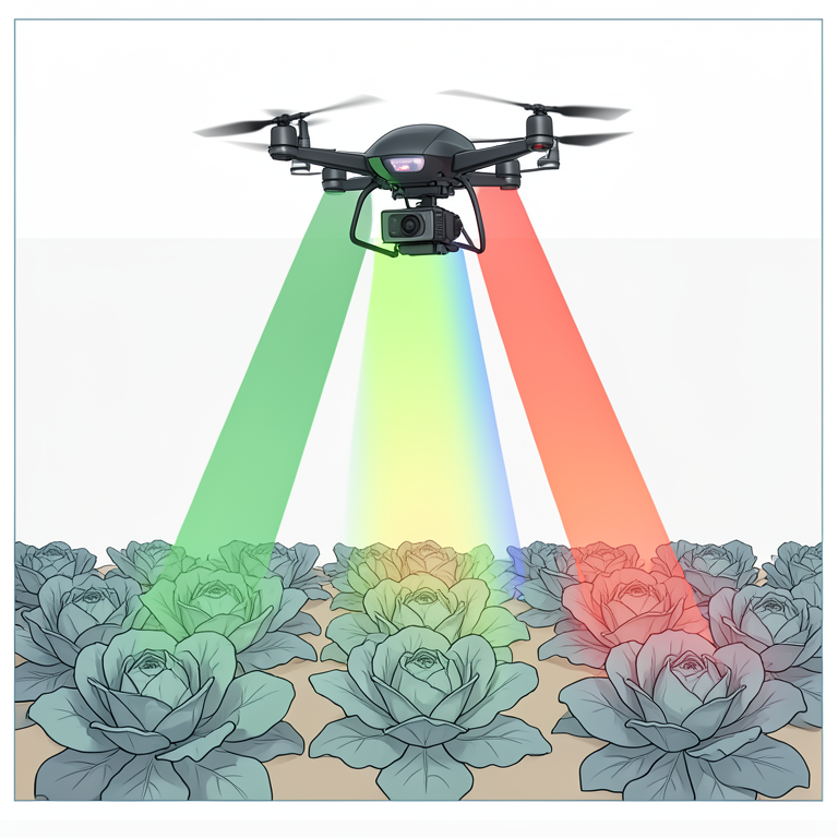
Drone Sensor Types in Horticulture
AI-generated conceptual illustration (multirotor drone and a field of lettuce plants). It explains the idea and does not show study data.
View source evidence ↗Introduction
The horticultural industry is a significant component of global agriculture, contributing to the production of fruits, vegetables, flowers, and ornamental plants. As the demand for highquality horticultural products continues to rise, so does the need for efficient and sustainable farming practices. Traditional horticultural methods, while effective, often face challenges such as labor shortages, high input costs, and environmental concerns. To address these challenges, innovative technologies such as drones, or Unmanned Aerial Vehicles (UAVs), have been increasingly adopted in horticultural operations. Drones have revolutionized various sectors, including agriculture, by providing real-time data and enabling precision management practices. According to a report by the Association for Unmanned Vehicle Systems International (AUVSI), the integration of drones in agriculture is expected to contribute over $75 billion to the global economy by 2025. This rapid growth is driven by the drones' ability to perform tasks that are time-consuming, labour-intensive, and often challenging for humans, such as monitoring large fields, assessing crop health, and managing resources efficiently. One of the key applications of drones in horticulture is crop monitoring and health assessment. Equipped with advanced imaging sensors, drones can capture highresolution images and multispectral data, allowing for detailed analysis of plant health. These images can detect early signs of disease, nutrient deficiencies, and water stress, enabling timely interventions that can save crops and improve yields. A study by Sankaran et al. (2015) [1] . Demonstrated the effectiveness of drone-based imaging in detecting early stress symptoms in crops, which can be crucial for preventing large-scale losses. Precision agriculture, another significant application of drones, involves the use of detailed, sitespecific information to manage agricultural inputs more efficiently. Drones facilitate precision agriculture by creating detailed maps of soil properties, crop vigor, and moisture levels. This information allows farmers to apply fertilizers, water, and pesticides precisely where needed, reducing waste and improving crop performance. According to Zhang and Kovacs (2012) [2] , the use of drones in precision agriculture can increase productivity by up to 20%, while reducing input costs by 15%. Irrigation management is also enhanced by drone technology. Traditional irrigation methods can lead to over-or under-watering, both of which negatively impact crop health and yield. Drones equipped with thermal cameras can monitor soil moisture levels across large fields, identifying areas that require more or less water. This capability helps in optimizing irrigation schedules and ensuring uniform water distribution. A study by Evett et al. (2002) [3] highlighted the potential of UAVs in improving irrigation management, reducing water usage, and increasing water use efficiency.
In addition to these applications, drones play a crucial role in crop yield estimation and pest and disease management. Accurate yield estimation is vital for planning harvests, managing logistics, and forecasting market supply. Drones use advanced imaging techniques to estimate crop yields by analyzing plant height, canopy cover, and biomass. Rembold et al. (2013) [4] found that drone-based yield estimation is not only accurate but also cost-effective, providing valuable data for decision-making. Pest and disease management in horticulture can be challenging, especially in large-scale operations. Drones can monitor pest populations and disease spread in real-time, allowing for targeted interventions. This approach reduces the need for blanket pesticide applications, minimizing environmental impact and promoting sustainable practices. Huang et al. (2018) [5] . Demonstrated the utility of drones in integrated pest management (IPM) systems, highlighting their role in reducing chemical usage and improving crop health. Despite the numerous benefits, the adoption of drone technology in horticulture faces several challenges. Regulatory issues, technical limitations, and the initial cost of investment can be significant barriers. However, as technology advances and becomes more affordable, these challenges are likely to diminish, paving the way for broader adoption.
Objective of study
The objective of this study is to explore the applications, benefits, and challenges of using drones for monitoring and managing large-scale horticultural operations.
Applications of Drones in Horticulture Crop Monitoring and Health Assessment
Drones equipped with multispectral, hyperspectral, and thermal cameras have revolutionized crop monitoring and health assessment in horticulture. These advanced imaging technologies allow drones to capture high-resolution images that provide detailed information about the condition of crops. Multispectral cameras can detect various wavelengths of light reflected by plants, which helps in identifying different aspects of plant health. For instance, healthy plants typically reflect more near-infrared light and less red light, a relationship that is quantified in vegetation indices such as the Normalized Difference Vegetation Index (NDVI). By analyzing NDVI values, drones can assess the vigor and overall health of crops. Hyperspectral cameras go a step further by capturing a broader spectrum of light, often divided into hundreds of narrow bands. This level of detail can reveal subtle differences in plant health that might not be visible to the naked eye or even with multispectral imaging. Hyperspectral imaging can identify specific stress indicators, such as the presence of certain pigments that correlate with nutrient deficiencies or disease infections. A study by Sankaran et al. (2015) [1] . Demonstrated the effectiveness of drone-based hyperspectral imaging in detecting early signs of stress and disease in crops, which is crucial for timely interventions that can save entire fields from damage. Thermal cameras provide another layer of information by detecting temperature variations in the crop canopy. Plants under stress, whether due to disease, water deficiency, or nutrient imbalances, often exhibit changes in leaf temperature. Thermal imaging can thus help identify these stress areas, enabling farmers to take corrective actions before the problems become severe. For example, a rise in leaf temperature can indicate water stress, prompting adjustments in irrigation schedules. The integration of these imaging technologies into drones allows for comprehensive monitoring of large agricultural fields in a fraction of the time it would take using traditional methods. Farmers can receive real-time data on crop health, enabling them to make informed decisions quickly. This capability is particularly valuable in large-scale operations where manual scouting is impractical and time-consuming. The use of drones for crop monitoring not only enhances the efficiency of health assessments but also improves the accuracy of detecting issues such as nutrient deficiencies, pest infestations, and diseases. Moreover, the data collected by drones can be integrated into Geographic Information Systems (GIS) to create detailed maps of crop health. These maps can help in precision agriculture practices by pinpointing specific areas that require attention, thereby optimizing the use of inputs such as fertilizers and pesticides. This targeted approach reduces waste and minimizes the environmental impact of farming.
In conclusion, drones equipped with multispectral, hyperspectral, and thermal cameras provide an advanced and efficient means of crop monitoring and health assessment. The detailed images and real-time data they offer enable early detection of stress factors, enhancing the ability to maintain healthy crops and optimize yields. As the technology continues to evolve, the role of drones in horticulture is likely to expand, offering even more precise and comprehensive solutions for crop health management.
Precision Agriculture
Precision agriculture represents a transformative approach in modern farming, utilizing advanced technologies to optimize crop production and resource use. Drones play a pivotal role in this domain by providing high-resolution data that enables detailed mapping of soil properties, crop vigor, and moisture levels. This granular data allows farmers to implement site-specific management practices, which are crucial for enhancing efficiency and sustainability in agriculture. Drones equipped with sophisticated sensors can fly over fields and collect data on various parameters essential for precision farming. For example, multispectral and hyperspectral imaging can assess plant health and vigor by analyzing the light reflected from plant surfaces. These images can be processed to produce vegetation indices such as the NDVI, which provide insights into the photosynthetic activity and overall health of the crops. By mapping these indices across a field, farmers can identify areas of high and low crop vigor, guiding them in making targeted interventions. One of the significant advantages of drone technology in precision agriculture is the ability to create detailed soil maps. These maps can highlight variations in soil properties such as pH, nutrient levels, and texture. Understanding these variations is critical for applying the right type and amount of fertilizers, ensuring that plants receive the nutrients they need while minimizing waste and environmental impact. A study by Zhang and Kovacs (2012) [2] . Demonstrated that drone technology significantly enhances the precision and efficiency of agricultural practices by providing accurate and timely data. Water management is another area where drones excel in precision agriculture. Drones equipped with thermal cameras can monitor soil moisture levels and detect areas of over-or under-watering. This capability is particularly beneficial in optimizing irrigation schedules and ensuring uniform water distribution across fields. Efficient water use is essential for sustainable agriculture, especially in regions facing water scarcity. Drones help farmers conserve water by pinpointing exactly where irrigation adjustments are needed. Pest and disease management also benefits from the precision offered by drone technology. Drones can identify the early onset of pest infestations and disease outbreaks through high-resolution imaging. This early detection allows for targeted treatments, reducing the need for broadspectrum pesticides and minimizing the impact on nontarget organisms and the environment. The targeted application of pesticides not only improves crop health but also reduces input costs. Furthermore, drones facilitate crop scouting, a critical component of precision agriculture. Traditional crop scouting methods are labour-intensive and time-consuming. In contrast, drones can cover large areas quickly and provide real-time data, allowing farmers to monitor crop conditions regularly and make informed decisions. This real-time monitoring is invaluable for responding to dynamic field conditions and implementing timely interventions. The integration of drone data with other technologies such as GIS and machine learning further enhances the capabilities of precision agriculture. GIS helps in creating detailed field maps and managing spatial data, while machine learning algorithms can analyze patterns and predict outcomes based on historical and real-time data. This integration allows for more accurate forecasting and better decision-making, ultimately leading to higher yields and more sustainable farming practices. In summary, drones are a cornerstone of precision agriculture, providing detailed and accurate data that enable site-specific management practices. By optimizing the use of inputs such as water, fertilizers, and pesticides, drones help improve crop yields, reduce costs, and minimize environmental impact. The continued advancement of drone technology and its integration with other digital tools promise to further revolutionize precision agriculture, making it more efficient and sustainable.
Irrigation Management
Effective irrigation management is crucial for ensuring optimal crop growth and maximizing agricultural yields. Drones equipped with advanced imaging technologies, particularly thermal cameras, have become invaluable tools in this aspect of horticulture. These drones can monitor irrigation systems and identify areas of over-or underwatering, providing critical data that helps farmers adjust irrigation schedules and ensure uniform water distribution across their fields. Thermal imaging from drones works by detecting variations in soil and plant canopy temperatures. Areas that are wellwatered typically have lower temperatures due to the cooling effect of evapotranspiration, whereas dry areas exhibit higher temperatures. By capturing these thermal images, drones can create detailed moisture maps that highlight variations across a field. This capability allows farmers to pinpoint specific areas that require more or less water, optimizing irrigation practices. The potential of drones in improving irrigation management is significant. Traditional irrigation methods often involve fixed schedules and uniform water application, which can lead to inefficiencies such as water wastage and uneven crop growth. Drones provide a dynamic approach by offering real-time data that reflects the actual water needs of different field areas. This information enables farmers to implement precision irrigation, where water is applied based on the specific requirements of each zone. A study by Evett et al. (2002) [3] highlighted the benefits of UAVs in irrigation management, demonstrating that dronebased monitoring could significantly reduce water waste and increase water use efficiency. By ensuring that crops receive the right amount of water, drones help in maintaining optimal soil moisture levels, which is critical for plant health and productivity. Proper irrigation management also minimizes the risk of waterlogging, which can lead to root diseases and negatively impact crop yields. In addition to optimizing water use, drones can monitor the performance of irrigation infrastructure. For instance, drones can inspect irrigation canals, pipelines, and sprinkler systems for leaks or blockages that might compromise water delivery. Detecting and addressing these issues promptly ensures that the irrigation system operates efficiently and reduces the risk of water loss. Drones also play a role in evaluating the impact of irrigation practices on crop health. By combining thermal imaging with multispectral or hyperspectral sensors, drones can assess the overall health and vigor of crops. This integrated approach provides a comprehensive view of how well crops are responding to irrigation practices. For example, if certain areas of a field show signs of water stress despite adequate irrigation, farmers can investigate and address underlying issues such as soil compaction or nutrient deficiencies. Furthermore, drones can facilitate the adoption of advanced irrigation techniques such as drip irrigation and fertigation. These methods require precise water and nutrient delivery to be effective. Drones provide the necessary data to fine-tune these systems, ensuring that water and fertilizers are applied accurately and efficiently. This precision reduces resource wastage and enhances crop growth and yield. The environmental benefits of drone-assisted irrigation management are also noteworthy. Efficient water use helps conserve a vital resource, especially in regions facing water scarcity. By reducing water waste and optimizing irrigation practices, drones contribute to more sustainable agricultural practices that minimize the environmental footprint of farming activities. In conclusion, drones equipped with thermal imaging and other advanced sensors offer significant advantages for irrigation management in horticulture. They provide realtime data that helps farmers optimize water use, ensure uniform water distribution, and maintain crop health. The integration of drone technology into irrigation practices enhances efficiency, conserves water, and supports sustainable agriculture. As drone technology continues to evolve, its role in irrigation management is expected to expand, offering even more precise and effective solutions for water management in horticulture.
Crop Yield Estimation
Accurate crop yield estimation is essential for effective planning, logistics management, and market forecasting in horticulture. Traditional methods of yield estimation, which often rely on manual sampling and visual assessments, can be labour-intensive, time-consuming, and prone to error. Drones, equipped with advanced imaging techniques, offer a more efficient and accurate alternative for estimating crop yields by analyzing parameters such as plant height, canopy cover, and biomass. The use of drones for crop yield estimation not only enhances accuracy but also provides timely data, enabling better decision-making and optimizing the entire supply chain. Drones equipped with high-resolution cameras and multispectral sensors can capture detailed aerial images of crop fields. These images provide a comprehensive view of the crop canopy, allowing for the analysis of various parameters that are indicative of crop yield. For instance, plant height and canopy cover are closely related to biomass and yield potential. By measuring these parameters across the entire field, drones can generate accurate yield estimates that reflect the overall performance of the crop. One of the significant advantages of using drones for crop yield estimation is the ability to cover large areas quickly and efficiently. Traditional yield estimation methods typically involve manual sampling, where small sections of the field are harvested and analyzed to extrapolate the total yield. This approach can be time-consuming and labourintensive, particularly in large fields. In contrast, drones can survey extensive areas in a fraction of the time, providing comprehensive data that is representative of the entire field. This efficiency not only saves labor costs but also allows for more frequent monitoring, providing up-to-date information on crop performance. Rembold et al. (2013) [4] . Conducted a study that highlighted the accuracy and cost-effectiveness of drone-based yield estimation. Their research demonstrated that drones could provide yield estimates with a high degree of accuracy, comparable to traditional methods, but at a lower cost and with greater efficiency. The ability to obtain precise yield estimates helps farmers plan harvests more effectively, ensuring that they have the necessary resources, such as labor and equipment, in place at the right time. This planning is crucial for optimizing the logistics of harvesting, transporting, and storing the crop, ultimately reducing waste and maximizing profitability. In addition to measuring plant height and canopy cover, drones can also assess other factors that influence yield, such as crop health and stress levels. Multispectral and hyperspectral imaging allow drones to detect variations in plant health that may affect yield. For example, areas of the field showing signs of disease, pest infestation, or nutrient deficiencies can be identified and targeted for intervention. By addressing these issues promptly, farmers can mitigate their impact on yield and ensure that the crop reaches its full potential. Furthermore, the data collected by drones can be integrated with other precision agriculture technologies to enhance yield estimation. For instance, combining drone imagery with ground-based sensors and weather data can provide a more comprehensive understanding of the factors affecting crop growth and yield. This integrated approach allows for more accurate yield predictions and better risk management, helping farmers make informed decisions about planting, irrigation, fertilization, and pest control. The ability to estimate yields accurately also has significant implications for market forecasting and supply chain management. Accurate yield estimates enable farmers and agribusinesses to forecast production levels more reliably, helping to balance supply and demand in the market. This forecasting is particularly important for crops with volatile prices, as it helps stabilize market conditions and reduce price fluctuations. Additionally, accurate yield estimates facilitate better coordination with buyers, processors, and distributors, ensuring that the supply chain operates smoothly and efficiently. In conclusion, drones equipped with advanced imaging techniques provide a powerful tool for crop yield estimation, offering significant advantages over traditional methods. The ability to capture detailed aerial images and analyze parameters such as plant height, canopy cover, and biomass enhances the accuracy and efficiency of yield estimates. This capability not only helps farmers plan and optimize their operations but also supports better market forecasting and supply chain management. As drone technology continues to advance, its role in crop yield estimation is likely to expand, providing even greater benefits for the horticultural industry.
Pest and Disease Management
Pest and disease management is a critical aspect of horticulture, directly impacting crop health, yield, and quality. Traditional methods of pest and disease monitoring often involve manual inspections and the use of fixed sensors, which can be labour-intensive, time-consuming, and limited in coverage. Drones equipped with advanced imaging sensors offer a more efficient and comprehensive approach, enabling real-time monitoring and targeted interventions that reduce the need for blanket pesticide applications and minimize environmental impact. Drones can be equipped with multispectral, hyperspectral, and thermal cameras to detect signs of pest infestations and disease outbreaks early. Multispectral and hyperspectral imaging can identify changes in plant reflectance that indicate stress caused by pests or diseases. For example, infected plants may exhibit changes in chlorophyll content, which can be detected by analyzing specific wavelengths of light. Thermal imaging can also be useful, as infected or stressed plants may have different temperature profiles compared to healthy plants. These early detection capabilities allow farmers to intervene promptly, preventing the spread of pests and diseases and reducing crop losses. Huang et al. (2018) [5] . Demonstrated the utility of drones in integrated pest management (IPM) systems. Their study highlighted how drones could monitor pest populations and disease spread across large fields, providing detailed and accurate data that informs targeted interventions. By focusing on specific areas that are affected, farmers can apply pesticides or other treatments more precisely, reducing the overall use of chemicals and minimizing the impact on beneficial insects and the environment. This targeted approach not only enhances the effectiveness of pest and disease management but also promotes sustainable agricultural practices. The real-time data provided by drones is particularly valuable for managing pests and diseases that spread rapidly. Traditional monitoring methods may not provide timely information, leading to delays in intervention and greater crop damage. Drones, on the other hand, can cover large areas quickly and provide immediate feedback on the condition of the crop. This rapid response capability is crucial for controlling fast-spreading pests and diseases, ensuring that interventions are implemented before significant damage occurs. In addition to detecting pests and diseases, drones can also assess the effectiveness of treatments. After applying pesticides or other control measures, drones can monitor the treated areas to determine if the interventions are working. This capability allows farmers to adjust their management strategies based on real-time feedback, optimizing the use of chemicals and other resources. By continuously monitoring the crop, drones help ensure that pest and disease control measures are effective and that the crop remains healthy throughout the growing season. Furthermore, the use of drones in pest and disease management reduces the need for manual labor, which can be costly and time-consuming. Manual inspections require workers to physically traverse the field, which can be challenging, especially in large or densely planted areas. Drones can perform these inspections more efficiently, covering extensive areas in a short period and providing detailed data that would be difficult to obtain manually. This efficiency not only saves labor costs but also allows for more frequent monitoring, enhancing the overall effectiveness of pest and disease management. The integration of drone data with other precision agriculture technologies can further enhance pest and disease management. For instance, combining drone imagery with weather data and predictive modeling can help forecast pest outbreaks and disease spread, allowing for proactive management strategies. This integration enables a more holistic approach to crop protection, addressing potential issues before they become severe and ensuring that the crop remains healthy and productive. In conclusion, drones equipped with advanced imaging sensors play a crucial role in pest and disease management in horticulture. Their ability to detect early signs of infestations and infections, monitor the effectiveness of treatments, and provide real-time data significantly enhances the efficiency and precision of crop protection measures. By enabling targeted interventions and reducing the need for blanket pesticide applications, drones contribute to more sustainable and environmentally friendly agricultural practices. As drone technology continues to evolve, its role in pest and disease management is likely to expand, offering even greater benefits for the horticultural industry.
Conclusion
Drones have the potential to revolutionize large-scale horticultural operations by providing precise, efficient, and sustainable solutions for crop monitoring and management. While challenges remain, ongoing technological advancements and collaborative efforts will likely drive the widespread adoption of drones in horticulture. This review underscores the importance of continued research and innovation to harness the full potential of drone technology in enhancing horticultural productivity and sustainability.
References
7 in the original paper- Sankaran S, Khot LR, Espinoza CZ, et al. Advances in unmanned aerial vehicles integrated with hyperspectral and multispectral imaging sensors for precision agriculture. IEEE Geo sci. Remote Sens. Mag. 2015;3(3):47-54.
- Zhang C, Kovacs JM. The application of small unmanned aerial systems for precision agriculture: A review. Precis Agric. 2012;13(6):693-712.
- Evett SR, Howell TA, Schneider AD, Tolk JA. Soil moisture sensing for water balance, ET and WUE. Agric Water Manag. 2002;57(3):211-231.
- Rembold F, Atzberger C, Savin I, Rojas O. The use of remote sensing in crop yield gap analysis. Field Crops Res. 2013;143:119-132.
- Huang Y, Lan Y, Thomson SJ, Fang A, Hoffmann WC, Lacey RE, et al. Applications of unmanned aerial vehicle-based sensors in agriculture: a review. Remote Sens. 2018;10(9):1348.
- Association for Unmanned Vehicle Systems International (AUVSI). The Economic Impact of Unmanned Aircraft Systems Integration in the United States; c2013. Available from: https://www.auvsi.org/our-impact/economic-report. Accessed July 8, 2024.
- American Farm Bureau Federation. Drones in Agriculture: Opportunities and Challenges; c2018. Available from: https://www.fb.org/marketintel/drones-in-agriculture-opportunities-andchallenges. Accessed July 8, 2024.
Cited by 1
From OpenAlex, OpenCitations and reference lists read by Scinovex
- Emerging trends in precision horticulture integrating digital technologies for smart crop management
NK Meena, Ashish Kumar, V S Yadav, S. Panigrahi, Thusharreddy Jaganathan, Gargi Shekhar · International Journal of Advanced Biochemistry Research · 2025
Precision horticulture constitutes a new paradigm of crop production, which utilizes digital, geospatial, and automation technologies to manage spatial and temporal variability in fruits, vegetables, and ornamentals. In this regard, this review focused on the development, features, and exploitation of digital tools, which are differentiating existing and emerging smart horticultural systems. Among these, a number of key enabling technologies exist including IoT, remote sensing, drones, Artificial Intelligence (AI), Machine Learning (ML), and robotics which facilitate technology convergence to