
Research article · 2022 · Full text
International Journal of Agriculture Extension and Social DevelopmentSoil erosion estimation using remote sensing techniques in theshirvan plain of the republic of Azerbaijan
Volume 5(2) · Pages 37–44 · DOI: 10.33545/26180723.2022.v5.i2a.149 ↗
Research areasSoil and Environmental StudiesSoil erosion and sediment transportMarine and environmental studies
Abstract
Author-writtenSoil erosion is one of the major environmental problems in terms of soil degradation in the Shirvan plain of the Republic of Azerbaijan. Soil erosion leads to significant on- and off-site impacts such as significant decrease in the productive capacity of the land and sedimentation. The key aspects influencing the quantity of soil erosion mainly rely on the vegetation cover, topography, soil type, and climate. This research studies the quantification of soil erosion under different levels of data availability in the Shirvan plain. Remote Sensing (RS) and Geographic Information Systems (GIS) techniques have been implemented for the assessment of the data, applying the Revised Universal Soil Loss Equation (RUSLE) for the calculation of the risk of erosion. Thirty soil samples were randomly selected for the calculation of the erodibility factor, based on calculating the ð¾-factor values derived from soil property surfaces after interpolating soil sampling points. Soil erosion risk map was reclassified into five erosion risk classes and 25.3% of the Shirvan plain is under severe risk (190,740 ha). GIS and RS proved to be powerful instruments for mapping soil erosion risk, providing sufficient tools for the analytical part of this research. The mapping results certified the role of RUSLE as a decision support tool.
Summary
Source-checkedPlain-language reading of the full paper, prepared with AI and checked against the text. Each point links to the authors' own words.
Why it matters
- Soil erosion is a primary environmental issue causing soil degradation in the Shirvan plain of Azerbaijan. View evidence ↗
- The impacts of soil erosion include sedimentation and a significant reduction in the land's productive capacity. View evidence ↗
- Globally, agricultural systems lose approximately 75 billion tons of fertile topsoil annually. View evidence ↗
The question
- The study aims to quantify soil erosion in the Shirvan plain, Azerbaijan's main agricultural zone, by examining the soil erodibility K-factor using the Revised Universal Soil Loss Equation (RUSLE) model. View evidence ↗
What they did
- The researchers used 30 m resolution Digital Elevation Model (DEM) data and 2019 Landsat 8 Operational Land Imager (OLI) scenes. View evidence ↗
- Thirty topsoil samples were collected using a stratified random sampling method based on geologic formations. View evidence ↗
- The study calculated C, R, P, and LS factors, estimated the K-factor via the USDA nomograph, and compared three interpolation methods (RBF, IDW, and OK) for accuracy. View evidence ↗
What they found
- The K-factor estimation showed an acceptable level of accuracy, with a standard error of 0.005 t ha hr/ha MJ mm between point and surface values. View evidence ↗
- The final erosion risk map, created using RBF interpolation for K-factor values, achieved an R² of 0.89. View evidence ↗
- After reclassifying the risk map into five classes, it was found that 25.3% of the Shirvan plain (190,740 ha) is under severe erosion risk. View evidence ↗
- The analysis indicated that 26.5% of the total area is under slight risk, while 19.3% is under severe risk. View evidence ↗
What it means
- The authors conclude that GIS and Remote Sensing are essential tools for implementing the RUSLE model to assess spatial soil erosion risk. View evidence ↗
- The authors note that a denser grid of sampling sites would improve the K-layer interpolation, though it would increase costs and time. View evidence ↗
Visual summary
1 visualsIllustrations explain the paper; they do not show study data.
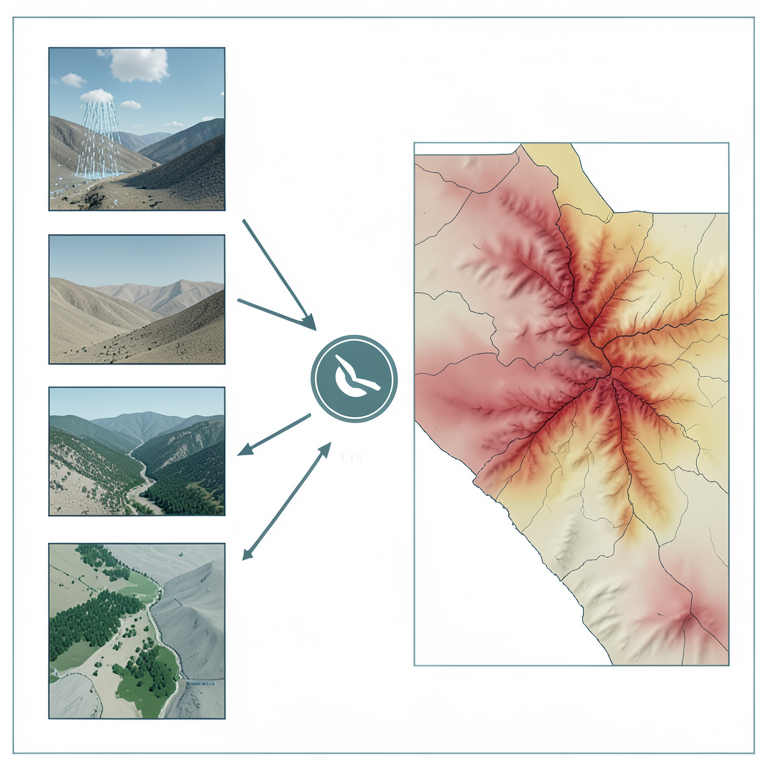
RUSLE Factor Integration
AI-generated conceptual illustration (The Shirvan plain landscape of Azerbaijan). It explains the idea and does not show study data.
View source evidence ↗Figures & tables
From the original paper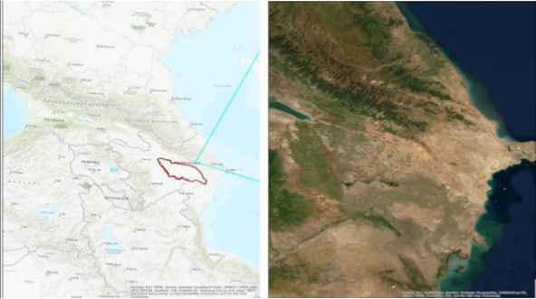 Figure 1
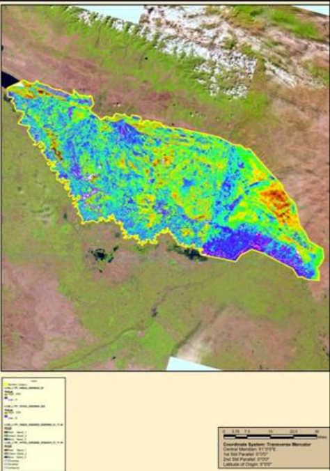 Figure 2
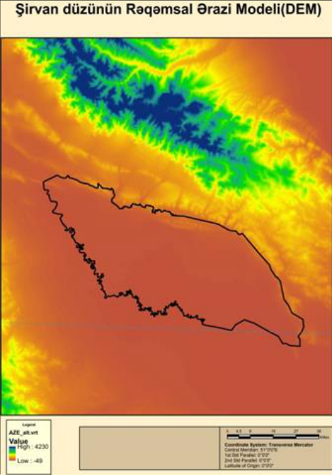 Figure 3
 Table 1
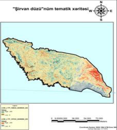 Figure 4
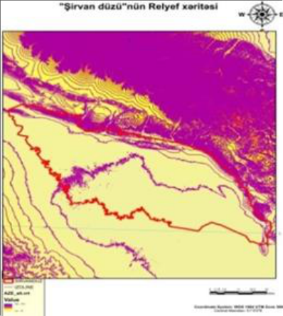 Figure 5
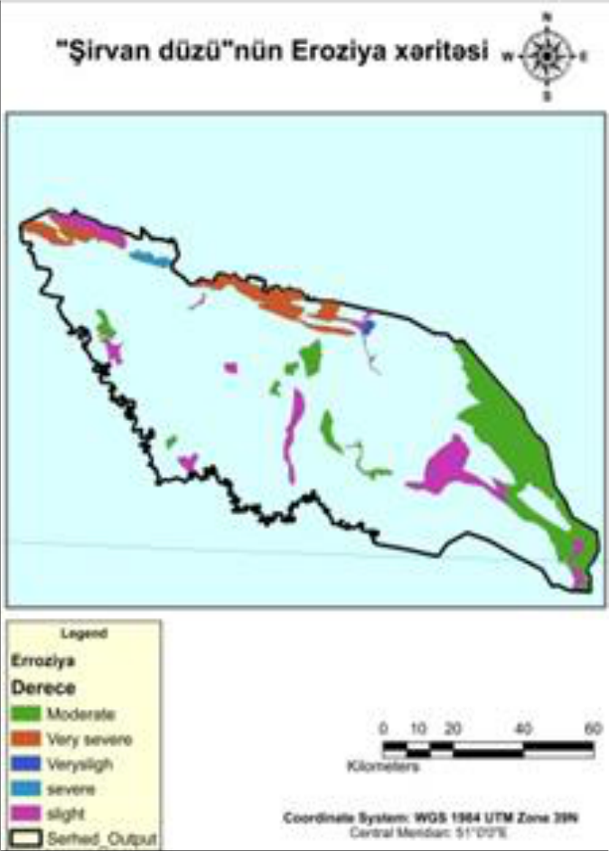 Figure 6
Introduction
Evaluating soil erosion risks is a difficult under taking task due to several concurrent processes, which affects individually other multifaceted interactions and continues at amounts that vary in both time and space [2] . Soil erosion is caused by the erosive forces of wind or water. In this publication, we focus our attention on concepts surrounding water-induced soil erosion. This type of erosion threatens our ability as humans to sustain our global population with food and fiber, and is closely linked to economic vitality, environmental quality, and human health concerns. Roughly 75 billion tons of fertile topsoil is lost worldwide from agricultural systems every year. Erosion in the Republic of Azerbaijan the total area of affected lands was 3144.7 thousand hectares, which is 36.4% of the country's territory. 38.8% (1220.1 ha) of eroded lands of the republic are weak, 29.4% (924 ha) are medium, 31.8% (1000.6 ha) was severely eroded. According to researchers, in the watershed and transit areas of river basins located in mountainous areas 70-80% of the soil cover is eroded under complex geomorphological conditions. [1] . Soil erosion occurs when parts of the soil are shifted around due to rainfall, wind, and ice melt. This is a natural process, but human activity can speed it up. The best way to combat soil erosion? Preventing it in the first place. Luckily, there are some additional methods that can also help you reverse the impacts of soil attrition [8] .
With the presence of GIS competencies, the efforts have been directed to be based on spatially distributed models simulating erosion dynamics and surface runoff of more complex and larger catchments [14,10] . Several models have been developed and used for either research or operational purposes. Some of the most known soil erosion models are USLE (Universal Soil Loss Equation, 1965), EPIC (Erosion/Productivity Impact Calculator, 1984), EUROSEM (European Soil Erosion Model, 1993), RUSLE (Revised Universal Soil Loss Equation, 1997), Rill Grow (a model for rill initiation and development, 1998), SEMMED (Soil Erosion Model for Mediterranean Regions, 1999), EGEM (Ephemeral Gully Erosion Model, 1999), PESERA (Pan-European Soil Erosion Risk Assessment, 2003), and so forth. Soil erosion models can be distinguished as mechanistic (or process based) when they simulate the physical erosion processes by specific formulas or empirical when they calculate erosion based on regression of soil loss based on the physical properties of land and climate features [11, 12] . They also can be characterized as dynamic when the time is a contained parameter. Long-term models are based on accumulated temporal data while event-based models describe single events [13,10] . The soil erosion estimation models are focused on the identification and quantification of the erosion processes and the controlling factors, resulting in the sequential erosion models development beginning with the universal www.extensionjournal.com erosion equation (USLE) realized by Wischmeier and Smith [15] , followed by a modified equation (MUSLE) for the quantification of the alluvium resulting from erosion following each rainfall realized by Williams [16] , and eventually computerized and more complex equation (RUSLE) developed by Renard et al. [17] . The most important climatic variable in soil erosion processes is rainfall erosivity, which is related to rainfall amount and rainfall intensity [18,19] . Plants vegetative cover in addition to crop residues reduces soil erosion potential, due to the fact that the vegetation cover protects and leads to slowing down surface runoff movement and enhancing surplus surface water infiltration [20][21] . Type, extent, and quantity of the vegetation cover are the limiting factors of soil erosion effectiveness [22,23] . The main aim of this research is to quantify the soil erosion in the Shirvan plain, which is the main agricultural zone in the Republic of Azerbaijan through examining the soil erodibility K-factor under different levels of soil data availability using the RUSLE model.
Materials and Methods
Shirvan steppe is part of the Kur-Araz Low land of Azerbaijan and is located on the left bank of the Kura River, in the area between the Kura River and the Caspian Sea It is one of the areas where flat mud volcanoes are spread. It has Chala lakes fed by the Upper Shirvan canal. The elevation of the steppe ranges between 16 m and 100 m.The steppe has grey desert soil. Its vegetation is halophytic and wormwood, with estuary meadows. The upper Shirvan water channel was directed from the Mingachevir reservoir in order to irrigate the land. X= 165672.168, Y= 4523537.932and X= 327493.967, Y= 4423734.657 located between the coordinates. Summer is very hot and dry. On some days, the temperature reaches 36-400C. The second is the temperate hot semidesert and dry steppe climate with dry winters. The annual number of sunny hours in the area varies between 2100-2400. The average annual temperature in the area varies between 14-150. In the Shirvan plain, soil temperature is unevenly distributed depending on air temperature, soil history and vegetation cover. The lowest average monthly temperature is 1-3. 50 and the highest is 30-350 C on the soil surface of the plain.
Precipitation is unevenly distributed in the Shirvan plain. The amount of precipitation in the area varies from 250 to 510 mm. Most precipitation falls in spring and autumn. It snows very little. The thickness of snow cover is 20-25 cm, the settling time is 10-13 days. Winds blowing in the Shirvan plain are formed under the influence of local conditions and incoming air masses. These winds often change direction due to the change of seasons [3] . The rivers entering the Shirvan plain are of transit nature. These rivers belong to the Kura basin and start from the altitude of 2000-3500 m on the southern slope of the Main Caucasus Range. Alijanchay, Turyanchay, Goychay and Girdimanchay are divided into a number of branches after rising from the lowlands to the Shirvan plain. Garasu Rivers are formed from the water that flows underground from the surface of the supply cones and rises to the surface in the form of boils in the outer parts. The Turyanchay River begins at the foot of the Bazarduzu and Tufan peaks of the Main Caucasus Range, at an absolute height of 3,680 m, and flows into the Kura at a height of 3.5 m, west of the city of Zardab. In the upper reaches, the catchment area of the Turyanchay is 1,842 km2, water consumption is 15.6 m³ / sec, and the annual flow is 491,000 m3.The Goychay River began at an altitude of 2,500-3,000 m at the foot of the Savalan Pass and Babadag Peak and flowed into the Garasu at an absolute height of 9 m. In connection with the subsequent reclamation measures, it was connected directly to the globe. The catchment area is 1770 km 2, the average annual water consumption is 12.5 m³ / sec. The length of the river is 50-60 km. Girdimanchay flowed into Garasu at an altitude of 9 m, starting from 3000 m at the foot of Babadag Peak. Later, it was discharged into the Kura River through an artificial bed. The catchment area is 232 km2, water consumption is 2.34 km3 / sec. The length of the Shirvan plain is about 25.2 km. The density of the general river network of the Shirvan plain is 0.46-0.5 ka / km2. The flow in the rivers of the Shirvan plain is uneven throughout the year. In addition to the rivers with a constant flow mentioned above, there are many dry valleys and ravines of different lengths, starting from the low mountains and having a temporary flow during heavy rains. The largest lake in the Shirvan plain is Hajigabul [3] . Water is discharged from the Kura River to keep the water level stable in the lake, which has an area of about 16 km2. The lake is currently drying up.The dry, arid climate of the Shirvan plain requires maximum use of irrigation. The Upper Shirvan canal, which starts from the Mingachevir reservoir and stretches for 123 km, allows to irrigate more than 47,000 hectares. The Shirvan plain rivers have rich groundwater resources. Groundwater. The food source of groundwater is rainwater, river water and irrigation leaks. The groundwater level in the 5-6 km wide strip along the Kura River is 1 m deep, and in the Goychay ground cone it is 1.5-2 m. The flow of groundwater in the Shirvan plain was very weak, mainly due to the general inclination of the plain. Mud volcanoes in the lowlands are also relatively affected by the mineralization of groundwater in the eastern part of the Shirvan plain [2] . www.extensionjournal.com Soil erosion from irrigated fields has been discussed previously (7, 8); this article focuses on unique aspects of irrigation-induced soil erosion that are important when managing and simulating soil erosion on irrigated lands. Soil erosion mechanics can be divided into three components: detachment, transport, and deposition. Water droplets and flowing water detach soil particles; flowing water then transports these detached particles downstream; deposition occurs when flowing water can no longer transport the soil particles because flow rate decreases as water infiltrates or as rill slope or roughness changes. Some particles are deposited within a few meters although others are transported off the field with runoff water. These mechanisms are the same for surface irrigation, sprinkler irrigation and rainfall; however, there are some systematic differences between irrigation and rainfall erosion and especially between surface irrigation and rainfall. Erosion rates as high as 145 Mg / ha in 1 h (9) and 40 Mg / ha in 30 min (10) were reported in some early surface irrigation erosion studies. These extreme losses do not represent a sustained seasonal rate. Within field erosion rates on the upper quarter of a furrow irrigated field can be 10-30 times more than the field average erosion rate (12). Some soil eroded from the upper end of a field is deposited on the lower end, whereas some soil leaves the field with runoff. Losing topsoil from the upper end of the field can decrease crop yields by 25% when compared with the lower end of the field (13). Sediment cannot be transported without runoff. Runoff is planned with many surface irrigation schemes in order to irrigate all areas of the field adequately [25] .
Methodological Framework
The methodology is implemented through several steps which led to the intermediate and the final results. Initially, the 𝐶, 𝑅, 𝑃, and LS factors were calculated in order to be included in the RUSLE formula. Then, the 𝐾-factor was estimated from the soil samples using the USDA nomograph [23] . Later, three interpolation methods (Radial Basis Functions (RBF), Inverse Distance Weighted (IDW), and Ordinary Kriging (OK)) were checked for their accuracy and the 𝐾-factor layer (thematic map) was created using the most accurate method. By multiplying the RUSLE factors calculated earlier (𝐶 * 𝑅 * 𝑃 * LS) with the 𝑘-layers (thematic map), soil erosion risk thematic map was created. Finally, the erosion risk map was reclassified into five classes of risk. The mathematical expression of RUSLE is 𝐴=𝑅 * 𝐾 * LS * 𝐶 * 𝑃, (1) Where, 𝐴 is the average annual erosion rate (t ha-1 yr-1); 𝑅 is the rainfall erosivity (MJ mm ha-1 h-1 yr-1); 𝐾 is the soil erodibility (t ha h ha-1 MJ-1 mm-1); LS is slope length and slope steepness factor (dimensionless); 𝐶 is the correction coefficient for the effect of vegetation (dimensionless); and 𝑃 is the correction coefficient for the effect of erosion control measurements (dimensionless).
Digital Elevation Model (DEM) data were used DEM is is highly accurate DEM covering all the land on earth with 30 m spatial resolution. Landsat 8 Operational Land Imager (OLI) scene was acquired in, 2019. Landsat 8 consists of 9 multispectral bands of 30 m spatial resolution and two thermal bands of 100 m spatial resolution in addition to the panchromatic bands of 15 m spatial resolution. Two Full-Width-Half-Maximum (FWHM) bands of 654.6 𝜇m as red band and 864.7 𝜇m as infrared band were exercised to drive. Normalized Difference Vegetation Index (NDVI).
Generation of R, K-, LS, C, and P Factors
Rainfall erosivity factor (R), estimation of the rainfall erosivity factor (𝑅), is highly based on annual rainfall (mm), and when the annual rainfall is high, erosivity (𝑅) is also high. Rainfall erosivity factor (𝑅) was estimated based on total kinetic energy (𝐸) and maximum intensity in 30 minutes (𝐼) in an average year's rain. Barfield et al. [25] According to Wischmeier [27] , the best predictor of 𝑅 was R=
Where, Is the total storm kinetic energy? 𝐼30 is the maximum 30-minute rainfall intensity, 𝑗 is the counter for each year used to produce the average, 𝑘 is the counter for the number of storms in a year, 𝑚 is the number of storms 𝑛 each year, and 𝑛 is the number of years used to obtain the average www.extensionjournal.com 𝑅 rain kinetic energy (𝐸) could be predicted by 𝐸 = 916 + (331)log 10 (𝐼).
𝐾-factor (soil erodibility) is the one that will be mainly examined.
Using the stratified random sampling method, thirty points, randomly selected and stratified in regard to the geologic formations, were sampled for their necessary topsoil properties.
Then, 𝐾 values were calculated according to the RUSLE formula for these methods [24] . Finally, the 𝐾 values were interpolated to produce a surface of 𝐾 values for the total area. Not only is soil texture the principal component affecting 𝐾, but also soil permeability and soil organic content are essential. [26] . Proposed an algebraic approximation taking into consideration five different soil features (soil organic content, soil permeability, soil texture, soil structure, and soil coarse fragments) as follows:
Where, 𝑀 is the textural factor with 𝑀 = (𝑚silt+𝑚vfs) * (100-𝑚c); 𝑚c [%] is clay fraction content (<0.002mm); 𝑚silt [%]is silt fraction content (0.002-0.05mm); 𝑚vfs [%] is very fine sand fraction content (0.05-0.1mm); OM [%] is the organic matter content; 𝑠 is the soil structure; And 𝑝 is the permeability class. The slope factor (LS) refers to the topographic and/or the relief factor. The slope length factor L computes the effect of slope length on erosion and the slope steepness factor S computes the effect of slope steepness on erosion. The topography related parameters were derived from the Digital Elevation Model (DEM) [27].
Based on Wischmeier and Smith [15], LS values were estimatedas follows:
Where, ℓ is the cumulative slope length in feet; Is the downhill slope angle; 𝑚, is a slope contingent variable, 0.5 if the slope angle is greater than 1.86∘, 0.4, on slopes of 1.72∘ to 2.86∘, 0.3, on slopes of 0.57∘ to1.52∘, And 0.2, on slopes less than 0.51∘.
The cover management factor (C) is dimensionless for each grid cell ranging from 0 to 1 under standard fallow conditions. As the surface cover is added to the soil, the 𝐶 www.extensionjournal.com factor value approaches zero. Generally, the 𝐶 factor is calculated based on derivation of Normalized Difference Vegetation Index (NDVI) and then reclassification of NDVI in order to extract the 𝐶 factor with higher positive values of NDVI. Red band and infrared band of Landsat 8 were exercised to estimate NDVI as follows:
Where 𝐼𝑅 is the infrared band and 𝑅 is the red band.
The support practice factor (P) is defined as the ratio of soil loss with a specific support practice to the corresponding soil loss with up and down cultivation. The lower the 𝑃 value is, the more effective the conservation practice is deemed to be in reducing soil erosion. Usually, in practice, expert opinion is used to qualitatively assess this factor.
Integration of Factors for Erosion Risk Mapping
The erosion risk maps were generated by integrating all preestimated factors according to the RUSLE to create erosion map using 𝐾-factor values derived from soil sampling with interpolation. This was done using map algebra following the RUSLE method, where all layers generated previously were multiplied under GIS environment. [15] .
Results and Discussion
In order to assess the soil erosion risks in the study area, several applications and analyses were implemented. Each generated factor was thus fully described and processed. Regression was found between the mean annual precipitation 2010-2020 (mm/year) and the elevation to be read as
The regression relationship was established before estimating the rainfall erosivity index as a function of average annual precipitation and elevation with R2 of 0.667. The final thematic map for rainfall erosivity factor is shown in Figure 2. The standard error of estimate between the point and the surface 𝐾-factor is 0.005 t ha hr/ha MJ mm; 𝐾factor is with an acceptable level of accuracy [29] . Thematic map for the soil erodibility factor is shown in Figure 3. To determine LS factor adjusted by Moore and Burch [27][28][29][30] under GIS environment, the slope and flow length for each grid cell were estimated and illustrated in Figure 4. The effectiveness of the plant cover in reducing the raindrop impact depends on the height and the continuity of the canopy and the density of the ground cover. In this study, the 𝐶 factor was calculated using sigmoidal function derivation of Normalized Difference Vegetation Index (NDVI) to extract the 𝐶 factor. The derivation of the NDVI values follows a monotonically decreasing sigmoid function with two control inflection points (0 and 1) which was used in order to define the fuzzy value of 𝐶 factor as illustrated in. However, reclassification of the NDVI values was done in order to assign small values (near zero) for the 𝐶 factor for vegetated areas which are less risky in terms of erosion potential and big values (close to one) than sparsely vegetated areas and bare ground, which are more prone to erosion as it is shown in Figure5.
Standard normal distribution function practiced on the NDVI values indicated that most of the values are around zero value as demonstrated in Figure 6.
Table 1: Erosion risk classes (ERC) following Wischmeier and Smith [11] . Several negative values were reordered but there were more positive values indicating higher organic content [31] . The erosion risk map was generated by integrating all preestimated factors according to the RUSLE equation to create soil erosion map using 𝐾-factor values derived from soil sampling with interpolation of RBF with 𝑅2 of 0.89. Erosion is observed in the high hills of the Shirvan plain, along natural and artificial watersheds, in areas with dense drainage. In addition, the stream network carves its course and it carries the sediment that erodes as it flows. This gives it more power to erode as there is more friction in the moving water, but it also deposits this material when it flows out of the upper stream onto the lower stream [32] . Figure 10 (which is not shown conventionally) demonstrates the proportion of each erosion risk class to the total basin area of Shirvan plain. Some of the total area is under slight risk (26.5%).
| S.no | Erosionclas | ERC 1 | ERC 2 | ERC 3 | ERC 4 | ERC 5 |
|---|---|---|---|---|---|---|
| 1 | Losst / ha / yea | 0-5 | 5-10 | 10-20 | 20-40 | >40 |
| 2 | Classification | Verysligh | slight | Moderate | Severe | Very severe |
Table text extracted from the original PDF; superscript letters are shown inline. The original table image is below.
View original table image
S.no Erosionclas
On the other hand, considerable areas are under severe risk (19.3%) and need further attention. 4. Conclusion Erosion risk values are ranked into classes, which is in accordance with RUSLE standards as it provides better identification of the area most prone to erosion. The dissimilarities discovered earlier seem to fade out. GIS and Remote Sensing are inevitable technological environments when implementing RUSLE for assessing soil erosion risk in the spatial domain. The adopted approach was based on mapping procedures, such as conversion of categorical into numerical polygons, interpolation of point samples, map algebra, and raster map reclassification. Data quality is a crucial parameter in soil erosion modeling and those errors and uncertainties are propagated to the final erosion results. Denser grid of sampling sites for the soil survey approach would produce a better 𝑘 layer after interpolation although such a procedure is costly and time-consuming.
Conclusion
Erosion risk values are ranked into classes, which is in accordance with RUSLE standards as it provides better identification of the area most prone to erosion. GIS and Remote Sensing are inevitable technological environments when implementing RUSLE for assessing soil erosion risk in the spatial domain. The adopted approach was based on mapping procedures, such as conversion of categorical into numerical polygons, interpolation of point samples, map algebra, and raster map reclassification. Data quality is a www.extensionjournal.com crucial parameter in soil erosion modeling and those errors and uncertainty es are propagated to the final erosion results. Denser grid of sampling sites for the soil survey approach would produce a better 𝑘 layer after interpolation although sucha sprocedureis costly and time-consuming.
Figures and tables from the paper
References
22 in the original paper- Soviet Encyclopedia of Azerbaijan. Kuba-Misir. Ch. Ed. D. Guliyev. Baku. 1982;1(10):47-48.
- Valentin C, Poesen J, Li Y, Gully erosion: Impacts, factors and control, Catena. 2005;63(2-3)132-153.
- Wainwright J, Parsons AJ, Abrahams AD, Plot-scale studies of vegetation, overland flow and erosion interactions: Case studies from Arizona and New Mexico, Hydrological Processes. 2000;14(16-17): 2921-2943.
- Kumar M Hazarika, Honda K. Estimates of soil erosion using Remote and GİS, İts valuation and Economic İmplications on Agricultural production. 2001;2:3-4.
- Gregorich EG, Greer KJ, Anderson DW, Liang BC. Carbon distribution and losses: Erosion and deposition effects, Soil Tillage Research. 1998;47(3-4):291-302.
- Williams CJ, Pierson FB, Robichaud PR, Boll J. Hydrologic and erosion responses to wildfire along the rangeland-xeric forest continuum in the western US: Are view and model of hydrologic vulnerability, International Journal of Wildland Fire. 2014;23(2):155 -172.
- Sivakumar MVK. Interactions between climate and desertification, Agricultural and Forest Meteorology. 2007;142(2-4):143-155.
- Gitas IZ, Douros K, Minakou C, Silleos GN, Karydas CG. Multi-temporal soil erosion risk assessment in N. Chalkidiki using a modified USLE raster model, EAR SeL Proceedings. 2009;8(1)40-52.
- Podwojewski P, Janeau JL, Grellier S, Valentin C, Lorentz S, Chaplot V. Influence of grass soil cover on water runoff and soil detachment under rainfall simulation in a sub-humid South African degrade strange land, Earth Surface Processes and Landforms. 2011;36(7):911-922.
- Grellier S, Kemp J, Janeau J-L, et al., The indirect impact of encroaching trees on gully extension: A year studying subhumid grassland of South Africa, Catena. 2012;98:110-119.
- Renard K, Foster GR, Weesies GA, Porter JP. Rusle revised Universal Soil Loss Equation, Journal of Soil and Water Conservation. 1991;46:30-33.
- Bochet E, Garcıa-Fayos P. Factors controlling vegetation establishment and water erosion on motorway slopes in Valencia, Spain, Restoration Ecology. 2004;12(2):166-174.
- Zuazo VHD, Pleguezuelo CRR. Soil erosion and runoff prevention by plant covers review, Agronomy for Sustainable Development. 2008;28(1):65-86.
- Zuazo VHD, Martınez JRF, Pleguezuelo CRR, Raya AM, Rodrıguez BC, Soil-erosion and runoff prevention by plant cover sinamountain ousarea (SESpain): implications for sustainable agriculture, Environmentalist. 2006;26(4):309-319.
- Psilovikos A, Elhag M. Forecasting of remotely sensed daily evapotranspiration data over Nile Delta region, Egypt, Water Resources Management. 2013;27(12):4115-4130.
- Castillo VM, Martinez-Mena M, Albaladejo J. Runoff and soil loss response to vegetation removal in a semiarid environment, Soil Science Society of America. Journal. 1997;61(4):1116-1121.
- Duran Zuazo VH, Martınez JRF, Pleguezuelo CRR, Martınez Raya A, Rodrıguez BC, Soil-erosion and runoff prevention by plant covers in a mountainous area (SE Spain): implications for sustainable agriculture, Environmentalist. 2006;26(4):309-319.
- Drzewiecki W, Wezyk P, Pierzchalski M, Szafra´nska B. Quantitative and qualitative assessment of soil erosion risk in Małopolska (Poland), support tedbyan object-based analysis of high-resolution satellite images, Pure and Applied Geophysics. 2014;171(6):867-895.
- Mooreand ID, Burch GJ. Physical basis of the lengthslope factor in the universal soil loss equation, Soil Science Society of Americaт Journal. 1986;50(5):12941298.
- Mooreand ID, Burch GJ. Model ling erosion and deposition: topographic effects, Transactions of the American Society of Agriculture Engineers. 1986;29(6):1624-1630.
- Elhag M. remotely sensed vegetation indices and spatial decision support system for better water consumption regime in Nile Delta. A case study for rice cultivation suitability map, Life Science Journal. 2014;11(1)201209.
- Elhag M. Characterization of a typical Mediterranean watershed using remote sensing techniques and GIS tools, Hydrology: Current Research. 2015;6(1):197204.