
Research article · 2021 · Full text
International Journal of Geography Geology and EnvironmentForest inventory practice in Nepal and its challenges: A synopsis
Volume 3(2) · Pages 47–54
Research areasRemote Sensing and LiDAR ApplicationsForest Ecology and Biodiversity StudiesWood and Agarwood Research
Abstract
Author-writtenForest inventory is a useful tool to show the status of the forest which supports policy makers and scientific community to understand the situation and find the intervention options to effectively manage the forest. However, there are several knowledge gaps to show the inventory practices in Nepal. Thus, this review was done aiming to assess the existing forest inventory systems of Nepal; challenges incurred to implementing forest monitoring; and way forward for future forest monitoring system. The international and national level published and unpublished literatures were collected and these were descriptively analyzed. It was found that Nepal has been practicing periodic national level inventory in every ten years and at the local level, community forests’ monitoring is practiced every year. The national inventory provides the overall status of forest of the country while the local level monitoring and evaluation show the status of community managed forests. However, lack of fund for inventory and incompatibility in findings, lacking the research alternatives, reliance on traditional technology, difficult geography of hilly terrain, problematic to accept the community based inventory practices in national inventory and limited budgets as well as insufficient technical capacity are some important challenges in inventory practices in Nepal. Thus, the establishment of forest research unit at local level; recognizing and incorporating the community based inventory practices, application of modern technology in forest inventory, multi-stakeholder collaboration, unified monitoring system and application of Near Real Time (NRT) monitoring practice can importantly play a vital role in the national inventory. The review will be useful milestone to design the forest inventory at national level.
Summary
Source-checkedPlain-language reading of the full paper, prepared with AI and checked against the text. Each point links to the authors' own words.
Why it matters
- In Nepal, forests are critical for generating national revenue and providing staple food for rural populations. View evidence ↗
- Forest inventory serves as a vital tool for policymakers and scientists to understand forest status and determine effective management interventions. View evidence ↗
- Deforestation in mountainous regions like Nepal can lead to severe environmental issues, including landslides, land erosion, and biodiversity loss. View evidence ↗
The question
- The study aims to review Nepal's existing forest inventory systems, assess implementation challenges, and explore ways to enhance forest monitoring. View evidence ↗
What they did
- The authors conducted a descriptive analysis of collected national and international published and unpublished literature. View evidence ↗
- Key sources analyzed included national forest inventory reports, the Land Resource Mapping Project, and various inventory guidelines for community forests and non-timber forest products. View evidence ↗
What they found
- Nepal conducts national-level forest inventories every ten years, while community forests are monitored annually at the local level. View evidence ↗
- As of May 2020, approximately 35% of Nepal's total forest area (2.24 ha.) is managed by 22,266 Community Forest User Groups (CFUGs). View evidence ↗
- Successive national inventories are often incomparable because they vary in data sources, estimation techniques, and assessment periods. View evidence ↗
- The use of Landsat imagery is hindered by persistent cloud cover, particularly during the rainy season, creating data gaps in land-use analysis. View evidence ↗
- Major challenges in Nepal's forest inventory include funding shortages, reliance on traditional technology, difficult hilly terrain, and limited technical capacity. View evidence ↗
- The distribution of forest information is limited by poor broadband internet access outside of major urban centers. View evidence ↗
What it means
- The authors recommend establishing local research units, incorporating community-based practices, using modern technology, and implementing a unified Near Real Time (NRT) monitoring system. View evidence ↗
- A unified monitoring system is necessary to coordinate data across local, provincial, and central government levels. View evidence ↗
Visual summary
1 visualsIllustrations explain the paper; they do not show study data.
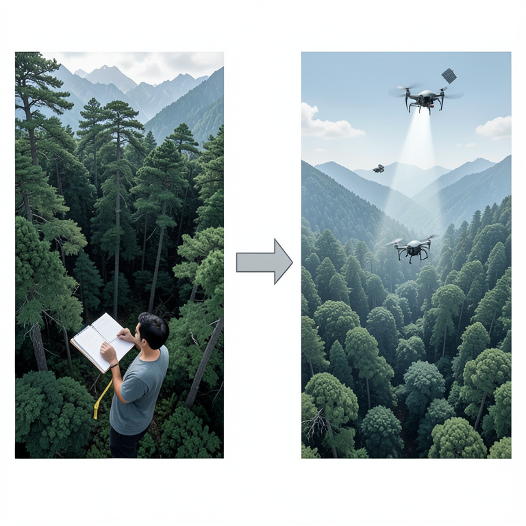
Transition from Traditional to Modern Forest Monitoring
AI-generated conceptual illustration (Himalayan forests in Nepal). It explains the idea and does not show study data.
View source evidence ↗Figures & tables
From the original paper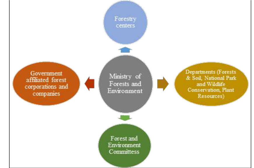 Figure 1
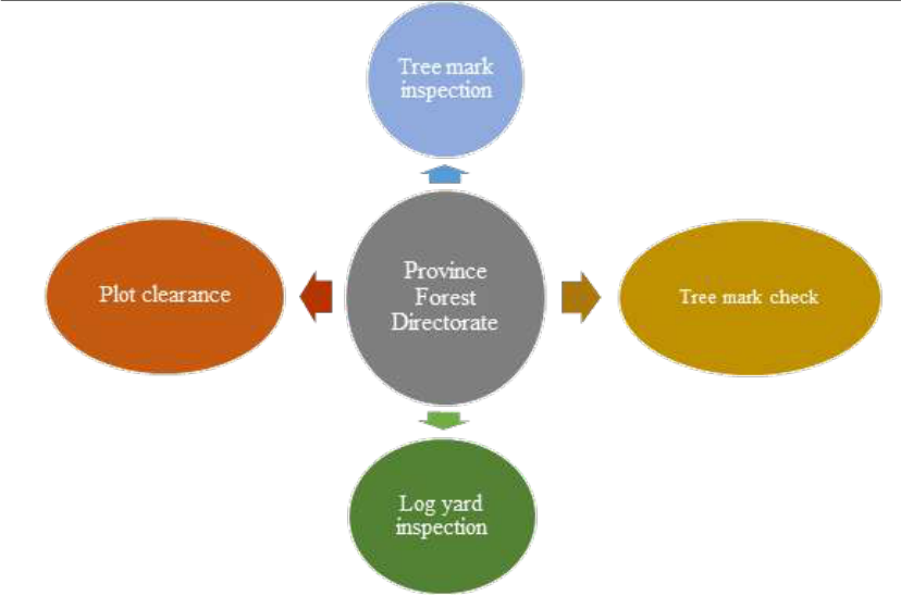 Figure 2
Introduction
A forest is characterized as land area of more than 0.5 ha. with trees taller than 5 m. and a canopy cover of more than 10%, or trees capable of reaching these thresholds in situ (FAO, 2000) [11] . Dorji et al. (2019) [8] identified a range of important ecosystem goods and services provided by forests, including provisioning (food, fodder, and timber), regulating (climate, water, and pollination), supporting (soil formation, nutrient cycling, and primary production), and cultural value (recreational, spiritual, religious, and nonmaterial benefits). In landlocked countries like Nepal where natural resources are mostly land-based, forests play an important part in generation of national revenue and fulfillment of staple food requirement of rural people (Acharya et al., 2011) [1] . In Nepal, the ecological resource that serves community the most in ecological, economic, cultural and spiritual terms is the forest ecosystem; which is the most productive land resource and with sound management is also self-sustainable (Chaudhary et al., 2016) [4] . Forests provide various services to humans; most specifically to those who live nearby and are totally dependent on it for their livelihood. Role of forests can be evidently observed in rural communities which depend upon forests for employment, energy, drinking water, staple food and sound health (Acharya et al., 2011) [1] . Additionally, forests also play an integral part in the Nepalese farming system. It has been estimated in order to sustain 1 hectare of paddy land, 50 hectares of forest and pastureland is necessary in high altitude (FAO, 1980) [10] and 3.5 ha of forest land in midhills (Wyatt-Smith, 1982) [31] . Transformation of forest to some other landuse or long term reduction in tree canopy below the minimum threshold of 10% is defined as deforestation (FAO, 2001). The cause of this transformation is rather complex and has been attributed to population pressures, migration, settlements and their interactions with several other economic, social and governance factors. Four major driving forces of deforestation have been identified, namely; forest encroachment due to subsistence agricultural expansion, irrational incentives linked with illegal timber harvesting, forest fires and livestock grazing; all of whose impacts are immediate in nature. Further deforestation causes include: daily fuelwood consumption, haphazard developmental activities, and conflicting policies (Chaudhary et al., 2016) [4] . In localized terms, deforestation affects a particular geographic area but widespread deforestation can cause global impacts. On a small scale, deforestation can lead to negative effects on fuelwood supply for households, soil and water resources and quality of rural life while on a larger scale, this deforestation can lead to changes in global wood supply, hydrological balance, genetic diversity and global cycles of carbon and other essential elements (Allen & Barnes, 1985) [3] . In the context of mountainous countries like Nepal, the repercussions get escalated as deforestation can lead to land erosion, landslides, drying up of natural water resource, depletion of biodiversity, land falls, land slips, forest fires and human-wildlife conflict. Human activities have become an immediate factor for land use change, which has acted as a catalyst for deforestation and forest degradation (Tole, 1998) [30] . Spatial and temporal detection of deforestation and forest degradation processes could provide valuable information that could be used in planning and sustainable management of forests (Panta et al., 2008) [24] . Not all forest types experience similar rate of deforestation and forest degradation. In this regard, in Nepal, Terai Shorea robusta forest was found to decrease between the years 1976-2001 and such changes have direct implications for forest resource management (Panta et al., 2008) [24] . Periodic review of national forest conditions offers a snapshot of the key forest attributes that will enable to shape future policies. However, regular monitoring of forest cover change (in vulnerable areas) without causing disruption to the forest is essential in order to address the causes of such change within a short span. In this regards, value of forest monitoring is a pre-requisite. Forest monitoring has been defined by the International Union of Forest Research Organizations (IUFRO) as the measurement of certain forest parameters on a constant and periodic basis to provide baselines for detecting and observing differences in such parameters over time. Monitoring can be broadly defined as term that refers to a sequence of periodic assessments of the same target entity's status over time, i.e. a method for determining whether or not change has occurred, as well as its direction and magnitude (Ferris-Kaan & Patterson, 1992) [14] . Understanding various forest attributes, including the depletion of biodiversity and decline in carbon sequestration capacity caused by deforestation and forest degradation becomes even more difficult without reliable figures and robust statistics. National data collection techniques have never been systematic due to the broad variety of criteria for what constitutes as forest and the variation of methods for calculating forest cover. The purpose of this research is to review into the forest monitoring practices of Nepal. The aims of this paper are to: (i) highlight the existing forest inventory systems of Nepal; (ii) assess the challenges in implementing forest monitoring; and (iii) explore the ways by which the forest monitoring in Nepal can be enhanced.
Literature collection and review
Many national and international papers were collected and reviewed to prepare this review paper. The documents related to international practices like monitoring reporting verification (MRV) and its application in REDD+ mechanism. Similarly, the national documents like report of national forest inventory, Land Resource Mapping Project (LRMP), Forest Resource Information System Project (FRISP: 1990-93), national-level forest resource assessment, Community forest inventory guideline, NTFPs inventory guideline, Monitoring reporting verification documents were the main part of literatures. The gist of these literatures were prepared and analyzed descriptively to show the situation, challenges in forest inventory in Nepal and extract the future way forward.
Forest Inventory Practices in Nepal
Forest monitoring deals with regular measurements of forest related attributes to determine the changes in them so that it could be beneficial in addressing to those changes and prescribing management interventions (Lund, 1992) [20] . In Nepal, forest monitoring has been carried out in the following ways:
Periodic assessments:
This includes measurement of forest stock and determining the annual harvestable volume during the renewal of forest management operational plans.
National level forest inventories:
This includes measurement of different attributes of forest conditions using different methodologies and instruments. The national forest inventories conducted so far in the country with their methodologies and key findings have been summarized below: Kirkpatrick's visit to Nepal in 1793 marked the beginning of forest inventory in Nepal (Kirkpatrick, 2011) [18] . Initially, in the national context, some local forest resource mapping operations were attempted, however, the first national forest inventory (1963-67) marked the initiation of modern forest mapping in Nepal which employed aerial photographs (Rajbhandari, 1976; Adhikari and Dhungana, 2010) [27,2] . This national forest inventory (NFI) covered the Terai (southern plains), Inner Terai, Churia hills (southernmost foothills of the Himalayan range) and southern face of Mahabharat range in the midhills. Within this range, central lowland district of Chitwan was not included and was later inventoried separately. The method employed was field inventory and visual interpretation of aerial photographs of 1953-54 and 1963-64 and classified forests as commercial and non-commercial (HMG, 1968) [13] . The focus of this inventory was estimation of timber estimates and its domestic consumption (Joshi, 2018) [15] . Nevertheless, this was the first comprehensive assessment of commercial forests of southern lowlands and adjoining hilly areas. Between 1968 and 1989, most of the Terai and some hill districts underwent a series of district-level forest inventories. During this period, Land Resource Mapping Project (LRMP) developed landuse and forest cover maps which included information regarding forest type, size and crown cover. This was done with the help of aerial photographs taken between 1977 and 1979 supplemented by ground truthing (LRMP, 1986) [19] . Four crown cover classes (0-10%, 10-40%, 40-70% and 70-100%) were identified and based on the dominant species, each forest was defined as coniferous, hardwood or mixed. This survey interpreted the aerial photographs and produced land utilization maps at the scale of 1:50,000 (Joshi, 2018) [15] . Department of Forest Survey (DFRS) used Landsat TM (28.5 m spatial resolution) satellite imageries to assess forest resources and deforestation in the Terai region from 1978/79 to 1990/91, but omitted protected areas from its findings. Similarly, the Forest Resource Information System Project (FRISP: 1990-93) studied the forest and shrub cover of Nepal focusing on analyzing deforestation of Terai forests. This was followed by FRISP (1994-98) which employed GIS and prepared Operational Forest Management Plans (OFMPs) of some Terai districts (DFRS, 1999) [5] . Further Landsat TM images of 1998/99 and Indian remote sensing images of 1999/2000 were used in the national level forest classification of 1999-2001. These images were used to analyze forest distribution, type, condition and landuse. Former Department of Forests (DoF) used Landsat images of 1990/91 and 2000/01 to study Terai forest cover change and classified landuse/cover into six main categories: forest, degraded forest, grassland, barren land, water bodies and other land (Joshi, 2018) [15] . Nepal had employed Landsat imageries, a passive sensor, in its penultimate national forest inventory as the primary source of information to support the forest change assessments. Landsat data has been adopted as a big data source for large-area forest cover for change detection as it is free of charge and has user-friendly data access. These images come with open source pre-processing algorithms and fully pre-processed images can be downloaded making it a convenient ready-to-use forest monitoring tool. However, one of the major shortcomings of this tool is the persistent cloud cover (Reiche et al, 2012) [28] . This limitation although could be partly overcome by image composting, cloud persistence on some regions (especially in the tropics) will eventually lead to data gaps, even when composting is performed. Thus, lack of usable optical images during rainy season is a challenge for temporal and spatial analysis of changed landuse and landcover (Reiche et al, 2012) [28] . Moreover, inventory done partly with Landsat images, partly with aerial photographs with some field verification may not represent the actual forest cover of the country under the same scale. There also are issues with the Landsat images and aerial photographs taken during the previous national forest inventory of the 1990s. With the image resolution of 30 m. in Landsat TM, small forest patches getting excluded from forest cover mapping is highly possible. Further, the aerial photographs were taken during the months of December-January and during this period persistent snow cover, particularly in High mountains and High Himalayas, can provide unrealistic estimates and thus affect the interpretation of forest cover (Khanal et al., 2016) [17] . The most comprehensive national-level forest resource assessment in Nepal (FRA 2010-15) was recently completed (Joshi, 2018) [15] . FRA Nepal measured more than 40 national level attributes related to forests, soil carbon, biodiversity, ethno-botany and disturbances under the systematic and permanent sampling scheme (DFRS, 2015) [6] . Stratified two-phased systematic cluster sampling method was adopted to measure major forest attributes in five physiographic regions: Terai, Churia, Mid Mountain, High Mountain and High Himal. For this, visual interpretation of satellite images using key landuse categories: forest, other wooded land, shrubland, agricultural land (with and without tree cover), dry rivers, water, permanent ice, other land (without tree cover), accessibility etc. was done. The study identified more than 53,000 sample plots and were interpreted within 9187 clusters. Additionally, in order to accurately estimate forest stock, above ground forest biomass and carbon, Light Detection and Ranging (LiDAR) was employed in Terai Arc Landscape (TAL) area of western Terai (Kandel, 2016) [16] . These advancements suggest the expansion in scope of national forest inventory in Nepal since the first national forest assessment. This recent national forest inventory has tried to incorporate the shortcomings of previous inventories. The FRA inventory used RapidEye MSS Satellite imagery, secondary images from Google Earth and Landsat, ancillary maps from LRMP and topographical maps and field inventory data. The 2010 FRA has all the sample plots measured with georeferenced locations which are set up as permanent sample plots, thus is more comprehensive in terms of reassessment (Khanal et al., 2016) [17] . It is a multi-source assessment which, in addition to tree parameters, included additional variables such as: soil characteristics, soil carbon, litter and dead wood, stump and disturbance (Kandel, 2016) [17] . This assessment had sample plots throughout the entire country including the protected areas, which was not the case in previous assessments. There are however, some shortcomings of this assessment too. The images were taken during March-April and during this period accurate detection of forest cover of some deciduous tree species is difficult due to leaf defoliation (Khanal et al., 2016) [17] . Nonetheless, FRA of 2010s can be considered more accurate than the previous assessments as the mapping results were passed through data validation procedure. Field data verification was done for the results obtained for Terai, Churia and Mid Mountains; whereas Google Earth verification was done for High Mountain and High Himal regions.
District Forest Inventory
This is usually done in order to develop and design district forest management plan for a period of five years. In this inventory, detail study on forests, forest dependent communities, NTFPs, forest hazards and forest enterprises of the district are documented. This provides a detail plan for implementing forestry activities within the district in the next five years.
Governmental forest monitoring system
This is done by the national-level, provincial-level and district-level government forestry institutions. The monitoring depends upon the set objective and is mostly field-based. This type of monitoring includes aspects such as: monitoring of plantation activities, disease outbreak, monitoring for determining the land to be allotted to developmental projects, mandatory field check for harvesting in government managed forests and so on. At the central level, Monitoring and Evaluation section within the Planning, monitoring and evaluation division of Ministry of Forests and Environment carries out forest monitoring activities. Earth observation data for near-real time forest fire detection, monitoring and burnt area assessments. The related stakeholders are alarmed via a text message providing critical information on the size and location of the fire. The message is disseminated to the local inhabitants, DFOs and local community representatives across all districts of Nepal (Maden, 2018) [21] . However, Nepal still lacks proper resources: skilled manpower, tools and finance to combat forest fire. Nevertheless, monitoring provides a quantitative and location based information which helps to budget for activities towards community mobilization and forest fire management in the new fiscal year.
Challenges and Gaps in Forest Inventory in Nepal
Lacking fund for inventory and incompatibility in finding Lacking research alternatives, Reliant on traditional technology, Effect of difficult geography of hilly terrain, Difficult to accept the community based inventory practices as national inventory and Limited budgets and insufficient technical capacity are some important challenges in inventory practices in Nepal.
Lacking fund for inventory and incompatibility in finding:
In Nepal, forest monitoring is primarily linked up with periodic national forest inventories and determining the change between the successive inventory periods. These are often aided by external funding and technical resources. The base data, scale, data acquisition month, forest area estimation techniques, data sources, minimum mapping unit, assessment period, field verification and accuracy assessment during the successive national inventories vary making the results incomparable thus cannot precisely determine the changes that have occurred during the consecutive periods (Khanal et al., 2016) [17] . As such, having a robust and real time forest monitoring is tough to achieve, though it's a must. For developing nations like Nepal, the advancements in satellite imageries have been a golden opportunity in assessing its forest resources in present times. In countries like Nepal, dependency in costly remote sensing data for forest resource measurement is done only when there is an external source of combined funding and technologies. The national forest inventories have been resource-driven, thus there exists a long gap between successive inventories.
Lacking research alternatives:
Monitoring success is a significant determinant of forestry-related management strategies. Monitoring aids in determining which blanks need to be filled in order to achieve long-term sustainability. Since monitoring is currently not significantly aided by research alternatives, this void is degrading the degree of conservation and use. In a dynamic landuse such as forests, monitoring is a tedious task, especially when there is a lack of permanent sample plots (PSPs). This was the case in the past national forest assessments, which caused difficulty in pin-pointing the actual changes in the forests. However, the latest assessment concluded by FRA has a mandate to establish and to carry out periodic assessment of PSPs for monitoring purposes. But, the undefined period has led to the conduction of measurement in varying times. This uncertainty in the periodic measurement will eventually result in difficulty in determining the periodical changes in the forest cover and stock.
Reliant on traditional technology: High reliance on traditional tools and techniques for forest assessment and monitoring, slow progress on technology development and knowledge transfer within the forest technocrats with special regards to aerial photography and remote sensing, incompetence in identifying the cause (human-induced or natural) and lack of precise assessment of climate change impacts have been identified as some key causes behind the irregularities in forest monitoring in Nepal.
Effect of difficult geography of hilly terrain: Forest
Research and Training Center (FRTC, formerly Department of Forest Research and Survey) is responsible for carrying out forest monitoring activities but it is periodical with an average monitoring period being 10 years. Mostly, remote sensing data based on medium-resolution images are used. Important forest variables such as: assessment of grazing and its impact, assessment of carbon stock and forest biomass, measuring natural hazards, and generation of cobenefits from forests (socio-economic, biodiversity and watershed services) were overlooked in previous national inventories. It is indeed a tedious task to monitor forest cover change of the whole country, especially for Nepal, where there is a lot of diversity in terms of physiography and species. As far as FRTC (former DFRS) is concerned, it is a central level government organization and lack of field level offices and officials make the task of forest monitoring even more cumbersome. Ministry of Forests and Environment has one of the largest forestry institutions representing every 77 districts under 84 division forest offices. These district level forest offices have continuous access to their district level forest resources. However, the main task of such district level offices is focused on forest conservation, management and utilization, there is a lacking in forest related researches and forest resource assessment within the district.
Difficult to accept the community based inventory practices as national inventory:
There are however, some parallel voices being raised for enabling community forest user groups in carrying out forest monitoring activities. Around 35% of Nepal's total forest area (2.24 ha.) is being managed by 22,266 CFUGs benefiting 2.91 million households (33% of country's population), as of May, 2020 (Pathak, 2020) [25] . In the present context, where forest data monitoring in Nepal is primarily conducted by the government forest entities, opinions of involving CBFM [1] systems to support the government in such activities have been increasing. It has also been advocated that data gathered by CBFM systems may also be equally accurate, and also can be acquired at lower cost. This system can also provide more detailed data regarding the occurrence, extent and drivers of forest losses, degradation and forest enhancement as the users concentrate in their respective forest and are aware of the local conditions. This also can be helpful in carrying out periodic measurements with greater repeatability (Paneque-Gálvez et al., 2014) [23] . However, educating forest users about the tools and techniques of measurement and monitoring is a tedious task and not all CBFM users are educated enough to learn and adopt such methodologies.
Limited budgets and insufficient technical capacity:
Lot of important forest areas in Nepal such as: Chure, wetlands, biodiversity hotspots and other nationally and internationally recognized ecological areas require real time surveillance with a Real Time (RT) or a Near Real Time (NRT) monitoring. Further, factors like limited budgets and insufficient technical capacity to fully integrate NRT data into the work, limitations of financial and logistical resources to support field staff in carrying out forest patrol, trainings and insufficient political support both locally and nationally pose a huge hindrance in forest monitoring in such important areas. Additionally, production and dissemination of forest related information to related stakeholders are often affected by limited broadband internet access, which is limited, particularly outside the major urban centers.
Way Forward
It is evident that the system of forest monitoring in Nepal via national forest inventory has improved in accuracy, inclusiveness and scale in recent years. GIS and remote sensing have been found to play an important role in the generation of forest related data to identify degraded and deforested areas as well as potential areas for conservation. Thus, the future way forward of Nepal's inventory should be considered these points like i. Establishment of forest research unit at local level; ii. Recognition and incorporation of community based inventory practices iii. Application of modern technology in forest inventory; iv. Multistakeholder collaboration; v. Unified monitoring system and v. Application of Near Real Time (NRT) monitoring practice importantly.
Forest research unit at local level:
In the present condition, DFRS due to the lack of staff and field level offices, forest research unit can be included in every district level forest offices for forest monitoring purpose. These staffs need to be thoroughly trained and be updated about the recent advancements. In this regard, an annual district forest profile can be generated. This will not only improve the national forest database but also help in REDD MRV [2] implementation. Further, every year some forest management and measuring instruments are procured in every district level forest offices but these devices are rarely utilized to its optimum. In such, these get non-functional in a quick time. This proposed section can properly handle and utilize such devices and can last for a long run.
Recognition and incorporation of community based inventory practices:
Almost 35% of Nepal's forest is managed by communities through their periodic operational plans. In such forests, there can be some users who can be trained and utilized to collect field level data from their respective forests. These data can be then used in forest monitoring purposes. This can assist the forest authorities on one hand and also can increase the feeling of ownership in the communities and develop local forest technicians.
Application of modern technology in forest inventory:
In some critically important areas, real time or near real time forest monitoring is required. In those areas, use of drones to detect the degenerative trends in forest conditions can be assessed. Further, these areas can also be monitored by a dedicated team applying remote sensing and GIS which can regularly keep track of changes and report the same to the concerned department for appropriate actions.
Multi-stakeholder collaboration: Forest monitoring activities should push towards multi-stakeholder collaboration. This can directly aid in the effectiveness of forestry-related projects, campaigns or programs. This can be beneficial as it ensures stakeholders support during program implementation. Near-real-time monitoring may eventually be consolidated into a limited number of powerful, multi-functional monitoring systems serving data at global scales (Musinsky, 2014) [22] , there continues to be a role for specialized forest monitoring systems providing access to data in unique ways. The existence of multiple data delivery systems is not inherently bad; it creates redundancy, which may increase the likelihood that users continue to receive forest monitoring information if one system is retired; it provides users with the possibility of cross-checking data for accuracy; and it enables opportunities for re-branding, allowing governments to use officially sanctioned sources of data, even if the original data sources are the same.
Unified monitoring system: Dissemination and distribution of alerts to the concerned stakeholders is an important part of forest monitoring. In such condition, distribution of such information and alerts need to be carried out via text messages, email and simple mobile applications to assure that the concerned stakeholders are updated with the information on time. The promulgation of the new constitution of Nepal has delegated forest management authority at three levels of government, namely local level, provincial level and central level. However, there seems to be lack of coordination and uniform database. There needs to be a unified monitoring system that incorporates them and provides up-to-date database regarding forest attributes. Monitoring spatial structures of forest landscape has been globally recognized as an important means of detecting deteriorating trends in forest conditions. It is also useful in assessing the growth on the other hand as well. As such, it is imperative to have a highly precise and regular system of forest monitoring.
Application of Near Real Time (NRT) monitoring practice:
Evidences based on NRT satellite data related to forest fires and illegal forest activities are employed for many different purposes by the governments, industries, non-government organizations, community-based groups and other related stakeholders. Public access to such information support governance by improving transparency and also helps in measuring the effectiveness of bodies responsible for protecting and managing forest resources. This in turn can lead to a positive public pressure for improving governance and implementation. A steady flow of NRT notifications that monitor fire activity and other threats over time assists organizations in designing and executing management strategies that result in enhanced forest land security. Project managers are increasingly using NRT forest tracking systems as adaptive management techniques to support REDD+ forest carbon initiatives. It can also help to maintain product value chains by providing buyers with timely information about where commercial crops and biofuels are cultivated and whether they are grown using sustainable land use practices that conform to national laws and private sector sourcing policies. Finally, the success of NRT forest tracking systems has resulted in unpredictable implications, such as declines in the average size of deforestation patches in specific regions as loggers have learnt to adapt (Faleiros 2011) [9] . Each year, an increasing number of NRT forest surveillance systems focusing on fire, deforestation, illicit logging/encroachment, and smoke/air quality are introduced. Some existing networks are emerging to merge new data sources and provide a broader range of facilities, such as social networking and mobile data sharing. With more satellite data sources becoming available, there are more possibilities for the production of NRT forest tracking and warning systems. Such development will be beneficial in achieving not only short term goals of forest conservation and management, but also for meeting the ambitious global biodiversity, climate mitigation and sustainable development targets.
Figures and tables from the paper
References
31 in the original paper- Acharya KP, Dangi RB, Acharya M. Understanding forest degradation in Nepal. Unasylva 2011;62(2):3138.
- Adhikari J, Dhungana H. The State and Forest Resources: An Historical Analysis of Policies Affecting Forest Management in the Nepalese Tarai. Himalaya, the Journal of the Association for Nepal and Himalayan Studies 2010;29(1). https://digitalcommons.macalester.edu/himalaya/vol29/i ss1/4/
- Allen JC, Barnes DF. The Causes of Deforestation in Developing Countries. Annals of the Association of American Geographers 1985;75(2):163-184. https://doi.org/10.1111/j.1467-8306.1985.tb00079.x
- Chaudhary RP, Uprety Y, Rimal SK. Deforestation in Nepal. Biological and Environmental Hazards, Risks, and Disasters 2016, 335-372. https://doi.org/10.1016/b978-0-12-394847-2.00020-6
- DFRS. Forest resources of Nepal (1987-1998). Publication No. 74. Department of Forest Research and Survey, Ministry of Forests and Soil Conservation & Forest Resource Information System Project, Government of Finland 1999.
- DFRS. State of Nepal's Forests. In. Government of Nepal, Ministry of Forests and Soil Conservation, Department of Forest Research and Survey, Forest Resource Assessment, Nepal 2015. https://core.ac.uk/download/pdf/52283309.pdf
- Dhungana S, Poudel M, Bhandari TS. (Eds.). Himalayan High-Altitude Wetlands: An Ecosystem beyond Habitats for Waterfowls Special Publication REDD+ in Nepal: Experiences from the REDD Readiness Phase REDD Implementation Center Ministry of Forests and Environment Government of Nepal. REDD Implementation Centre, Ministry of Forests and Environment, Government of Nepal 2018. https://climatenepal.org.np/sites/default/files/doc_resou rces/REDD%2BinNepalRedinessPhase.pdf
- Dorji T, Brookes J, Facelli J, Sears R, Norbu T, Dorji K, et al. Socio-Cultural Values of Ecosystem Services from Oak Forests in the Eastern Himalaya. Sustainability 2019;11(8):2250. https://doi.org/10.3390/su11082250
- Faleiros G. Looking Down on Deforestation: Brazil Sharpens Its Eyes in the Sky to Snag Illegal Rainforest Loggers. Scientific American 2019. https://www.scientificamerican.com/article/brazilsatellites-catch-illegal-rainforest-loggers/
- FAO. Agronomy research in the Hill Areas of Nepal. Hill Agricultural Development Project. Terminal Report. P.T.S. Whiteman 1980.
- FAO. Global forest resources assessment 2000 -main report -FRA 2000. Forestry Paper 2000, 140.
- FAO. Natural Forest Management. Fao.org 2018. http://www.fao.org/forestry/sfm/en/
- His Majesty's Government of Nepal (HMG). Forest statistics for the Tarai and adjoining regions, 1967. Forest Resources Survey, Kathmandu, Forest Resources Survey Office 1968.
- Ferris-Kaan R, Patterson G. Forestry Commission bulletin 108 Monitoring Vegetation Changes in Conservation Management. Forestry Commission Bulletin 1992, 108. https://www.forestresearch.gov.uk/documents/6576/FC BU108.pdf
- Joshi, C. (2018). Forest Monitoring System for REDD+. In REDD+ in Nepal: Experiences from the REDD Readiness Phase (pp. 46-54). REDD Implementation Center Ministry of Forests and Environment Government of Nepal.
- Kandel PN. Estimation of Above Ground Forest Biomass by Integrating Airborne LiDAR, Satellite Imagery and In-Situ Measurement in Subtropical Mountain Forests of Nepal [Ph.D. Dissertation] 2016. https://www.researchgate.net/profile/PemKandel/publication/309609170_Estimation_of_Above_ Ground_Forest_Biomass_by_Integrating_airborne_LiD AR_satellite_imagery_and_insitu_measurement_in_subtropical_mountain_forests_of _Nepal/links/5819789708aee7cdc685fc62/Estimationof-Above-Ground-Forest-Biomass-by-Integratingairborne-LiDAR-satellite-imagery-and-in-situmeasurement-in-subtropical-mountain-forests-ofNepal.pdf
- Khanal S, Poudel BS, Mathema P, Pokharel YP, Kharal DK. Comparison of forest cover mapping results of two successive forest resource assessments of Nepal. Banko Janakari 2016;26(1):97-100.
- Kirkpatrick W. An Account of the Kingdom of Nepal. London 2011.
- LRMP. Land Utilisation Report. Kenting Earth Sciences Limited. His Majesty's Government of Nepal and Government of Canada 1986.
- Lund HG. Sampling designs for national forest inventories. Proceedings of Ilvessalo Symposium on National Forest Inventories 1992, 17-21.
- Maden U. Satellite data aids forest fire detection and monitoring in Nepal. Phys.org 2018. https://phys.org/news/2018-06-satellite-aids-forestnepal.html
- Musinsky J. Near-real time monitoring and alert systems. REDD+ Measurement, Reporting and Verification (MRV) Manual, 181-199. USAIDsupported Forest Carbon, Markets and Communities Program, Washington, DC 2014.
- Paneque-Gálvez J, McCall M, Napoletano B, Wich S, Koh L. Small Drones for Community-Based Forest Monitoring: An Assessment of Their Feasibility and Potential in Tropical Areas. Forests 2014;5(6):14811507. https://doi.org/10.3390/f5061481
- Panta M, Kim K, Joshi C. Temporal mapping of deforestation and forest degradation in Nepal: Applications to forest conservation. Forest Ecology and Management 2008;256(9):1587-1595. https://doi.org/10.1016/j.foreco.2008.07.023 25. Pathak B. सामु दायिक वनको २५ वर्षे उपलयधि.
- Langtangnews.com 2020. https://tinyurl.com/fh27bs5x
- Pratihast A, DeVries B, Avitabile V, de Bruin S, Kooistra L, Tekle M, Herold M. Combining Satellite Data and Community-Based Observations for Forest Monitoring. Forest 2014;5(10):2464-2489. https://doi.org/10.3390/f5102464
- Rajbhandari KR. History of botanical explorations in Nepal. Journal of Bombay Natural History Society 1976;72:468-481.
- Reiche J, Lucas R, Mitchell AL, Verbesselt J, Hoekman DH, Haarpaintner J et al. Combining satellite data for better tropical forest monitoring. Nature Climate Change 2016;6(2):120-122. https://doi.org/10.1038/nclimate2919
- Roy R, Silori CS, Poudyal BH, Paudel NS. Grassroots capacity development for REDD+: Approaches and key lessons from Nepal. Policy Brief 2014, (31).
- Tole L. Sources of Deforestation in Tropical Developing Countries. Environmental Management 1998;22(1):19-33. https://doi.org/10.1007/s002679900081
- Wyatt-Smith J. The agricultural system in the hills of Nepal: the ratio of agricultural to forest land and the problem of animal fodder. Www.cabdirect.org; Agricultural Project Services Centre Occasional Paper 1. Kathmandu, Agricultural Project Services Centre 1982. https://www.cabdirect.org/cabdirect/abstract/19831802 300