
Research article · 2020 · Full text
International Journal of Research in AgronomyProduction characteristics of Salyan plain land
Volume 3(2) · Pages 51–54 · DOI: 10.33545/2618060x.2020.v3.i2a.39 ↗
Research areasRegional Socio-Economic Development TrendsAgricultural Development and PoliciesAgricultural and Financial Auditing
Abstract
Author-writtenIn the article, the positive impact of Bob on the quantitative and qualitative indicators of agricultural products produced here due to the land reform carried out in the country since 1995 in stages and as a result of this formation of special property on the land, increasing the biological activity of the lands due to the application of high technologies, thereby achieving, it is a city that has a positive impact on increasing their fertility and improving their protection. He it is also noted that, along with all these achievements, it is almost impossible to implement various measures to combat erosion in the field of protection and efficient use of State and municipal lands, especially in the land reclamation and intensive development of the country. it is emphasized. This problem is based on the need for large-scale application of the scientific-based urgent measures for land protection in the direction of solution of the assigned State important issues. With the results of conducted field-soil research and laboratory analysis, dynamic processes in territorial soils over the past 25 years, erosion processes that have found wide development from natural and anthropogenic effects (especially irrigation erosion), soil salinization and its consequences, etc. brought to you explanatory stats about. All this, in turn, was a fairly rich material database in terms of agrarian and agro-production evaluation of territorial lands.it is of exceptional importance in finding and eliminating the existing problems.
Summary
Source-checkedPlain-language reading of the full paper, prepared with AI and checked against the text. Each point links to the authors' own words.
Why it matters
- Azerbaijan faces challenges with limited land resources, with only 0.18 hectares of arable land available per person. View evidence ↗
- Land reforms starting in 1995 that established private ownership have helped improve land fertility, protection, and overall agricultural efficiency. View evidence ↗
- Despite reforms, implementing erosion control and efficient management on state and municipal lands remains extremely difficult. View evidence ↗
The question
- The study aims to provide explanatory statistics on soil dynamics over 25 years, focusing on salinization and erosion caused by natural and human factors, particularly irrigation. View evidence ↗
What they did
- The research was conducted on the Salyan plain, located in the south-east of the Kur-Araz lowland between the Kura River and the Akusha tributary. View evidence ↗
- The researchers used a combination of field-soil research and laboratory analysis to evaluate the land. View evidence ↗
- An agro-industrial grouping cartogram was created to categorize land suitability based on soil erosion and salinity rates. View evidence ↗
What they found
- The Salyan region experiences an average annual precipitation of 283 mm, while potential surface evaporation is significantly higher at 962 mm. View evidence ↗
- Gray-meadow soils are characterized by physical clay content ranging from 42.82% to 48.44% in upper layers, increasing to 55.20% to 61.67% deeper in the profile. View evidence ↗
- Good quality soils, which are weakly saline, cover 18.5 hectares, representing 44.05% of the total studied area. View evidence ↗
- Medium quality soils, which are moderately saline, cover 25.10 hectares, making up 50.24% of the total area. View evidence ↗
- Medium quality soils have lower nutrient levels than good quality soils, with top-layer humus between 1.43% and 1.80% and total nitrogen between 0.06% and 0.10%. View evidence ↗
What it means
- The authors conclude that there is an urgent need to implement advanced, low-intensity, and water-saving irrigation technologies. View evidence ↗
- The authors recommend sowing salt-resistant grass seeds in sparse pasture areas to enrich the grass cover. View evidence ↗
Visual summary
3 visualsIllustrations explain the paper; charts are replotted from the paper's own table values.
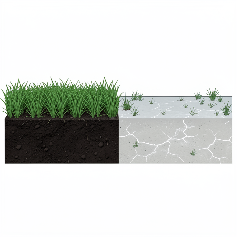
Land Quality Distribution
AI-generated conceptual illustration (Salyan plain land soil). It explains the idea and does not show study data.
View source evidence ↗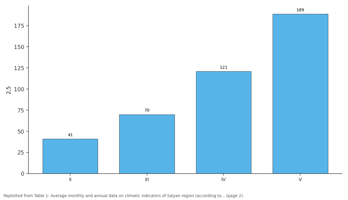
2,5: II vs III vs IV vs V
Replotted from Table 1 (page 2) of the original paper. Every bar is the paper's own table value.
View source evidence ↗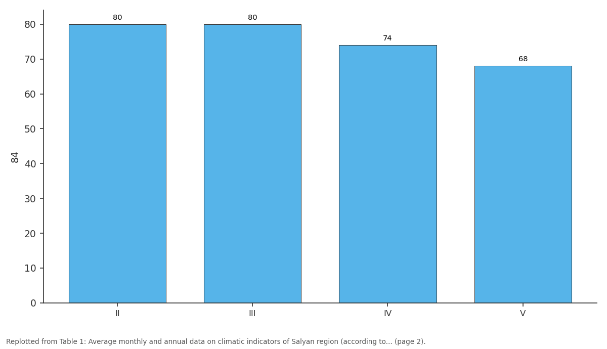
84: II vs III vs IV vs V
Replotted from Table 1 (page 2) of the original paper. Every bar is the paper's own table value.
View source evidence ↗Figures & tables
From the original paper Table 1
 Table 2
 Table 3
 Table 4
Introduction
The Republic of Azerbaijan is one of the countries with limited land resources. There is 0.18 hectares of arable land per capita. The country has 0.18 hectares of arable land per capita and about 0.38 hectares of agricultural land. The gradual land reform implemented in the Republic of Azerbaijan since 1995 and the resulting formation of private ownership of land, along with significant progress in agricultural production, have had a positive impact on the efficient use of lands, increasing their fertility and improving protection. However, it is unfortunate that, in addition to the above, it means the protection and efficient use of state and municipal lands, especially in the field of land reclamation and the implementation of various types of intensive erosion control measures in the country. almost impossible and so on. The problem-solving issues, which are reflected in even the most important state programs, have not yet been resolved. The solution of these problems is urgent and as important as the demands of the day [1,3,7] .
Geographical position:
The Salyan plain studied by us is located in the south-east of the Kur-Araz lowland between the Kura River and its Akusha tributary. The territory of Salyan plain is bordered by Hajigabul in the north, Caspian Sea in the north-east, Neftchala and Bilasuvar in the south-east, south-west, Sabirabad in the west and north-west [2,3] . Relief: Relief is one of the important factors in the process of soil formation, and slight changes in relief elements lead to changes in climatic elements, which in turn leads to changes in the intensity of the process of soil formation. They differ from each other due to their characteristics [3, 5] . The relief of the Salyan plain we are studying consists of a slightly sloping wavy plain. Climate: Among other factors, climate plays an exceptionally important role in soil formation. Climatic conditions accelerate or slow down the erosion and general erosion of rocks, as well as the decay and mixing of plant and animal remains.
The territory of Salyan region, which is the object of research, is located in the east of the Kur-Araz lowland. The climate of the area belongs to the temperate hot semi-desert and dry steppe [3] climate type, which is represented by it. [1,3,4] . The average temperature is 14.50. The average monthly temperature fluctuates between 2.50C in January and 26.20C in July. The average annual precipitation is 283 mm, and the possible evaporation from the surface reaches 962 mm. The average annual relative humidity is 74% (Table 1). Vegetation: It is of great importance for soil fertility, as the accumulation of humus in it is directly related to plants. Thus, under the influence of the organic world, the soil profile is formed, the nutrient cycle takes place, resulting in an important quantitative indicator such as fertility. The vegetation of the area is distributed according to the nature of the soil. The vegetation of the study area consists of the following: clay, spike grass, cat's claw, blackbird, bird's eye view, cane, wormwood, etc. Cotton, grain and other crops are grown in the area [3] . Soil-forming rocks: Soil-forming rocks play an important role in the process of soil formation. In turn, relief elements have a great influence on the distribution of soil-forming rocks. The soil-forming rocks of the study area are alluvial [2,4,9] . Soil cover: Based on the results of our field-soil-erosion studies and laboratory analysis, it was determined that the following soil types are prevalent in the area. 1. Gray-meadow 2 Irrigated Gray-Meadow [4] .
| Climate indicators | Months | — | — | — | — | — | — | — | — | — | — | — | — |
|---|---|---|---|---|---|---|---|---|---|---|---|---|---|
| I | II | III | IV | V | VI | VII | VIII | IX | Х | ХI | ХII | İl | |
| Average air temperature, with C0 | 2,5 | 4,1 | 7,0 | 12,1 | 18,9 | 23,6 | 26,2 | 26,0 | 21,9 | 16,4 | 10,2 | 5,2 | 14 |
| Average relative humidity, in% | 84 | 80 | 80 | 74 | 68 | 61 | 60 | 64 | 70 | 77 | 82 | 83 | 74 |
| Precipitation, in mm, | 30 | 30 | 33 | 31 | 17 | 11 | 7 | 8 | 16 | 37 | 38 | 25 | 28 |
| Possible evaporation, in mm | 25 | 25 | 40 | 61 | 100 | 144 | 172 | 153 | 106 | 67 | 38 | 30 | 96 |
| The average temperature of the soil surface, with С0-lə | 3 | 3 | 9 | 16 | 25 | 31 | 34 | 32 | 26 | 18 | 11 | 5 | 18 |
Table text extracted from the original PDF; superscript letters are shown inline. The original table image is below.
View original table image
I. Gray-meadow soils
Research these spread to almost all areas of our territory. The relief of the area is slightly sloping, wavy plain, the granulometric composition of the soil is heavy and medium clayey.
According to the granulometric composition, gray-meadow soils are divided into the following types of diversity:
1. Heavy clay-gray meadow;
2. Medium clayey gray-meadow.
In order to get acquainted with the morphological features of these soils, we demonstrate the morphological description of section 1, dug in the field of melons and vegetables planted in the area. 0-21 cm: Light gray, topavari, medium clayey, less solid, roots and rhizomes, the transition is boiling, dry, clear. 21-33cm: Light gray, small clumps, heavy clayey, less solid, insect tracts, root fringes, boiling, wet, gradual 33-68 cm: Light gray, small clusters, medium clayey, less solid, insect nests, white spots, boiling, moist, gradual. 68-83 cm: Straw gray, small topavari, heavy clayey, solid, carbonate and rust spots, boiling, moist, gradual.
As can be seen from the morphological description of the section, the structure of these soils is light gray and straw gray, and the structure is clustered and indistinguishable.
As can be seen from the morphological description of the section, the color of these soils is light gray and straw-gray, and the structure is clustered and indistinguishable. The density is less firm and hard depending on the soil moisture. New derivatives (sprouts) are found in roots and rhizomes, insect tracts, carbonate and rust spots. It boils under the influence of 10% hydrochloric acid. Moist, dry and moist. It boils under the influence of 10% hydrochloric acid. It is moist, dry and moist. The appearance of genetic layers is clear and gradual.
It is clear from the results of laboratory analysis that the graymeadow soils are heavy and medium clayey, as the amount of physical clay fluctuates between 42.82-48.44 in the upper layers. The values along the profile are 55.20-61.67 (Table 2). Main components: as can be seen from the results of the analysis, the hydroscopic humidity varies between 3.6-3.9% on the profile. Humus is 3.57-2.27% in the upper layers and 1.39-0.88% in the 50 cm layer; Total nitrogen is 0.21-0.40% in the top layer and 0.84-0.056% in the half-meter layer, respectively. These soils are carbonated throughout the profile. The total thickness of the absorbed bases in the half-meter layer is 36.50-31.00 mg. Calcium cation 30.25-26.27% of the total absorbed bases; magnesium cation is 5.0-4.0%.
| Cut № | Depth in cm | Particle size in mm, quantity in% | — | — | — | — | — | Physical clay, in% |
|---|---|---|---|---|---|---|---|---|
| 1-0,25 | 0,25-0,05 | 0,05-0,01 | 0,01-0,005 | 0,005-0,001 | <0,001 | <0,01 mm | ||
| 1 | 1. Heavy clay gray-meadow | |||||||
| 0-21 | 3,58 | 28,52 | 25,08 | 15,78 | 18,00 | 9,04 | 42,82 | |
| 21-33 | 0,65 | 12,11 | 38,80 | 9,16 | 18,56 | 20,72 | 48,44 | |
| 33-68 | 0,84 | 25,76 | 33,20 | 19,60 | 18,40 | 13,20 | 51,20 | |
| 68-83 | 1,40 | 28,60 | 12,00 | 22,00 | 12,80 | 23,20 | 58,00 |
Table text extracted from the original PDF; superscript letters are shown inline. The original table image is below.
View original table image
II. Irrigated grasslands
These lands are spread to the south and east of the study area and cover 10.4 hectares or 27.15% of the total area. The relief of the area is sloping, wavy plain, the mechanical composition is heavy and medium clayey. Due to their granuliometric composition, these irrigated graymeadow soils were divided into the following types.
3. Heavy clayey, irrigated gray-meadow; 4. Medium clayey, irrigated gray-meadow.
To get acquainted with the morphological features of these soils, we show a field description of one of the cuttings in the field: 0-30 cm: Light gray, lizard, heavy, soft, roots and rhizomes boil, moist, gradual; 30-70 cm: Light gray, small lizard, heavy, soft, roots and rhizomes boiling insect tracts, ways, boiling, wet, gradual; 70-100 cm: Straw-gray, selected, heavy clayey, solid, carbonate and rust spots, boils, damp.
As can be seen from the morphological description of the section, the color of these soils is light gray and gray, the atruktutu is lizard and indistinguishable. The mechanical composition is heavy clayey. The density is soft and hard depending on the soil moisture. New derivatives are found in roots and rhizomes, insect tracts, carbonates and rust. It boils under the influence of 10% hydrochloric acid. Moist, damp, genetic layers The appearance is clear and gradual [4,6,8] .
Explanation of the cartogram of agro-industrial grouping of lands
In order to group the lands in terms of agro-production and determine their suitability for agriculture, an agro-industrial grouping cartogram was developed, which took into account the salinity and erosion rates of the soils and identified the following quality groups in the area.
I. Good quality soils
This group of lands is located in the east of the area and covers 18.5 hectares or 44.05% of the total area. The relief of the study area is slightly sloping, wavy plain, the mechanical composition is medium clayey in the depth layer of 0-100 cm. This group includes weakly saline areas of gray-meadow and irrigated gray-meadow soils of types 2 and 4 №. The amount of humus in the top layer of good quality soils is 3.57-2.27%; The amount of total nitrogen fluctuated between 0.210-14.10 In order to maintain the quality of this group of soils, there is an urgent need to create a deep cultural plowing layer by carrying out current leveling works in the fields. One of the effective methods here is to place weakly saline areas in the middle of winter with the appropriate water norm. In this case, it is necessary to apply 10-15 t / ha of manure to the field. The protection of grass cover in pastures is as important as the need of the day, and it should be enriched. To do this, saltresistant grass seeds should be sown in sparse areas of the area. In a sense, the mowing system should be widely applied.
II. Medium quality soils
Medium quality soils are spread mainly in the east of the area, covering 25.10 hectares or 50.24% of the total area. The relief of the area is slightly sloping, wavy plain, and the mechanical composition of the soil is heavy clayey. This group includes moderately saline areas of species 1 and 3 və of gray-meadow and irrigated gray-meadow soils. The amount of humus in these soils is 1.43-1.80% in the top layer;
The amount of total nitrogen varies between 0.06-0.10%. In order to improve these medium-quality soils, it is important to implement appropriate measures outlined in Group 1 and to wash moderately saline sown areas in the area with appropriate water norms in order to remove salts harmful to plants. In this case, the normal flow of water in the existing collector-drainage network should be regulated and its flow rate should be regulated.
Results and suggestions 1. Important and complex agro-ameliorative measures should be taken in order to improve the existing agro-industrial suitability of the lands of the Salyan plain, which is one of the irrigated agricultural zones of Azerbaijan. Measures should be taken to ensure that they are free of carbonate salts that are harmful to agricultural crops. 2. It is necessary to apply the rotation system in the graymeadow and irrigated gray-meadow lands of agricultural purpose, which are widespread in the area. 3. Taking into account the hydrographic and structural characteristics of the soils of the area, the large-scale application of low-intensity, water-saving advanced irrigation technologies is as urgent as the demand of the day. 4. Enrichment of grass cover in pastures and grazing areas of the area, sowing of salt-resistant grass seeds should be carried out in areas where sparseness is observed. 5. There is an urgent need to create a deep cultural plowing layer by carrying out current leveling works in the fields.
Figures and tables from the paper
| Cut № | Depth in cm | Hydroscopic Moisture % | Humus % | Total Nitrogen % | CО2 % | CaCO3 for CО2 |
|---|---|---|---|---|---|---|
| 1. Gray-grass with heavy clay | ||||||
| 12 | 0-23 | 3,16 | 3,57 | 0,210 | 8,57 | 19,5 |
| 23-37 | 3,93 | 2,27 | 0,140 | 7,83 | 17,8 | |
| 37-70 | 4,51 | 1,39 | 0,084 | 6,24 | 14,2 | |
| 70-87 | 5,05 | 0,88 | 0,056 | 5,63 | 12,8 |
Table text extracted from the original PDF; superscript letters are shown inline. The original table image is below.
View original table image
| Cut № | Depth in cm | Won the basics m.ekv | — | — | Total of lost bases | From the sum of the lost bases %-with | — | — |
|---|---|---|---|---|---|---|---|---|
| Cа | Мq | Nа | Cа | Мq | Nа | |||
| 3. Gray-meadow irrigated with heavy clay | ||||||||
| 3 | 0-23 | 20,00 | 0,95 | 1,50 | 30,25 | 66,12 | 28,92 | 4,90 |
| 23-37 | 15,13 | 10,50 | 1,20 | 36,83 | 56,39 | 39,14 | 4,47 | |
| 37-70 | 14,13 | 9,50 | 1,20 | 24,83 | 56,91 | 38,26 | 4,83 | |
| 70-87 | 13,63 | 11,50 | 1,10 | 26,23 | 51,96 | 43,84 | 4,20 |
Table text extracted from the original PDF; superscript letters are shown inline. The original table image is below.
View original table image
References
8 in the original paper- Aliyev ZH. Aliyev-Low-intensity irrigation equipment and technology in the highlands of Azerbaijan Vyaz publishing house Baku, 1999, 220.
- Aliyev BH, Aliyev ZH. Irrigated agriculture in the mountainous and foothill regions of Azerbaijan. ZiyaNurlan Publishing House. Baku, 2005, 330.
- Aliyev BH, Aliyev IN, Aliyev ZH. Some problems of agriculture in Azerbaijan and their solutions Ziya-Nurlan publishing house. Baku, 2004, 572. (Azerbaijani language)
- Aliyev BH. Some problems of agriculture in Azerbaijan and their solutions. / Baku, Ziya-Nurlan, 2004, 613.
- Bagirov ShX. Irrigation reclamation / "Maarif" publishing house, Baku, 1983.
- International Center for Agricultural Research in Dry and Dry Areas (ICARDA) Irrigation regimes and monitoring methods. Ü. Edited by Umarov and A. Karimov c. IC AQUA, 2002, 128.
- VF Nosenko. Irrigation in the mountains. Kolos Publishing House Moscow, 1981, 143.
- Yu A Markovskiy. Irrigation of collective and individual gardens of the agricultural organization Agropromizdat Leningrad, 1989, 64.