
Research article · 2020 · Full text
International Journal of Geography Geology and EnvironmentA review paper on ‘Remote sensing studies in coastal zone management: A new perspective
Volume 2(1) · Pages 01–03 · DOI: 10.22271/27067483.2019.v1.i1a.11 ↗
Research areasCoastal and Marine Management
Abstract
Author-writtenThe coastal zone represents varied and highly productive ecosystems. These ecosystems are under pressure on account of increased anthropogenic activity on the coast. It is necessary to protect these coastal ecosystems to ensure sustainable development. In most of the studies shorelines are manually digitized from satellite images and calculate the changes using remote sensing technology. GIS and RS technology has been recognized as one of the most dominant tool for quantifying the shoreline changes on temporal scales as it provides the information in digital form. ICMAM-PD has implemented a national project for monitoring the shoreline changes for entire Indian coast using satellite imageries to maintain a long-term database in GIS environment.
Summary
Source-checkedPlain-language reading of the full paper, prepared with AI and checked against the text. Each point links to the authors' own words.
Why it matters
- Coastal zones are highly productive ecosystems that are currently facing significant pressure from human activities. View evidence ↗
- These ecosystems are critical because they maintain biodiversity, cycle nutrients, filter pollutants, and provide a natural defense against storms and erosion. View evidence ↗
- Marine ecosystems contribute to global climate regulation by acting as primary sources of oxygen and sinks for carbon. View evidence ↗
- A large portion of the human population resides near the coast, with estimates suggesting nearly three quarters would live within 60 km of the coast by 2020. View evidence ↗
- In India, coastal populations are projected to grow from 15% to nearly 40% over the coming decade. View evidence ↗
The question
- The paper addresses the need to protect coastal ecosystems to ensure sustainable development. View evidence ↗
What they did
- The review highlights the use of multi-spectral data from satellite platforms such as IRS, LANDSAT, and SPOT to monitor coastal environments. View evidence ↗
- Biological data for fisheries and ecosystems is derived from ocean color data provided by OCANSAT I, OCM, SeaWiFS, and MODIS. View evidence ↗
- A common method in these studies involves manually digitizing shorelines from satellite imagery to calculate changes via remote sensing. View evidence ↗
What they found
- GIS and remote sensing are identified as dominant tools for quantifying shoreline changes over time because they provide data in digital form. View evidence ↗
- GIS is particularly useful for identifying spatial relationships between features and tracking how an area changes over time. View evidence ↗
- Remote sensing (RS) data is effective for evaluating coastal processes, specifically accretion, erosion, and shoreline shifts. View evidence ↗
- Remote sensing applications include mapping land use, wetlands, and shoreline changes, as well as monitoring pollution, water quality, and coastal hazards. View evidence ↗
What it means
- The authors conclude that remote sensing is a more efficient aid for coastal zone management than traditional ground-based techniques. View evidence ↗
- The authors state that RS and GIS data are essential for formulating coastal policies and ensuring long-term resource management and conservation. View evidence ↗
- The authors suggest that future advances in remote sensing will lead to more focused and rapid responses during emergencies. View evidence ↗
Visual summary
1 visualsIllustrations explain the paper; they do not show study data.
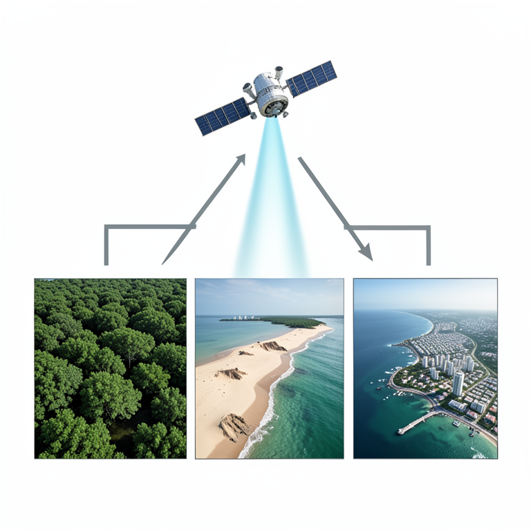
Remote Sensing Applications in Coastal Management
AI-generated conceptual illustration (Earth's coastal zone and an orbiting satellite). It explains the idea and does not show study data.
View source evidence ↗Figures & tables
From the original paper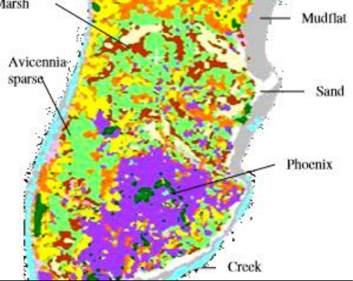 Figure 1
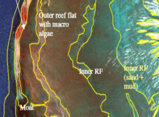 Figure 2
Introduction
Coastal zone is a unique environment where land, sea and atmosphere interact and interplay continuously influencing a strip of spatial zone. It is endowed with a very wide range of sensitive habitats. 1. Biomorpholical features:-Coral reefs, Mangroves, Sea grasses, Back Waters, coastal wetlands, Salt marshes, etc, 2.Geomorphological features:-Sand dunes, Mudflats, Beaches, Estuaries, Lagoons, etc Coastal Zone Management These zones are highly under pressure like, anthropogenic activities-Increase in population and Industrial developments, Natural activities-Erosion, Deposition, Periodic storms, Flooding and sea level changes. The coastal zone of world is under increasing stress due to development of industries, trade and commerce, tourism and resultant human population growth and migration, and deteriorating water quality. This region is of very high biological productivity and thus an important component of the global life system. Coastal ecosystems harbour wealth of species and genetic diversity, store and cycle nutrients, filter pollutants and help to protect shorelines from erosion and storms. Marine ecosystems play a vital role in regulating climate and they are a major carbon sink and oxygen source. The industrial development of coast has resulted in degradation of coastal ecosystems and diminishing the living resources of Exclusive Economic Zone (EEZ) in form of coastal and marine biodiversity and productivity. More than half population lives within 60 km of the coast and would rise to almost three quarters by 2020 (Anon, 1992). Episodic events, such as cyclones, floods, pose serious threat to human life and property in the coastal zone. Human activities also induce certain changes or accelerate the process of change.
Coastal Regulation Zone
The increasing pressure on the coastal zone due to concentration of population, development of industries, discharge of waste effluents and municipal sewage and spurt in recreational activities, has adversely affected the coastal environment. The population of coastal districts is increasing all over the coastal areas in the world. In India, the population on coastal regions is likely to increase to from 15 per cent at present to almost 40 per cent in next decade. In view of this, coastal stretches of bays, estuaries, backwaters, seas, creeks, which are influenced by tidal action up to 500 m from High Tide Line (HTL) and the land between the Low Tide Line (LTL) and the HTL has been declared as the Coastal Regulation Zone
Remote sensing technology in coastal zone management
The GIS and Remote sensing technology has been recognized as one of the most dominant tool for quantifying the shoreline changes on temporal scales as it provides the information in digital form (Nayak et al., 2009) [2] . The major advantages of GIS are that it allows identifying the spatial relationships between features and temporal changes within an area over time. Remote sensing satellites images have been effectively used for monitoring shoreline changes of different locations. Studies have been carried out using the data provided by these satellites in assessing the pattern and level of utilization of natural resources. Satellite imageries are useful tools for detecting the coastal morphology changes. RS data can be used to evaluate the coastal processes like erosion/ accretion and shoreline changes. Geographic Information System is designed to work with data referenced by spatial/geographical coordinates.
Conclusion
Remote sensing techniques can be utilized as a general aid in the field of coastal zone management. It is more efficient than ground-based techniques. Satellite based remote sensing techniques provide comprehensive, reliable and up to date information at a minimal cost and time. The Tools like Remote Sensing, Global Information System, Global Position System are extremely valuable in development and analyse of Data in the integrated manner, Remote Sensing and GIS data information could play an important role in the formulation of policies along the coast this technology helps in not only coastal resource management but also for protection and conservation in the long run. Advances in remote sensing will enable quicker and more focused emergency responses. More accurate map production will leads to best navigation system in Offshore and On shore exploration. LiDAR, Multibeam Echosounder and a number of techniques are recently improved in this field for marine habitat exploration.
Figures and tables from the paper
References
2 in the original paper- Kankara R, Chenthamil Selvan, Vipin J, Markose B, Rajan S, Arockiaraj. Estimation of long and short term shoreline changes along Andhra Pradesh coast using Remote Sensing and GIS techniques. Procedia Engineering, 2015; 116:855-862.
- Nayak S, Bahugunam A. Application of remote sensing data to monitor mangroves and other coastal vegetation of India. Indian Journal of Marine Science. 2009; 30(4):195-213.
Cited by 1
From OpenAlex, OpenCitations and reference lists read by Scinovex
- Mid-Term Monitoring of Suspended Sediment Plumes of Greek Rivers Using Moderate Resolution Imaging Spectroradiometer (MODIS) Imagery ↗
Sotirios Karalis, Efthimios Karymbalis, Konstantinos Tsanakas · Remote Sensing · 2023
This study focuses on the suspended sediment delivery of 17 rivers and streams of various sizes to the sea over a wide geographical area covering most of the Greek peninsula, utilizing two Moderate Resolution Imaging Spectroradiometer (MODIS) products. Equal-area polygons (“plume” polygons), were delineated at the mouths of each selected river. These polygons were utilized to estimate the suspended sediment…
❝ 5PDF